Airports in Norway Map
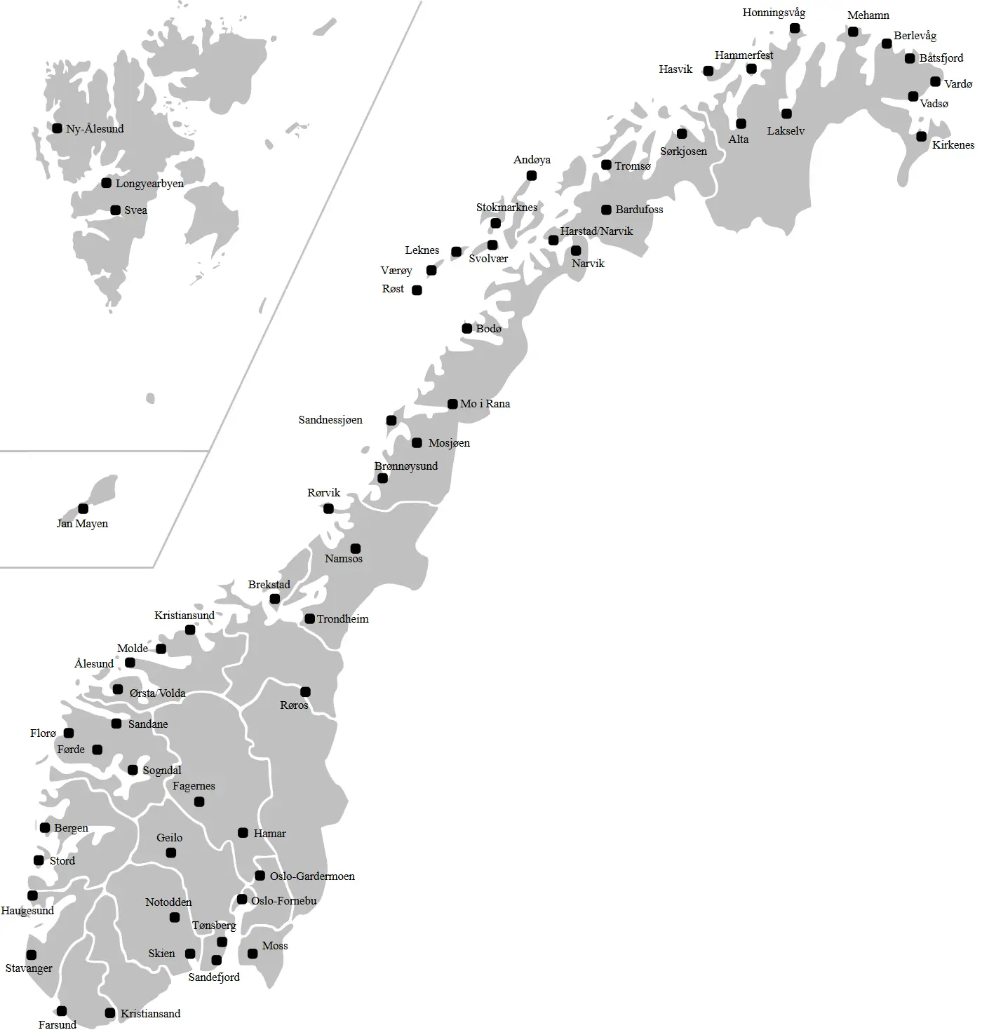
Click or tap the map to enlarge it.
Airports In Norway Map – Expert Cartographer
Key Takeaways
- Norway has a well-established network of airports for both domestic and international travel.
- The airports in Norway provide convenient access to various regions and attractions within the country.
- Travelers visiting Norway can choose from a wide range of airports based on their destination and preferences.
- The airport infrastructure in Norway is modern and ensures reliable and comfortable travel experiences.
- Norway’s airports play a crucial role in connecting the country with the rest of the world, facilitating tourism and business.
History of Airports in Norway
The development of airports in Norway can be traced back to the early 20th century when aviation started gaining importance. The Norwegian aviation industry took off with the establishment of civil aviation in the late 1920s.
One of the first airports in Norway was Oslo Airport, which was initially located at Kjeller before moving to Fornebu in 1939 and later expanding to its current location at Gardermoen in 1998.
Over the years, airport infrastructure in Norway witnessed significant growth and improvements. Various regional and international airports were established to meet the increasing demand for air travel. Today, Norway has a network of over 40 airports serving millions of passengers annually.
Unique Insights
- Norway has a well-connected airport network, ensuring easy access to even remote regions such as Svalbard.
- Some of the prominent airports in Norway include Oslo Airport, Bergen Airport, Stavanger Airport, and Trondheim Airport.
- Many airports in Norway offer stunning views during takeoff and landing, surrounded by picturesque landscapes.
- The airports in Norway are known for their efficient operations, advanced facilities, and commitment to passenger safety.
- Norway’s airports have a strong focus on sustainability and environmental initiatives, aiming to reduce their carbon footprint.
Airports in Norway – Facts and Figures
| Airport Name | Location | Year of Establishment | Annual Passenger Traffic |
|---|---|---|---|
| Oslo Airport | Gardermoen | 1998 | Over 27 million |
| Bergen Airport | Flesland | 1955 | Over 6 million |
| Stavanger Airport | Sola | 1937 | Over 4 million |
| Trondheim Airport | Værnes | 1914 | Over 4 million |
| Tromsø Airport | Langnes | 1964 | Over 2 million |
Frequently Asked Questions (FAQ)
1. How many airports are there in Norway?
Norway has over 40 airports that cater to domestic and international travel.
2. Which is the busiest airport in Norway?
Oslo Airport, located in Gardermoen, is the busiest airport in Norway, serving millions of passengers annually.
3. Are there airports in remote areas of Norway?
Yes, Norway has airports in remote regions to facilitate travel and connect even the most distant areas.
4. Are Norway’s airports environmentally friendly?
Yes, many airports in Norway have implemented sustainability initiatives to reduce their environmental impact.
5. Can I find international flights from Norway’s airports?
Absolutely, Norway’s airports offer international flights to various destinations around the world.
6. What are some of the popular airports for tourists?
Popular airports for tourists include Oslo Airport, Bergen Airport, and Tromsø Airport, among others.
7. Are Norway’s airports well-connected to other modes of transportation?
Yes, Norway’s airports are well-connected to transportation networks, making it easy to reach cities and attractions.