History
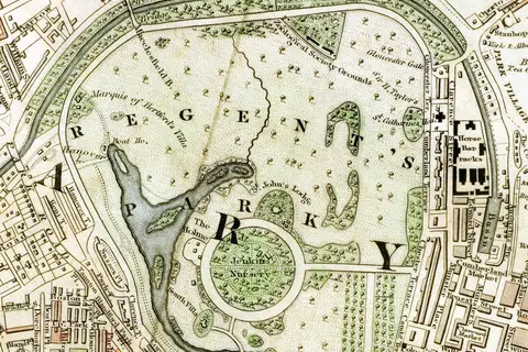
Regents Park London from 1833 Schmollinger Map
The “Regents Park London From 1833 Schmollinger Map” is a fascinating cartographic representation of Regents Park in London during the year 1833.
Subject
Empires, wars, borders and old maps that show how the world was divided and understood in the past.
404 maps in this collection
Historical maps are snapshots of power. Borders that look permanent today were drawn, redrawn and erased over centuries, and these maps capture particular moments: Greece on the eve of the Peloponnesian War, the Ottoman Empire in 1900, Oudh during the Indian uprising of 1857, the Pacific theatre of the Second World War and the Pala Empire of medieval Bengal.
The collection also includes transport and city history, from the early Singapore MRT network to a Republican-era map of China and the medieval Peloponnese. Each guide places the map in its period and summarises the events behind it.
History
The “Regents Park London From 1833 Schmollinger Map” is a fascinating cartographic representation of Regents Park in London during the year 1833.
History
The Rashtrakuta Empire was founded by Dantidurga in the mid-6th century CE, originally as a feudatory of the Chalukyas.
History
The Rashtrakuta Empire, which flourished from the 6th to the 10th century.
History
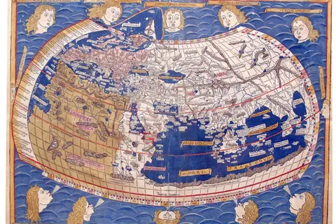
The Ptolemy Map from the 15th century, also known as the Ptolemaic Cartography, is a remarkable achievement in the field of cartography.
History
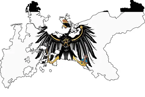
The flag map of the Kingdom of Prussia from 1701 to 1918 holds immense historical importance.
History
The Map Ofbengal326Bcgangaridai showcases the region of Bengal during the period around 326 BC.
History
The Polish-Lithuanian Commonwealth was established in 1569 through the Union of Lublin.
History
Key Takeaways The flagmap of Poland from 1918-1939 represents a significant period in Polish history.
History
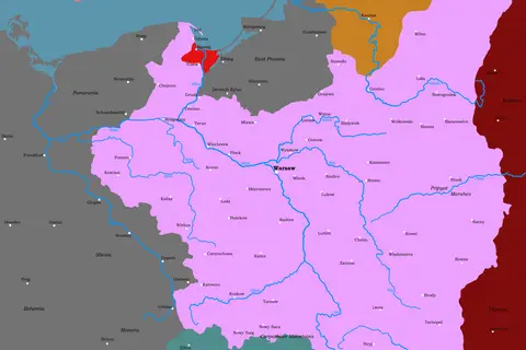
The map of Poland in August 1939 captures the political landscape leading up to World War II.
History
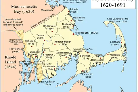
The Plymouth Colony map offers a visual representation of the journey undertaken by the Pilgrims.
Cartography
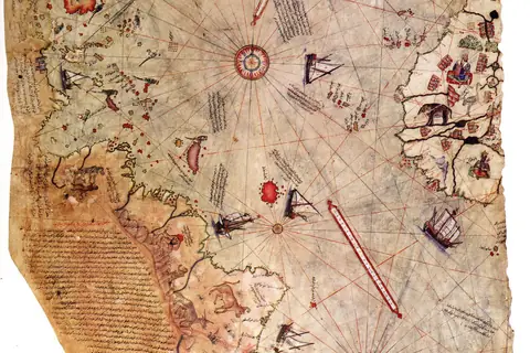
The Piri Reis map of 1513, one of the earliest surviving maps to show the Americas, and what it does and does not show.
History
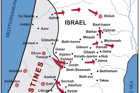
The Map of Philistine Cities Battles is a depiction of the ancient cities that were part of the Philistine civilization.
History
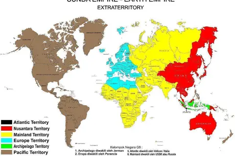
The Sunda Empire, also known as the Kingdom of Sunda, was a powerful maritime kingdom that thrived in Southeast Asia between the 7th and 16th centuries.
History
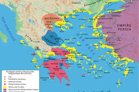
A map of the alliances of Athens and Sparta in 431 BC, with the course of the Peloponnesian War to 404 BC.
History
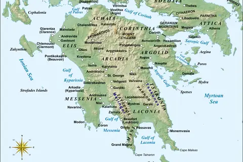
A map of the Peloponnese and its medieval history under Byzantines, Franks, Venetians and Ottomans.
History
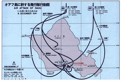
A Japanese chart of the air attack on Pearl Harbor, with the facts of the 7 December 1941 raid.
History
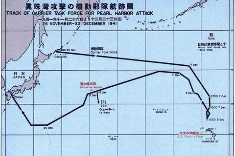
The Pearl Harbor Attack Force map represents the positions of Japanese naval vessels and aircraft during the surprise attack on Pearl Harbor, Hawaii.
History
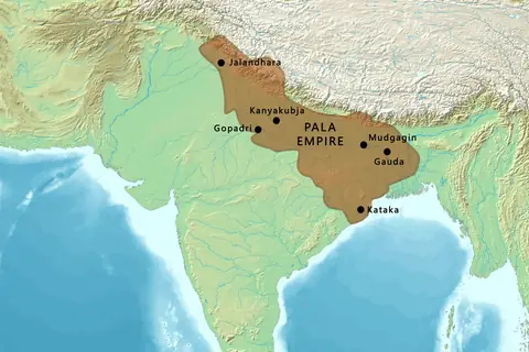
A map of the Pala Empire of Bengal and Bihar, the Buddhist dynasty that ruled eastern India from about 750 CE.
History
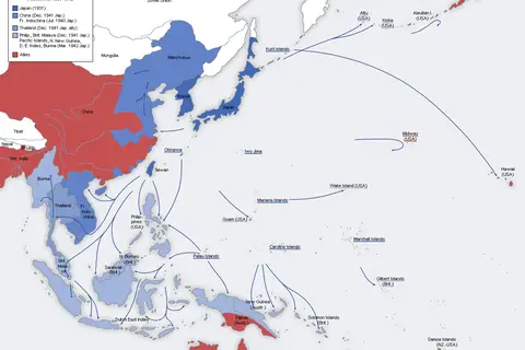
A map of Japanese expansion in Asia and the Pacific from 1937 to 1942, with the key battles and dates.
History
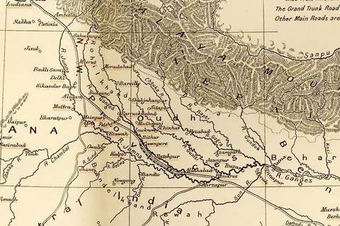
A Victorian map of Oudh and the 1857 rebellion, from the annexation of 1856 to the reconquest of Lucknow.
History
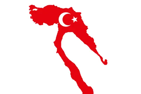
The Ottoman Empire, established in the early 14th century, was a multi-ethnic and multi-religious empire that spanned three continents – Europe, Asia.
History
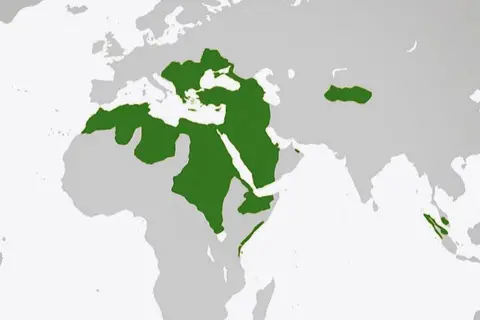
The Ottoman Empire World Map, created during the 16th century, encapsulates the dominance and remarkable expansion of the Ottoman Empire.
History
The Ottoman Empire, founded in the 13th century by Osman I, began as a small Anatolian state and gradually expanded its territories through military.
History
The Map of Ottoman Empire in 1900 (Latvian) provides a glimpse into the vast and influential empire that spanned three continents in its prime.