Antigua and Barbuda Regions Map
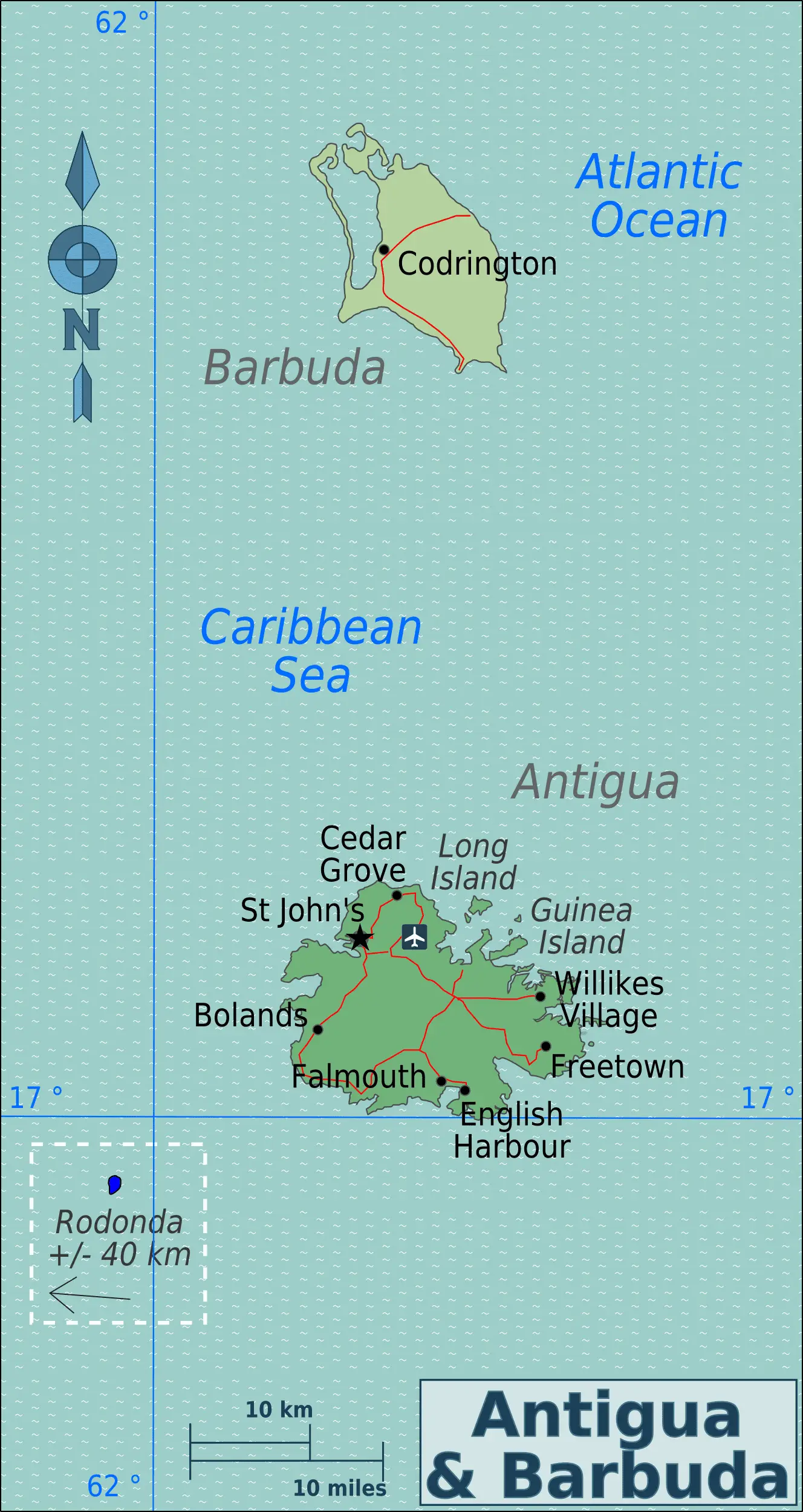
Click or tap the map to enlarge it.
Antigua And Barbuda Regions Map – Expert Cartographer’s Guide
Key Takeaways
- The Antigua and Barbuda Regions Map showcases the different administrative divisions within the country.
- These divisions reflect the unique geography, history, and cultural aspects of Antigua and Barbuda.
- The map offers valuable information for travelers, researchers, and individuals interested in exploring the region.
History
The Antigua and Barbuda Regions Map represents the various districts and divisions within the country, reflecting its rich history and cultural heritage. Antigua and Barbuda is an independent Commonwealth state located in the Caribbean region. It is composed of two main islands, Antigua and Barbuda, along with several smaller islands and islets.
The islands were originally inhabited by the indigenous Arawak and Carib peoples, but were later colonized by the Spanish, French, and British. In 1981, Antigua and Barbuda gained independence from the United Kingdom and became a sovereign nation.
The administrative divisions of Antigua and Barbuda consist of six parishes on Antigua Island: Saint George, Saint Mary, Saint John, Saint Paul, Saint Peter, and Saint Philip. Barbuda Island forms a single administrative division known as Barbuda. Each region has its own unique characteristics and attractions.
Unique Insights
The Antigua and Barbuda Regions Map provides some unique insights into the country:
- Antigua Island, the larger of the two main islands, is home to the capital city, St. John’s. It is known for its stunning beaches, historical sites, and vibrant cultural scene.
- Barbuda Island, located north of Antigua, is known for its unspoiled natural beauty, pink sandy beaches, and diverse wildlife.
- The parishes of Antigua Island offer a blend of history, culture, and natural wonders. Travelers can explore the historic Nelson’s Dockyard, hike through lush rainforests, or soak up the sun on beautiful beaches.
- Each region has its own distinct character, offering visitors a unique experience and a chance to immerse themselves in the local culture.
Relevant Facts
| Year | Event |
|---|---|
| 1493 | Christopher Columbus lands on Antigua during his second voyage to the Americas. |
| 1666 | English settlers establish the first permanent European settlement on Antigua. |
| 1981 | Antigua and Barbuda gain independence from the United Kingdom. |
Frequently Asked Questions (FAQ)
-
What are the main islands of Antigua and Barbuda?
The main islands of Antigua and Barbuda are Antigua and Barbuda, along with several smaller islands and islets.
-
How many administrative divisions are there in Antigua and Barbuda?
Antigua and Barbuda is divided into six parishes on Antigua Island and a single administrative division known as Barbuda.
-
What is the capital city of Antigua and Barbuda?
The capital city of Antigua and Barbuda is St. John’s, located on Antigua Island.
-
What are the main attractions on Antigua Island?
Antigua Island is known for its stunning beaches, historical sites like Nelson’s Dockyard, and vibrant cultural scene.
-
What makes Barbuda Island unique?
Barbuda Island is known for its unspoiled natural beauty, pink sandy beaches, and diverse wildlife.
-
Are there any hiking opportunities in Antigua and Barbuda?
Absolutely! Antigua Island offers various hiking trails through lush rainforests, providing an opportunity to explore the island’s natural beauty up close.
-
Can I experience the local culture in different regions of Antigua and Barbuda?
Yes, each region has its own distinct character and offers a chance to immerse yourself in the local culture through festivals, food, and traditional music.