Austrohungarian Railway Map
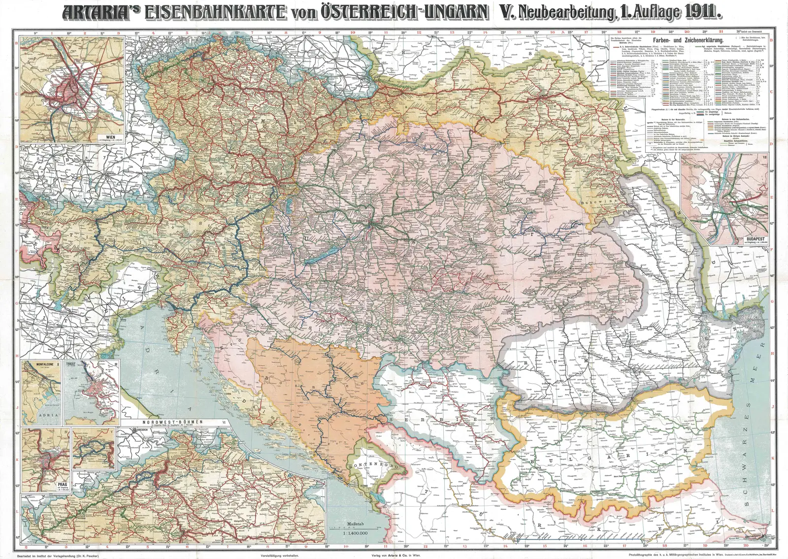
Click or tap the map to enlarge it.
The Austro-Hungarian Railway Map: Unveiling the Historic Network
Key Takeaways
- The Austro-Hungarian Railway Map showcases the extensive rail network that connected different regions within the Austro-Hungarian Empire.
- It played a crucial role in facilitating trade, transportation, and socio-economic development during the late 19th and early 20th centuries.
- The map serves as a valuable historical artifact, depicting the empire’s political boundaries, major cities, and railway routes.
History
The Austro-Hungarian Railway Map was created during the golden era of railway construction and expansion in Europe, specifically within the Austro-Hungarian Empire. The empire, which existed from 1867 to 1918, encompassed present-day Austria, Hungary, Czech Republic, Slovakia, Slovenia, Croatia, Bosnia and Herzegovina, and parts of Italy, Poland, Romania, and Ukraine.
As one of the largest empires in history, the Austro-Hungarian Empire realized the importance of railway transportation in connecting its diverse regions. The railway network enabled faster and more efficient movement of goods, services, and people, fostering economic growth and cultural exchange.
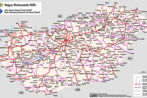
The Austro-Hungarian Railway Map accurately captures the railway lines, stations, and junctions across the empire, providing valuable insights into the connectivity and infrastructure of the time.
Unique Insights
The Austro-Hungarian Railway Map stands as a testament to the empire’s impressive engineering achievements, showcasing the following unique insights:
- The railway network extended over 22,000 kilometers, connecting major cities like Vienna, Budapest, Prague, and Trieste.
- The intricate railway lines facilitated trade between the empire’s diverse regions, promoting economic integration and development.
- Several rail lines ran through challenging geographical terrains such as the Alps, providing an incredible engineering feat.
- The Austro-Hungarian Railways were renowned for their remarkable punctuality and luxurious passenger services, setting new standards for railway travel.
Austro-Hungarian Railway Map Facts
| Year | Fact |
|---|---|
| 1837 | The first railway line in the empire, between Vienna and Bratislava, was opened. |
| 1854 | The Semmering Railway, an iconic mountain railway, was completed, showcasing Austrian engineering prowess. |
| 1870 | The empire’s railway network surpassed 10,000 kilometers in length. |
| 1884 | A direct railway connection between Budapest and Vienna was established, strengthening the ties between the empire’s two most prominent cities. |
| 1905 | The empire’s rail network reached its peak, with over 22,000 kilometers of track. |
Frequently Asked Questions (FAQ)
1. What was the significance of the Austro-Hungarian Railway Map?
The Austro-Hungarian Railway Map was significant as it depicted the extensive rail network that played a vital role in enabling trade, transportation, and socio-economic development within the empire.
2. Which major cities were connected by the Austro-Hungarian Railway?
The Austro-Hungarian Railway connected major cities such as Vienna, Budapest, Prague, Trieste, Bratislava, and many others.
3. How did the railway network contribute to economic growth?
The railway network facilitated the movement of goods, services, and people, promoting economic integration and fostering growth in various industries within the Austro-Hungarian Empire.
4. Did the Austro-Hungarian Railways face any engineering challenges?
Yes, the Austro-Hungarian Railways encountered engineering challenges, notably while constructing railway lines through the Alpine region.
5. Were there any remarkable features of the Austro-Hungarian Railways?
The Austro-Hungarian Railways were known for their punctuality and luxurious passenger services, setting new standards for railway travel.
6. When did the Austro-Hungarian Railways reach their peak length?
In 1905, the Austro-Hungarian Railways reached their peak length, spanning over 22,000 kilometers.
7. What happened to the Austro-Hungarian Empire and its railway network?
The Austro-Hungarian Empire dissolved in 1918 after the end of World War I. Consequently, the empire’s railway network underwent significant changes due to political developments and new national boundaries.
External Links
- Austro-Hungarian Empire Official Website
- The Golden Era of Railways in Europe
- Semmering Railway: UNESCO World Heritage Site
LSI Keywords
- Austro-Hungarian Empire
- Railway network
- Empire boundaries
- 19th-century transportation
- Economic integration
- Railway engineering
- Austro-Hungarian cities