Brazil Minas Gerais Location Map
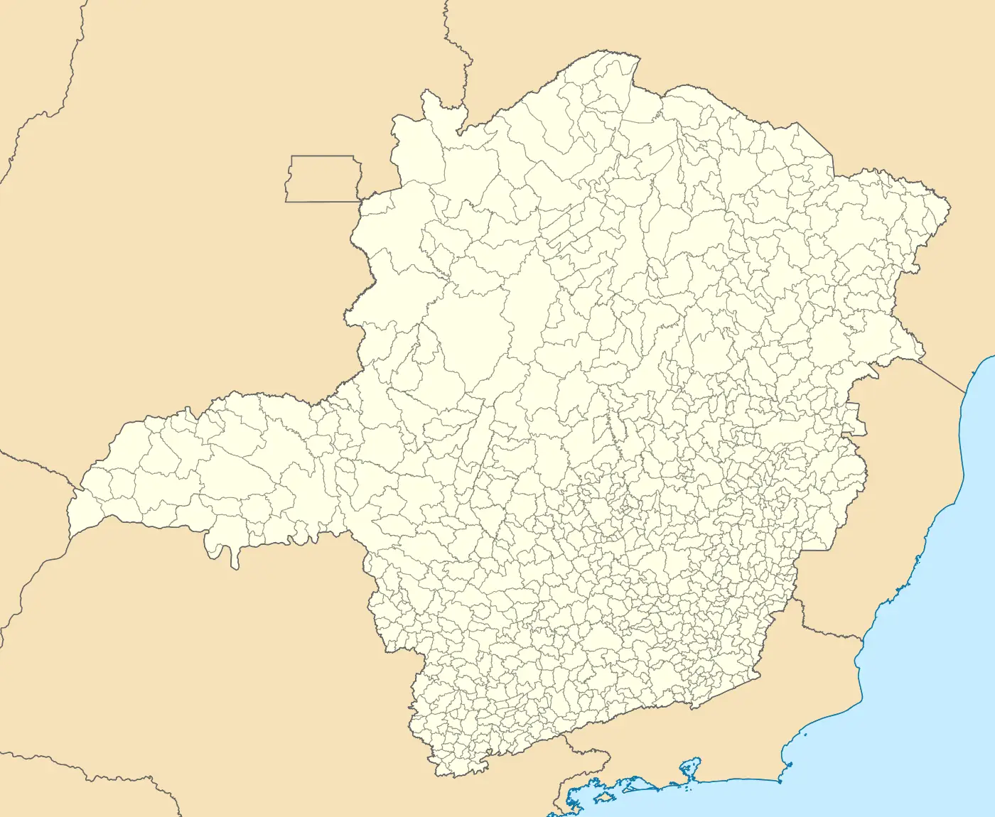
Click or tap the map to enlarge it.
Brazil Minas Gerais Location Map – Expert Cartographer’s Guide
Key Takeaways:
- The Brazil Minas Gerais Location Map helps identify the geographical position of the state of Minas Gerais within Brazil.
- Minas Gerais is the fourth largest state in Brazil and is known for its rich cultural heritage, stunning landscapes, and historical significance.
- The map serves as a valuable resource for tourists, researchers, and locals to explore the diverse attractions and understand the regional context of Minas Gerais.
History of Minas Gerais:
Minas Gerais, meaning “General Mines,” was officially established as a state on April 2, 1720. The region gained prominence during the 18th and 19th centuries due to the discovery of gold, diamonds, and other precious minerals.
During the colonial era, the Portuguese colonizers utilized slave labor to exploit the rich natural resources abundantly available in the region. This period of mining and exploration contributed significantly to Brazil’s economic growth and attracted immigrants from different parts of the world, resulting in a diverse cultural mix in Minas Gerais.
Minas Gerais played a vital role in Brazil’s independence from Portugal. The Brazilian Inconfidência Movement, an early attempt at independence, originated in this region, and its leaders played a crucial role in shaping Brazil’s history.
Today, Minas Gerais is recognized for its architectural treasures, colonial towns, vibrant cuisine, and breathtaking natural beauty, all of which are highlighted on the Brazil Minas Gerais Location Map.
Unique Insights:
1. Architectural Marvels: Minas Gerais boasts stunning architectural gems reflecting its colonial past. Cities like Ouro Preto, Diamantina, and Mariana feature intricate baroque churches, opulent palaces, and beautifully preserved cobblestone streets. Exploring these architectural marvels is a must for history enthusiasts and architecture lovers.
2. Natural Wonders: The map helps uncover the diverse natural wonders of Minas Gerais. From the majestic Serra do Cipó National Park with its waterfalls and canyons to the mystical beauty of the Chapada dos Veadeiros, nature lovers will be captivated by the state’s stunning landscapes.
3. Cultural Heritage: Minas Gerais is a melting pot of cultures and traditions. The map highlights cultural landmarks such as the Inhotim Institute, one of the largest contemporary art museums in Latin America, and the Congonhas Sanctuary, a UNESCO World Heritage site adorned with Aleijadinho’s sculptures.
4. Mining History: The Mining Museum in Ouro Preto offers insights into the region’s mining history, showcasing the tools, techniques, and artifacts from the bygone era. This museum is a great starting point to understand the impact of mining on the development of Minas Gerais.
5. Gastronomic Delights: Minas Gerais is renowned for its traditional cuisine. The map indicates various food hotspots, allowing visitors to savor delightful regional dishes such as pão de queijo, feijão tropeiro, and doce de leite.
Table of Relevant Facts:
| Period | Significant Event |
|---|---|
| 18th Century | Discovery of gold and diamonds in Minas Gerais. |
| 1720 | Minas Gerais officially established as a state. |
| 1789 | Inconfidência Mineira: Failed independence attempt. |
| 19th Century | Shift from mining to agriculture and industry. |
| 1980s | Recognition of cultural and historical importance, leading to preservation efforts. |
Frequently Asked Questions (FAQ):
1. Is it safe to travel to Minas Gerais?
Minas Gerais is generally safe for travelers and offers a welcoming environment. However, it is always recommended to take necessary precautions and stay aware of your surroundings, especially in crowded areas.
2. How do I reach Minas Gerais?
Minas Gerais is well-connected by air, road, and rail. International travelers can fly into major airports such as Tancredo Neves International Airport (Confins) or Belo Horizonte’s Pampulha Airport. Domestic flights are also available to various cities within the state.
3. What is the best time to visit Minas Gerais?
The weather in Minas Gerais is generally pleasant throughout the year. However, the months between April and October are often considered the best time to visit due to milder temperatures and lower chances of rainfall.
4. What are the must-visit attractions in Minas Gerais?
Some of the must-visit attractions in Minas Gerais include Ouro Preto, Diamantina, Inhotim Institute, Serra do Cipó National Park, and the historic towns of Tiradentes and Congonhas.
5. Can I explore Minas Gerais on a budget?
Yes, Minas Gerais offers a range of budget-friendly accommodation, dining, and transportation options. Additionally, many attractions and natural wonders can be explored for free or at a minimal cost.
6. Are there any specific local dishes to try in Minas Gerais?
Absolutely! Minas Gerais is famous for its delicious culinary delights. Don’t miss trying out local dishes such as pão de queijo (cheese bread), feijão tropeiro (bean and sausage dish), and doce de leite (caramel-like sweet made from condensed milk).
7. Can I experience the local culture in Minas Gerais?
Yes, Minas Gerais offers ample opportunities to experience the local culture. You can participate in traditional festivals, explore local handicrafts, visit historical landmarks, and savor authentic regional cuisine.