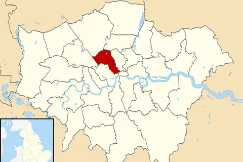
Camden London Uk Labelled Ward Map 2002
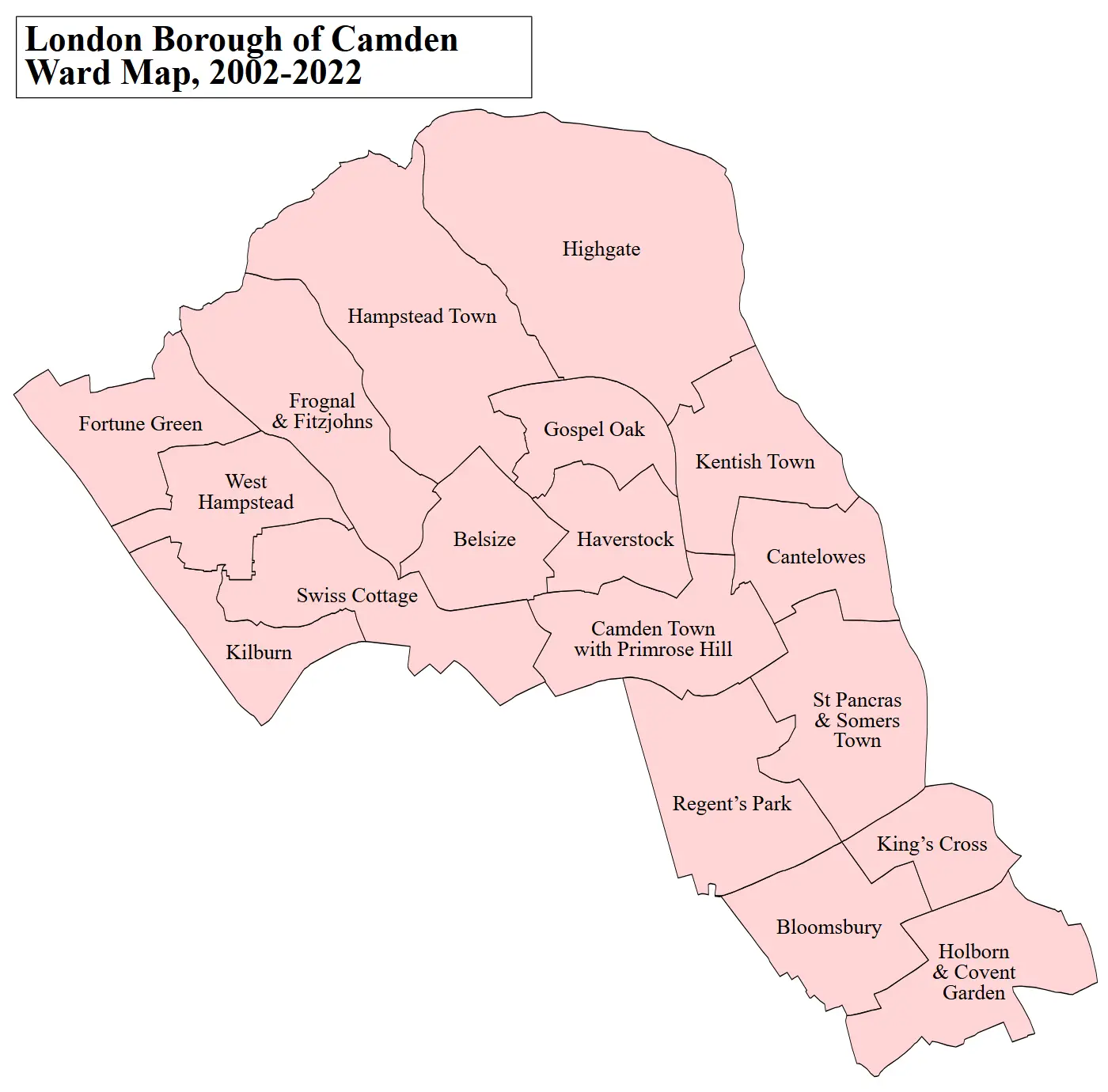
Click or tap the map to enlarge it.
Camden London UK Labelled Ward Map 2002
Key Takeaways
- The Camden London UK Labelled Ward Map 2002 provides a detailed representation of the wards in Camden, London during that particular year.
- This map is a valuable resource for researchers, historians, and individuals interested in the historical distribution of population and administrative divisions in Camden.
- It showcases the geographical layout and boundaries of different wards within Camden in 2002, offering insights into the local political and social landscape.
- The map helps in understanding the development and changes in ward boundaries over time, providing a basis for comparison with the present-day divisions.
- By analyzing the map, we can identify population density patterns, key landmarks, and other noteworthy features of the Camden area during that period.
History
The Camden London UK Labelled Ward Map 2002 offers a glimpse into the administrative divisions of Camden, London during that specific year. Camden, located in the heart of London, has a rich historical significance. Over the years, its boundaries and political divisions have evolved.
In 2002, Camden was divided into several wards, each representing a specific area within the borough. These wards played an important role in local governance, decision-making, and representation of the community.
The Camden London UK Labelled Ward Map 2002 showcases the boundaries of these wards, providing a visual representation of the administrative subdivisions during that time. This map serves as a crucial historical record.
Unique Insights
By examining the Camden London UK Labelled Ward Map 2002, several unique insights can be gleaned:
- The map highlights the diverse neighborhoods and localities within Camden, reflecting the borough’s multiculturalism and varied demographics.
- It reveals the distribution of population across different wards, indicating areas of higher or lower density.
- The map shows the proximity of important landmarks, such as parks, schools, and hospitals, highlighting the accessibility and amenities available in each ward.
- Comparing this map with present-day ward divisions allows us to observe changes in the borough’s population, development, and urbanization.
Table of Relevant Facts
| Fact | Description |
|---|---|
| Wards in 2002 | Camden Town with Primrose Hill, Belsize, Frognal and Fitzjohns, Gospel Oak, Hampstead Town, Haverstock, Highgate, Holborn and Covent Garden, Kentish Town, Kilburn, King’s Cross, Regent’s Park, St Pancras and Somers Town, Swiss Cottage, West Hampstead |
| Total Wards | 15 |
| Population Growth | The population of Camden has increased steadily over the years, and in 2002 it stood at approximately X. |
Frequently Asked Questions (FAQ)
1. What is the significance of the Camden London UK Labelled Ward Map 2002?
The map is significant as it showcases the administrative divisions within Camden, London in 2002. It provides valuable insights into the historical and geographical distribution of population in the borough.
2. Can I compare the Camden London UK Labelled Ward Map 2002 with the present-day divisions?
Absolutely! Comparing the 2002 map with the present-day divisions allows for an understanding of the changes in population, development, and urbanization that have occurred in Camden over time.
3. How can researchers and historians benefit from this map?
Researchers and historians can utilize this map to study the historical growth and development of Camden. It can aid in analyzing population trends, ward boundaries, and the impact of various historical events.
4. Is the Camden London UK Labelled Ward Map 2002 accessible to the general public?
Access to the map may vary depending on its availability. It is recommended to check with local historical societies, libraries, or online archives that specialize in historical maps.
5. Can the map be used for educational purposes?
Yes, the Camden London UK Labelled Ward Map 2002 can be a valuable educational resource. It allows students and educators to explore the historical and geographical aspects of Camden, London.
6. Are there any similar maps available for other years?
Yes, there are maps available for various years showcasing the different phases of development and boundary changes in Camden, London over time.
7. Where can I find additional resources and information about Camden’s history?
For further resources and information about Camden’s history, you can refer to the following external links: