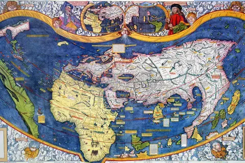
Egbert of Wessex Map
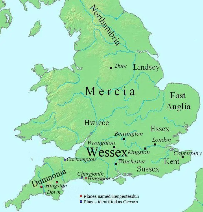
Click or tap the map to enlarge it.
Key Takeaways
- The Egbert of Wessex map is a historical map that provides a glimpse into the political boundaries of the world during the reign of King Egbert.
- It showcases the early medieval period and the kingdoms that existed during that time.
- The map reveals the influence and prominence of the kingdom of Wessex during this era.
- Exploring the Egbert of Wessex map allows us to understand the evolving nature of political landscapes and territorial divisions in the early medieval period.
- Studying this map can provide valuable insights into the historical context and cultural interactions of different regions during the reign of King Egbert.
History: The Egbert of Wessex Map
The Egbert of Wessex map is a significant historical cartographic representation that highlights the political boundaries and territories during the rule of King Egbert of Wessex in the early medieval period. King Egbert, who reigned from 802 to 839, was one of the first kings to be referred to as the “King of all England”.
Unique Insights
Exploring the Egbert of Wessex map provides unique insights into the political landscape of the early medieval period. Here are some notable insights:
1. Rise of Wessex
The map shows the territorial expansion and prominence of the kingdom of Wessex during King Egbert’s reign. Wessex gradually gained control over neighboring kingdoms and emerged as one of the dominant powers in pre-England.
2. Kingdoms and Territories
The map depicts various kingdoms and territories that coexisted during this era. It showcases distinct political boundaries, highlighting cultural and linguistic diversity across the region.
3. Viking Invasions
The map reveals the impact of Viking invasions on the political landscape. The Vikings frequently raided coastal areas, and their presence influenced territorial divisions and power dynamics. This map can help in understanding the vulnerability and resilience of different regions during Viking attacks.
4. Cultural Interactions
By studying the boundaries and overlaps of kingdoms on the map, we can gain insights into the cultural interactions and conflicts that occurred during this period. It presents an opportunity to explore the exchange of ideas, trade, and potential clashes between different ethnic groups.
Relevant Facts
| Year | Event |
|---|---|
| 802 | King Egbert ascends to the throne of Wessex |
| 825 | Battle of Ellendun – Wessex defeats the Mercians |
| 832 | Wessex conquers Cornwall |
| 835 | Isle of Wight is brought under Wessex’s control |
| 839 | King Egbert dies and is succeeded by his son, Ethelwulf |
Frequently Asked Questions
-
What is the significance of the Egbert of Wessex map?
The Egbert of Wessex map is significant as it provides insights into the political landscape and territorial divisions during the early medieval period.
-
How does the map reflect the rise of Wessex?
The map showcases the territorial expansion and prominence of the kingdom of Wessex during King Egbert’s reign, demonstrating its rise to power.
-
What can we learn about cultural interactions from the map?
By studying the boundaries and overlaps of kingdoms, we can gain insights into cultural interactions, trade, and potential clashes between different ethnic groups.
-
How did Viking invasions impact the political landscape?
Viking invasions influenced territorial divisions and power dynamics. The map helps us understand the vulnerability and resilience of regions during these attacks.
-
Who was King Egbert of Wessex?
King Egbert was a monarch who reigned over Wessex from 802 to 839 and was one of the first kings to be referred to as the “King of all England”.
-
When did King Egbert ascend to the throne?
King Egbert became the ruler of Wessex in the year 802.
-
What happened after King Egbert’s death?
After King Egbert’s death in 839, he was succeeded by his son, Ethelwulf.