Flag Map of Greater Italy Kingdom of Italy
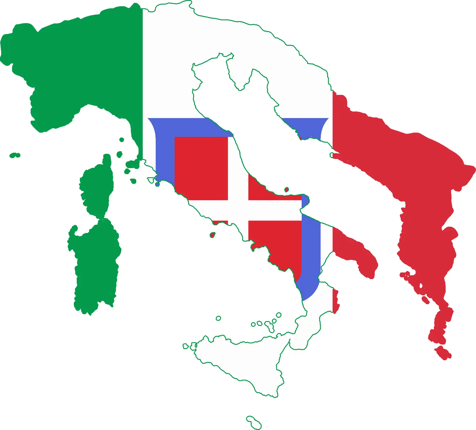
Click or tap the map to enlarge it.
Flag Map Of Greater Italy Kingdom Of Italy
Key Takeaways
- The flag map of Greater Italy Kingdom of Italy represents the territorial expansion during the peak of Italy’s power.
- This map showcases the land occupied by the Kingdom of Italy during the period from 1861 to 1946.
- Greater Italy included regions such as Trentino-Alto Adige/Südtirol, Trieste, and Istria among others.
- The map serves as a historical reference to understand Italy’s geopolitical changes during the late 19th and early 20th centuries.
History
The flag map of Greater Italy Kingdom of Italy represents the territorial reach and expansion of the Kingdom of Italy during the late 19th and early 20th centuries. This map depicts the regions that were part of the Italian nation-state from 1861 until 1946.
After Italy’s unification in 1861, the country initiated a period of significant expansion, aiming to regain the territories that were historically part of Italy. This ambitious undertaking was known as the “Italia Irredenta” or “Unredeemed Italy” movement. The map captures the areas that the Kingdom of Italy sought to incorporate to align with its notion of historical boundaries.
The regions represented on the flag map include Trentino-Alto Adige/Südtirol, Trieste, Istria, Zara, Dalmatia, the Italian-speaking parts of Corsica, Nice, Savoy, and Malta among others. The map signifies Italy’s ambition to consolidate its position as a major European power during this time.
Unique Insights
- The territorial expansions reflected on the flag map of Greater Italy were primarily driven by Italy’s desire to regain historically Italian regions, consolidate national identity, and increase political influence.
- Despite the territorial aspirations, Italy faced challenges in its quest for expansion. The acquiring of these territories was often met with resistance from rivaling nations and ethnicities.
- The areas depicted on the map hold historical significance due to their inclusion in the Kingdom of Italy during the peak of Italian nationalism and quest for identity.
Table of Relevant Facts
| Year | Event |
|---|---|
| 1861 | Italy becomes a unified nation-state. |
| 1866 | Italy acquires Venetia from Austria after the Austro-Prussian War. |
| 1870 | The Papal States are incorporated into the Kingdom of Italy. |
| 1919 | Treaty of Saint-Germain-en-Laye grants Italy territory including Trentino-Alto Adige/Südtirol, Trieste, and Istria. |
| 1946 | The Italian monarchy is abolished, leading to the end of the Kingdom of Italy. |
Frequently Asked Questions
1. What is the significance of the Greater Italy Kingdom of Italy flag map?
The flag map of Greater Italy Kingdom of Italy is significant as it represents the territorial expansion and ambitions of the Kingdom of Italy during the late 19th and early 20th centuries. It provides a visual reference to the regions that were part of Italy during this period.
2. What areas are included in the Greater Italy Kingdom of Italy flag map?
The areas depicted on the flag map of Greater Italy include regions such as Trentino-Alto Adige/Südtirol, Trieste, Istria, Zara, Dalmatia, the Italian-speaking parts of Corsica, Nice, Savoy, and Malta among others.
3. What was the goal of the Greater Italy expansion?
The goal of the Greater Italy expansion was to incorporate regions that were historically part of Italy, aligning with the notion of historical boundaries. Italy aimed to consolidate its position as a major European power and assert its national identity.
4. Did Italy face any challenges in its expansion efforts?
Yes, Italy faced challenges in its expansion efforts. Acquiring these territories was often met with resistance from rivaling nations and ethnicities. The acquisition of certain regions required diplomatic negotiations and agreements.
5. When did the Kingdom of Italy come to an end?
The Kingdom of Italy came to an end in 1946 when the Italian monarchy was abolished. This marked the transition to the Italian Republic.
6. Is the Greater Italy Kingdom of Italy flag map still relevant today?
The flag map of Greater Italy Kingdom of Italy holds historical significance in understanding Italy’s geopolitical changes. While the territorial boundaries have changed, the map serves as a historical reference and symbol of Italy’s past ambitions.
7. Are there any museums or exhibitions dedicated to the Greater Italy Kingdom of Italy flag map?
There may be museums or exhibitions dedicated to Italian history and territorial expansion where the flag map of Greater Italy could be displayed. It is recommended to check local museums, historical societies, or exhibitions on Italian history.