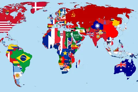
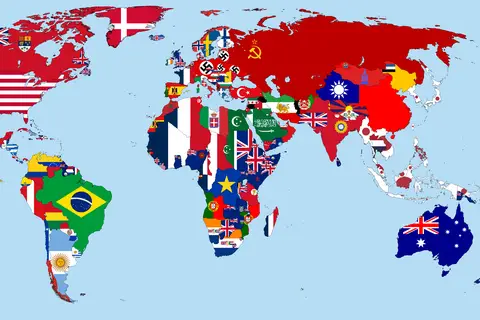
Flagmap of the World 1938
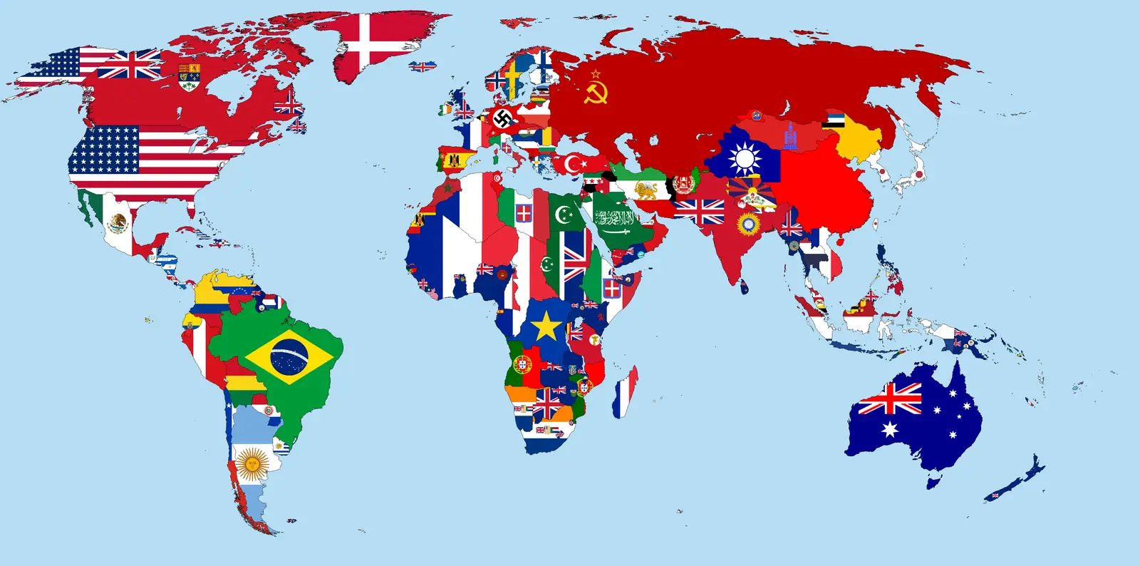
Click or tap the map to enlarge it.
Flagmap Of The World 1938
Key Takeaways
- The Flagmap Of The World 1938 is a unique representation of the world where each country’s flag is used to represent its geographic location.
- Created in 1938, the Flagmap provides a snapshot of the geopolitical landscape of that time.
- It allows us to visualize the distribution of countries and their national flags during the pre-World War II period.
- The Flagmap Of The World 1938 serves as a valuable historical artifact and an interesting cartographic study.
History
The year 1938 was a crucial time in world history as tensions were rising, and the world was on the brink of entering another devastating war. Amidst these circumstances, the Flagmap Of The World 1938 was created by visionary cartographers to provide a unique view of the world.
Each country’s national flag was meticulously placed in its respective geographic location, highlighting the diversity of flags across the globe. The Flagmap aimed to reflect the geopolitical reality of that time, enabling viewers to understand the distribution of nation-states and their symbols on a global scale.
Unique Insights
The Flagmap Of The World 1938 offers several unique insights:
- Visualization of National Identity: The use of flags allows viewers to see the distinct national identities of each country. It provides a glimpse into the symbolism and history associated with these flags.
- Geopolitical Analysis: The Flagmap enables geopolitical analysis by showcasing the distribution of nations and the proximity of neighboring countries.
- Changes Over Time: By comparing the Flagmap to current maps, we can identify how borders, political alliances, and national sovereignties have evolved over the years.
- Cultural Interplay: The Flagmap reveals the diverse range of colors, patterns, and symbols present in national flags, showcasing the cultural interplay between different regions and nations.
Table: Relevant Facts of 1938
| Event | Description |
|---|---|
| Anschluss | Annexation of Austria by Nazi Germany. |
| Munich Agreement | Agreement allowing Germany to annex parts of Czechoslovakia. |
| Kristallnacht | A series of coordinated attacks against Jews throughout Nazi Germany. |
| Spanish Civil War | The civil war in Spain between Republicans and Nationalists. |
| Second Sino-Japanese War | Conflict between China and Japan. |
Frequently Asked Questions (FAQ)
-
What is the significance of the Flagmap Of The World 1938?
The Flagmap is significant as it provides a unique representation of the geopolitical landscape before World War II. It allows us to visualize the distribution of countries and their national flags during that time.
-
Who created the Flagmap Of The World 1938?
The flagmap was created by visionary cartographers who wanted to offer a distinct perspective on the world and its nations.
-
Can the Flagmap be used for educational purposes?
Absolutely! The Flagmap is an excellent educational resource for students, researchers, and history enthusiasts who want to understand the geopolitical landscape of 1938.
-
How does the Flagmap differ from traditional maps?
The Flagmap uses national flags instead of traditional cartographic symbols to represent countries, providing a unique visual experience.
-
Are there any similar flagmaps for other historical periods?
While the Flagmap Of The World 1938 is notable, there are similar flagmaps available for different years, enabling comparisons between different time periods.
-
Can I purchase a physical copy of the Flagmap?
Depending on availability, physical copies of the Flagmap may be found in antique bookstores, map shops, or online auction platforms.
-
Can I use the Flagmap for my research or publication?
Yes, the Flagmap can be used for research or publication purposes, but it is essential to provide proper attribution and ensure compliance with copyright laws.