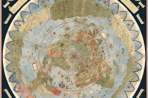
Fra Mauro World Map C1450
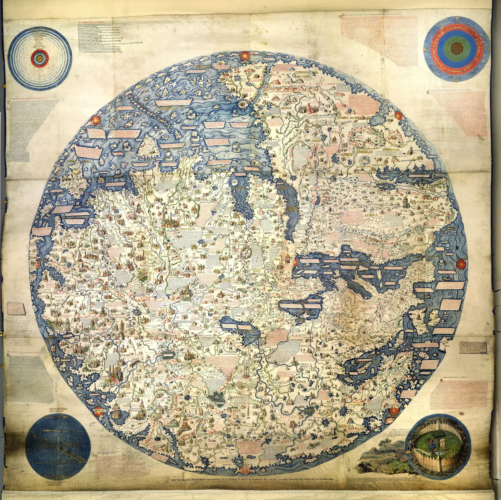
Click or tap the map to enlarge it.
Key Takeaways
- The Fra Mauro World Map, created around 1450, is a significant milestone in cartography.
- It features detailed geographical knowledge of the world during the early Renaissance.
- The map stands out for its accuracy, aesthetic beauty, and the wealth of historical information it provides.
- Fra Mauro, a Venetian cartographer and monk, created the map based on available information and accounts from explorers.
History
The Fra Mauro World Map is an important historical cartographic work created around 1450 by Fra Mauro, an
Italian monk and cartographer from the Republic of Venice. Fra Mauro spent several years meticulously
compiling information from various sources to create this groundbreaking map.
During the Renaissance, significant advancements were made in geographical understanding and exploration.
Explorers like Christopher Columbus, Vasco da Gama, and Ferdinand Magellan were paving the way for new
discoveries. Fra Mauro, driven by the curiosity of the era, combined available information to give a
comprehensive view of the known world.
Fra Mauro’s map, with its intricate details and artistic beauty, reflects the knowledge and artistic
capabilities of the time. It is considered one of the most valuable surviving maps from the 15th century.
Unique Insights
The Fra Mauro World Map provides unique insights into the geographical understanding of the time. Here are
some notable insights:
- Representation of the African continent: The map reflects the limited knowledge about Africa during
that period. Most of the interior parts of Africa are uncharted, with only the northern regions and the
Nile River Valley depicted. - Asia and the Silk Road: Asia, including the Indian subcontinent and China, is depicted with reasonable
accuracy. The Silk Road trade routes are also featured, showcasing the importance of trade during that
time. - European expansion: The map illustrates the European exploration that was occurring during the
Renaissance. European territories and exploration routes are evident, emphasizing the beginning of the
Age of Discovery.
Table of Relevant Facts
| Year | Event |
|---|---|
| 1450 | Creation of the Fra Mauro World Map |
| 15th century | Significant advancements in geographical exploration and understanding |
| Early Renaissance | Period of increased curiosity and discovery |
FAQ
-
Who was Fra Mauro?
Fra Mauro was an Italian monk and cartographer from the Republic of Venice. He is known for creating
the Fra Mauro World Map. -
What makes the Fra Mauro World Map significant?
The Fra Mauro World Map is significant due to its high level of geographical accuracy, aesthetic
beauty, and the wealth of historical information it provides from the 15th century. -
What does the map depict?
The map depicts the known world during the Renaissance, including Europe, Asia, and Africa. It also
showcases European exploration routes and the Silk Road. -
How was the map created?
Fra Mauro spent years compiling information from various sources, including explorers’ accounts, to
create the map. It was meticulously crafted with incredible attention to detail. -
Is the Fra Mauro World Map still intact today?
The original map created by Fra Mauro was lost; however, several high-quality copies and replicas
exist, allowing us to appreciate its significance. -
What insights does the map provide?
The map provides insights into the limited geographical knowledge of Africa, the importance of the
Silk Road, and European expansion during the Renaissance. -
What impact did the Fra Mauro World Map have?
The map played a significant role in advancing geographical knowledge during the Renaissance. It
influenced subsequent cartographic works and contributed to the overall exploration and
understanding of the world.
External Links
List of LSI Keywords
- Fra Mauro cartographer
- 15th century map
- Renaissance cartography
- Geographical understanding
- Christopher Columbus
- Age of Discovery
- European exploration
- Silk Road trade routes
- Africa during the Renaissance
- Asia in the 15th century