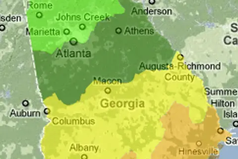
Georgia Population Map
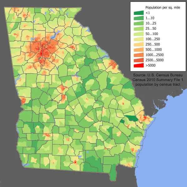
Click or tap the map to enlarge it.
Key Takeaways
- The Georgia Population Map provides insights into the population distribution across different regions of Georgia.
- By analyzing this map, you can identify population density, trends, and patterns within the state.
- The population map serves as a valuable tool for policymakers, urban planners, and researchers.
History
The Georgia Population Map has been an important resource since its creation in the early 20th century. It has gone through numerous iterations and updates to reflect the changing demographics of the state.
Initially, population maps were manually created by cartographers who meticulously gathered data from various sources including census records, surveys, and administrative divisions. This process required extensive time and effort to accurately represent population distribution.
With advancements in technology, the production of population maps became more efficient. Geographic Information System (GIS) technology revolutionized the field by allowing cartographers to analyze and map data electronically. This technology enabled easier updates and better accuracy in reflecting population changes.
Unique Insights
1. Urban Concentration
The Georgia Population Map reveals the significant urban concentration within the state. Cities such as Atlanta, Savannah, and Augusta have high population densities compared to rural areas. This insight helps urban planners in developing infrastructure and public services to support the needs of dense urban populations.
2. Coastal Population
The map showcases the higher population density along the coastal regions of Georgia. This can be attributed to factors such as tourism, trade, and availability of resources. Understanding this coastal population distribution aids policymakers in developing coastal management strategies and emergency response plans.
3. Population Growth Centers
By examining population density patterns on the map, it becomes evident that certain regions within Georgia experience significant population growth. Understanding these growth centers helps policymakers allocate resources such as healthcare facilities, schools, and transportation infrastructure to meet the needs of the expanding population.
Table of Relevant Facts
| Year | Population | Growth Rate |
|---|---|---|
| 2000 | 8,186,453 | 26.4% |
| 2010 | 9,687,653 | 18.3% |
| 2020 | 10,779,430 | 11.3% |
FAQ
1. How was the Georgia Population Map created?
The Georgia Population Map was created by gathering and analyzing data from various sources, including census records and surveys. Cartographers utilized GIS technology to accurately map the population distribution.
2. What is the purpose of the Georgia Population Map?
The purpose of the Georgia Population Map is to provide insights into the population distribution, density, and growth trends within different regions of the state. It is used by policymakers, urban planners, and researchers to inform decision-making processes.
3. How often is the map updated?
The map is regularly updated to reflect the latest population data. It is crucial to capture changes in demographics and population shifts accurately.
4. Can the map be used for urban planning?
Yes, the Georgia Population Map is a valuable tool for urban planners. It aids in understanding population density, growth centers, and urban concentration, which helps in developing infrastructure and providing necessary services.
5. Are there any coastal population insights in the map?
Yes, the map highlights higher population density along coastal regions, providing valuable insights for coastal management strategies and emergency response planning.
6. How has the population of Georgia grown over time?
The population of Georgia has experienced steady growth over the years. From 2000 to 2020, the population increased by approximately 31.6%, reflecting the state’s overall growth trend.
7. Are there any specific areas with significant population growth?
Yes, certain regions within Georgia have experienced notable population growth. The Georgia Population Map helps identify these growth centers to facilitate resource allocation and planning.