Hampi Ruins of Vijaynagar India Map 1911
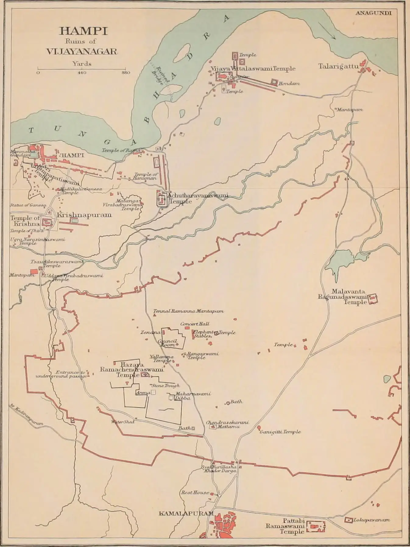
Click or tap the map to enlarge it.
Key Takeaways
- The Hampi Ruins of Vijaynagar, India, is depicted on a map from 1911.
- Explore the historical significance and archaeological marvel of this UNESCO World Heritage Site.
- Learn about the ancient city’s layout, key landmarks, and the rich cultural heritage it represents.
- Discover interesting insights about the decline of the Vijayanagara Empire and the subsequent rediscovery of the ruins.
History
The Hampi Ruins in Vijaynagar, India, are remnants of the once magnificent Vijayanagara Empire, which flourished between the 14th and 16th centuries. Located in the present-day state of Karnataka, these ruins are a testament to the city’s grandeur and architectural excellence. Hampi was the capital of the empire and served as a center for trade, arts, and culture.
The area covered by the map from 1911 showcases the layout of the ancient city along with its prominent landmarks. It provides valuable insights into the historical development of the region.
Unique Insights
- The map reveals the intricate planning and urban design of Vijayanagara, with its well-structured streets, markets, and palatial complexes.
- It highlights the iconic Virupaksha Temple, dedicated to Lord Shiva, which stands as a symbol of religious tolerance and architectural brilliance.
- Interesting topographical details, including the Tungabhadra River and the surrounding hills, enhance our understanding of Hampi’s natural setting.
- Through the map, we can also observe the spatial distribution of various temples, administrative buildings, and water bodies.
Table: Relevant Facts
| Year | Significance |
|---|---|
| 1336 CE | Establishment of the Vijayanagara Empire by Harihara and Bukka |
| 1565 CE | Final battle leading to the decline of the empire |
| 1986 CE | Hampi declared a UNESCO World Heritage Site |
Frequently Asked Questions (FAQ)
-
1. What is the historical significance of Hampi?
Hampi holds immense historical significance as the capital of the Vijayanagara Empire, showcasing the architectural and cultural heritage of the region.
-
2. How was Hampi rediscovered?
Hampi’s ruins were rediscovered by Colin Mackenzie, an officer in the British East India Company, during his survey of the region in the early 19th century.
-
3. Are the ruins well-preserved?
While many of the structures have suffered from natural decay and invasions, significant parts of the ruins remain well-preserved, captivating visitors with their intricate carvings and architectural marvels.
-
4. Can visitors explore the ruins?
Yes, visitors can explore the Hampi Ruins, which are open to the public. The Archaeological Survey of India has implemented measures to protect and preserve the site.
-
5. What is the best way to reach Hampi?
Hampi can be reached by air, rail, and road. The nearest airport is in Bellary, approximately 74 kilometers away.
-
6. Are there accommodation options near Hampi?
Yes, there are various hotels, guesthouses, and resorts available for tourists near Hampi, offering a comfortable stay during their visit.
-
7. Are there guided tours of the Hampi Ruins?
Absolutely! Guided tours are available for visitors, providing in-depth knowledge about the history, architecture, and cultural significance of the ruins.