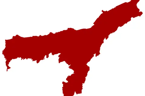
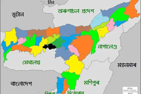
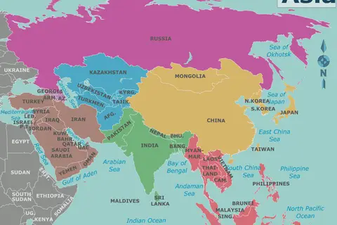
India Assam Locator Map
India Assam Locator Map – A Detailed Guide
Key Takeaways
- India Assam Locator Map helps in identifying the location of Assam within India.
- Assam is a state located in northeastern India, known for its rich wildlife, tea plantations, and cultural heritage.
- The map provides an overview of Assam’s neighboring states and bordering countries.
History
The India Assam Locator Map is a geographical representation of the state of Assam, situated in northeastern India. Assam has a deep-rooted historical significance and has been inhabited for centuries. The region has seen the rise and fall of numerous empires, witnessed invasions and dynasties, and experienced cultural assimilation.
Assam played a prominent role in the Ahom Kingdom, which ruled the region for nearly six centuries (1228-1826). It was during this period that Assam witnessed significant developments in governance, trade, and cultural exchanges.
In the colonial era, Assam came under British rule and played a crucial role in the tea industry. The British established numerous tea plantations, which eventually became a defining characteristic of Assam’s landscape and economy.
Unique Insights
- Assam is home to the Kaziranga National Park, a UNESCO World Heritage Site and a major wildlife conservation area.
- It is the largest producer of tea in India, known for its strong and distinct flavor.
- The Brahmaputra River, one of the major rivers in Asia, flows through Assam, shaping its geography and providing livelihood to many.
- Assam is known for its rich cultural heritage, including traditional dances, music, and handicrafts.
Table of Facts
| Year | Event |
|---|---|
| 1228 | Establishment of the Ahom Kingdom |
| 1826 | End of Ahom rule and Assam comes under British control |
| 1839 | Discovery of tea in Assam, leading to the establishment of the tea industry |
| 1985 | Assam Accord signed to address issues related to illegal immigration |
Frequently Asked Questions
-
What is the best time to visit Assam?
The best time to visit Assam is during the winter months of November to April when the weather is pleasant and wildlife sightings are common.
-
Is a permit required to visit Assam?
No, Indian citizens do not require a permit to visit Assam. However, foreign nationals need to obtain an Inner Line Permit (ILP) through the Ministry of Home Affairs.
-
What are some popular tourist attractions in Assam?
Some popular tourist attractions in Assam include Kaziranga National Park, Kamakhya Temple, Majuli Island, and Sivasagar.
-
What is Assam famous for?
Assam is famous for its tea, wildlife sanctuaries, and rich cultural heritage.
-
What is the main language spoken in Assam?
The main language spoken in Assam is Assamese. However, other languages like Bengali, Bodo, and Hindi are also widely spoken.
-
Are there any adventure activities available in Assam?
Yes, Assam offers various adventure activities like river rafting, trekking, and wildlife safaris.
-
How can I reach Assam?
Assam is well-connected by air, rail, and road. The main international airport is in Guwahati, the largest city in Assam.
External Links
LSI Keywords
- Assam tea
- Kaziranga National Park
- Ahom Kingdom
- Guwahati
- Indian wildlife sanctuaries
- Inner Line Permit
- Brahmaputra River