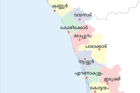
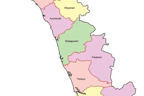
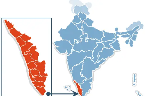
Kerala Profile Map
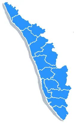
Click or tap the map to enlarge it.
Kerala Profile Map: A Comprehensive Guide
Key Takeaways
- Kerala is a state located in the southwestern region of India.
- The Kerala Profile Map displays the geographic features, major cities, and tourist attractions of the state.
- Understanding the map can help in better exploring and navigating through Kerala.
History
Kerala, known as “God’s Own Country”, has a rich history that is intertwined with trade, colonization, and cultural exchanges. The Kerala Profile Map provides insights into the historical significance of various regions in the state.
Ancient Period
During the ancient period, Kerala was known as “Chera Kingdom”. It had strong trade links with ancient civilizations like Rome, Greece, and Egypt. The spice trade played a crucial role in shaping Kerala’s history and attracting traders from different parts of the world.
Colonial Era
In the 15th century, the Portuguese arrived in Kerala, followed by the Dutch, and later the British. The map showcases the coastal areas where the foreign powers established trading posts and forts. These colonial influences left an indelible mark on Kerala’s culture, architecture, and cuisine.
Post-Independence
After India gained independence in 1947, Kerala became a state in 1956. The map highlights the various districts and cities that shape the picturesque landscape of Kerala today.
Unique Insights
- Kerala is famous for its backwaters, a network of canals, rivers, and lagoons that offer stunning scenic beauty.
- The Western Ghats mountain range, which runs parallel to the Arabian Sea, is a UNESCO World Heritage Site and is showcased on the map.
- The map reveals the presence of numerous wildlife sanctuaries and national parks in Kerala, making it a hub for nature enthusiasts.
Table: Major Events in Kerala’s History
| Time Period | Event |
|---|---|
| 2nd Century BCE | Establishment of Chera Kingdom |
| 15th century CE | Arrival of Portuguese |
| 17th century CE | Dutch presence in Kerala |
| 18th century CE | British colonization |
| 1947 | India’s Independence |
| 1956 | Formation of Kerala state |
Frequently Asked Questions (FAQ)
1. What is the significance of the Kerala Profile Map?
The Kerala Profile Map provides a comprehensive overview of the state, showcasing its geographic features, major cities, and tourist attractions. It helps in understanding the layout of Kerala and aids in navigation.
2. Are there any natural attractions highlighted on the map?
Yes, the map highlights the Western Ghats mountain range, backwaters, and various wildlife sanctuaries and national parks in Kerala.
3. How can the historical information on the map enhance our understanding of Kerala?
By exploring the historical information on the map, visitors can better appreciate the cultural influences, colonial heritage, and the journey of Kerala from ancient times to the present.
4. Is the Kerala Profile Map useful for tourists?
Yes, the map is extremely useful for tourists as it highlights major cities, touristic attractions, and transportation routes. It assists in planning itineraries and exploring the beauty of Kerala.
5. Can the Kerala Profile Map be accessed online?
Yes, the Kerala Profile Map is available online and can be accessed through various websites and mapping platforms.
6. Are there any landmarks specific to Kerala that are indicated on the map?
Yes, the map indicates prominent landmarks like historical forts, temples, palaces, and religious sites that are unique to Kerala’s cultural heritage.
7. Are there any specific geographical regions highlighted on the map?
Yes, the map showcases the distinct regions of Kerala, including the Malabar region, Travancore, Kochi, and the coastal belt.