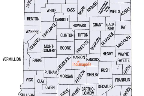
Location Map Indianapolis
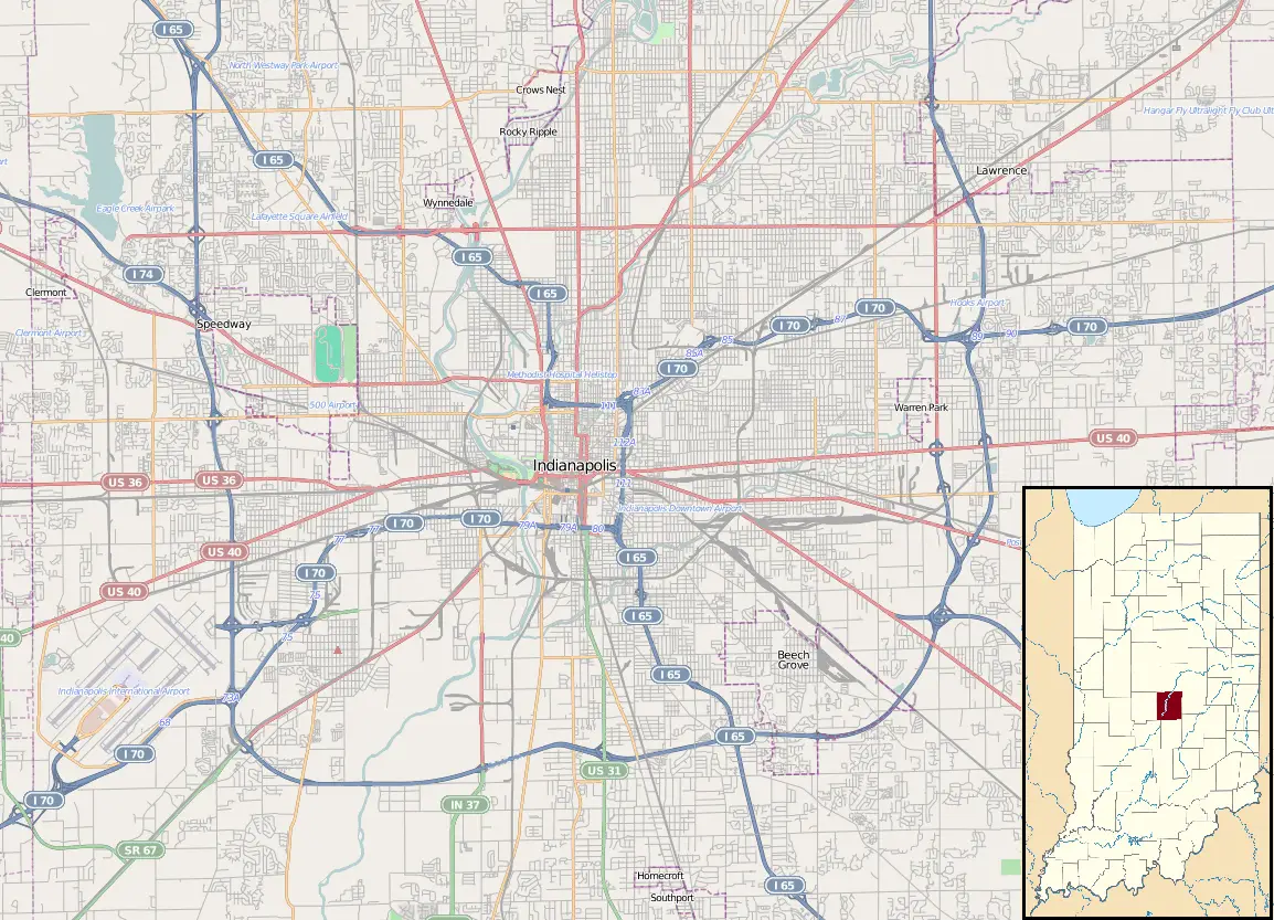
Click or tap the map to enlarge it.
Key Takeaways
- Indianapolis is the capital city of the U.S. state of Indiana.
- It is located in the Midwest region of the United States.
- Indianapolis is known for its sports heritage, particularly the Indianapolis 500 race.
- The city offers a wide range of cultural and recreational activities.
- Indianapolis is home to several renowned universities and museums.
History of Indianapolis
Indianapolis, the capital city of Indiana, has a rich history that dates back to its founding in 1820. The city was strategically planned as the state capital to promote growth and development in the region.
During the 19th century, Indianapolis flourished as a transportation hub due to its strategic location within the state and its connection to major railroads. This led to the city’s rapid population growth and economic prosperity.
Indianapolis played a significant role in the American Civil War as a major center for war-related manufacturing. The city’s industries supplied the Union Army with weapons, ammunition, and other essential supplies.
In the early 20th century, Indianapolis became known for its automobile manufacturing industry. The construction of the Indianapolis Motor Speedway in 1909 further solidified the city’s association with motorsports.
Unique Insights
Here are some unique insights about Indianapolis:
- Indianapolis is home to the largest children’s museum in the world, known as The Children’s Museum of Indianapolis.
- The city is also known for its stunning architecture, including the neoclassical Indiana State Capitol building.
- Indianapolis hosts numerous annual events and festivals, attracting visitors from around the globe.
- The city has a well-developed system of parks and green spaces, providing ample opportunities for outdoor recreation.
- Indianapolis has a diverse culinary scene with a wide range of restaurants offering various cuisines.
Relevant Facts about Indianapolis
| Year | Event |
|---|---|
| 1820 | Indianapolis founded as the state capital of Indiana. |
| 1865 | Abraham Lincoln’s funeral train passes through Indianapolis. |
| 1909 | The first Indianapolis 500 race takes place. |
| 1970 | Unigov consolidated Indianapolis with Marion County, expanding its boundaries. |
| 2012 | Indianapolis hosts Super Bowl XLVI. |
FAQ about Indianapolis
-
What is the population of Indianapolis?
The population of Indianapolis is approximately 900,000 according to recent estimates.
-
What are the major sports teams in Indianapolis?
Indianapolis is home to several professional sports teams, including the Indianapolis Colts (NFL) and the Indiana Pacers (NBA).
-
What are some popular attractions in Indianapolis?
Popular attractions in Indianapolis include the Indianapolis Motor Speedway, the Indianapolis Museum of Art, and the Indianapolis Zoo.
-
Is Indianapolis a walkable city?
While Indianapolis does have walkable areas, it is primarily a car-dependent city. However, efforts are being made to improve walkability and public transportation options.
-
What is the climate like in Indianapolis?
Indianapolis experiences a humid continental climate, characterized by four distinct seasons. Summers are generally warm and humid, while winters can be cold with occasional snowfall.
-
Which famous people are from Indianapolis?
Some notable individuals from Indianapolis include author Kurt Vonnegut, basketball player Larry Bird, and actor David Letterman.
-
What is the best time to visit Indianapolis?
The best time to visit Indianapolis is during the spring or fall when the weather is mild and many outdoor events take place.