Location Map Ireland County Donegal
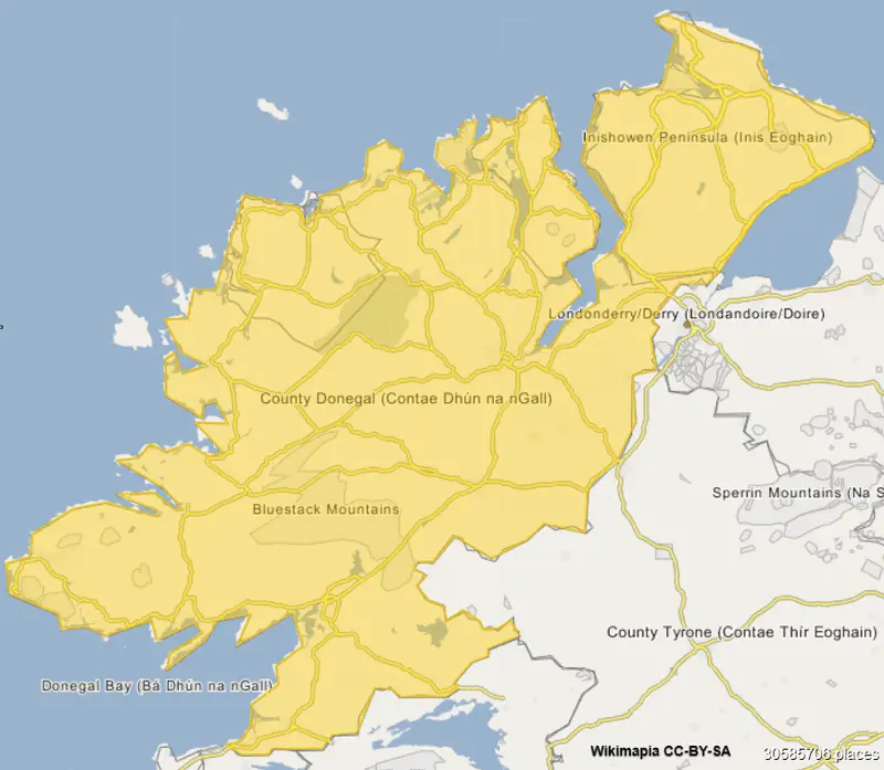
Click or tap the map to enlarge it.
Key Takeaways
- County Donegal is located in the northwest of Ireland and is part of the province of Ulster.
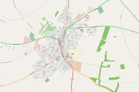
- This map provides a visual representation of the geographical location of County Donegal.
- County Donegal offers stunning landscapes, rugged coastlines, and rich cultural heritage.
- Exploring County Donegal through this location map can help you plan your visit and discover its attractions.
History
County Donegal, known as Tír Chonaill in Irish, has a rich history that dates back to ancient times. The earliest known settlements in the area date back to around 8000 BC, with evidence of Neolithic and Bronze Age activity.
Throughout the centuries, County Donegal experienced Viking raids, Norman invasions, and conflicts between Gaelic clans. The region has seen its fair share of turbulent times but has also flourished culturally and economically.
Unique Insights
- County Donegal is the second-largest county in Ireland and covers an area of approximately 4,841 square kilometers.
- It is home to Ireland’s highest sea cliffs, the Slieve League, which reach a height of over 600 meters.
- Glenveagh National Park, located in County Donegal, is a remote and stunning wilderness area covering over 16,000 hectares.
- Donegal Town, the county’s largest town, is known for its historical sites such as Donegal Castle and the Franciscan Abbey.
- The Inishowen Peninsula, situated in the northern part of County Donegal, offers breathtaking scenery and is a popular tourist destination.
- County Donegal is renowned for its traditional music, vibrant festivals, and warm hospitality.
Relevant Facts
| Year | Event |
|---|---|
| 1159 | County Donegal was formed as an administrative division of the Kingdom of O’Neill. |
| 1607 | The Flight of the Earls occurred when the last of the Gaelic chieftains left Ireland from Rathmullan, County Donegal. |
| 1922 | County Donegal became part of the Irish Free State as a result of the Anglo-Irish Treaty. |
| 1986 | Letterkenny became the county’s largest town, surpassing Donegal Town. |
Frequently Asked Questions (FAQ)
1. What are the main attractions in County Donegal?
County Donegal boasts a variety of attractions, including the stunning Slieve League cliffs, Glenveagh National Park, Donegal Castle, and the Inishowen Peninsula.
2. How can I reach County Donegal?
County Donegal is easily accessible by air, with airports in Donegal, Derry, and Belfast. You can also reach the county by road or take a ferry from Northern Ireland.
3. Are there any famous cultural festivals in County Donegal?
Yes, County Donegal hosts several renowned cultural festivals throughout the year, such as the Donegal International Folk & Roots Festival, the Earagail Arts Festival, and the MacGill Summer School.
4. Where can I find traditional Irish music in County Donegal?
Traditional Irish music can be enjoyed in various pubs and music venues across the county. Places like Ballyshannon, Letterkenny, and Ardara are known for their lively music scenes.
5. Is County Donegal suitable for outdoor activities?
Absolutely! County Donegal offers fantastic opportunities for outdoor activities such as hiking, golfing, fishing, surfing, and kayaking. Its diverse landscapes and coastline are perfect for adventurers.
6. What is the best time of year to visit County Donegal?
The summer months, particularly June to August, are popular for visiting County Donegal due to milder weather and longer days. However, each season has its own charm, and the county can be enjoyed year-round.
7. Can I explore County Donegal by public transport?
While public transport options are available, it is recommended to have a car to fully explore County Donegal, especially its more remote areas and natural attractions.