Map of Edenton Chowan County North Carolina 1769
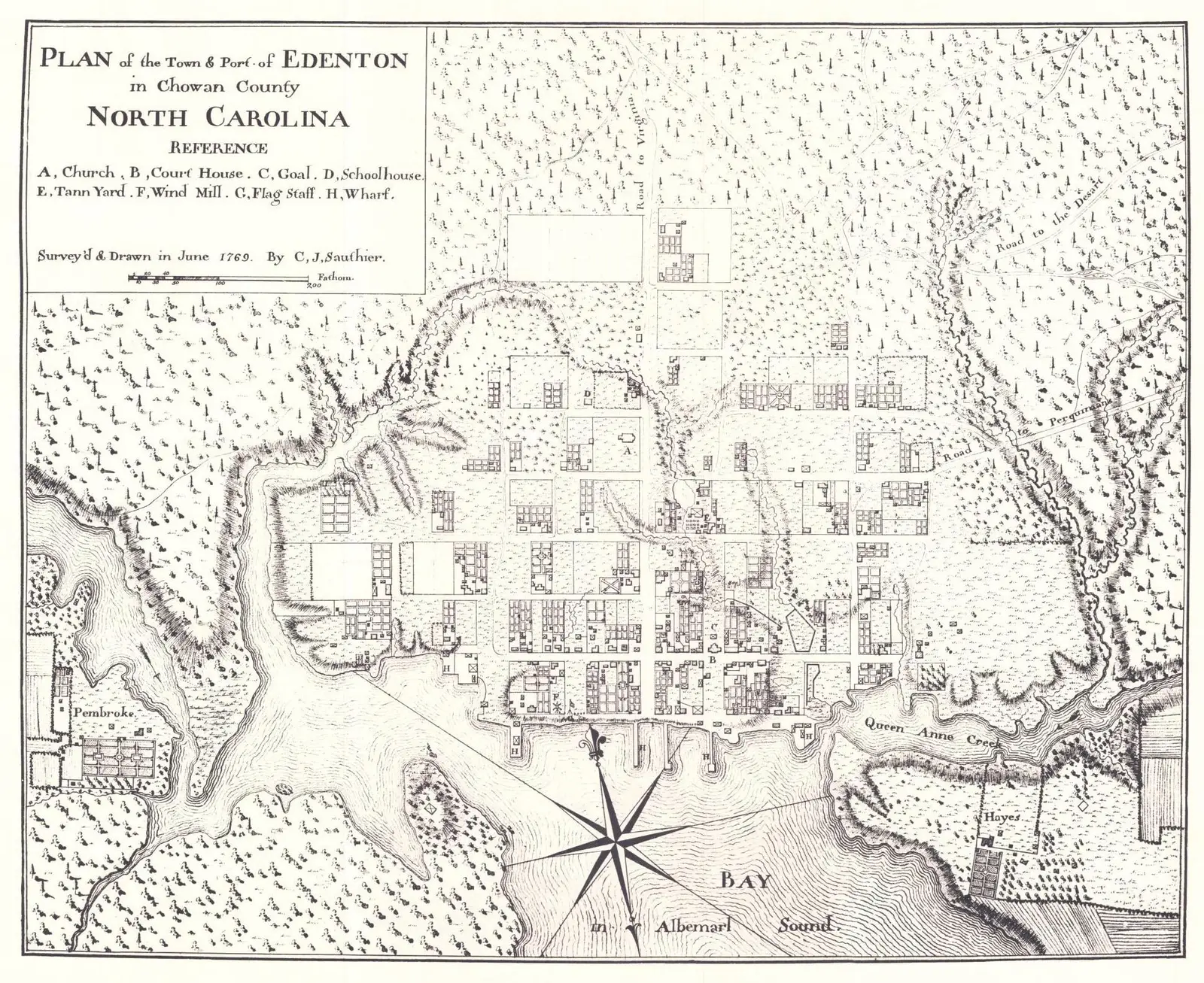
Click or tap the map to enlarge it.
Key Takeaways
- The Map of Edenton Chowan County, North Carolina from 1769 provides valuable insights into the historical development of the region.
- It offers a visual representation of the area’s topography, boundaries, and landmarks during that time.
- This map serves as a historical document showcasing the importance of accurate cartography in understanding the past.
History
The Map of Edenton Chowan County, North Carolina from 1769 was created by renowned cartographer John Collet. It was commissioned to portray the region’s landscape, settlements, and notable features during that period. Edenton Chowan County is located in the northeastern portion of North Carolina and has a rich historical background.
During the 1760s, Edenton Chowan County was a thriving port town and played a significant role in colonial America. The area was known for its agriculture, fishing, and trade, which fueled its growth and prosperity. The map captures the essence of the town’s development and the surrounding county, providing a glimpse into life in 18th-century North Carolina.
Unique Insights
1. Waterways: The map highlights the numerous waterways that contributed to the area’s economic and transportation systems. The Chowan River, Albemarle Sound, and their tributaries were vital for trading and travel.
2. Landmarks: The map identifies important landmarks such as St. Paul’s Episcopal Church and the courthouse, showcasing their significance in the community.
3. Road Networks: It showcases the road networks connecting Edenton to neighboring towns and cities, reflecting the importance of land transportation during that time.
4. Land Use: The map provides insights into the land use patterns, with agricultural fields, forests, and pasturelands visible. This offers valuable information about the local economy and resources.
Relevant Facts during 1769
| Fact | Description |
|---|---|
| Population | The population of Edenton Chowan County in 1769 was approximately 1,500 residents. |
| Economic Activities | The area’s economy was primarily based on agriculture, fishing, and trade. |
| Political Significance | Edenton was the colonial capital of North Carolina from 1722 to 1743 before the capital was moved to New Bern. |
| Social Structure | The society in Edenton Chowan County during that time was hierarchical, with wealthy landowners and a significant slave population. |
FAQ
-
Why is the Map of Edenton Chowan County important?
The map is important because it provides a visual representation of the region during a specific period in history. It helps researchers and historians analyze the development of the area and understand its significance in the broader context of colonial America.
-
Who created the Map of Edenton Chowan County?
The map was created by John Collet, a renowned cartographer, and surveyor, who was known for his attention to detail and accuracy in his works.
-
What landmarks are featured on the map?
The map features prominent landmarks such as St. Paul’s Episcopal Church and the courthouse. These landmarks were of historical and cultural significance to the community.
-
What can we learn about the transportation systems from the map?
The map highlights the waterways such as the Chowan River and Albemarle Sound, which were essential for transportation and trade. It also indicates road networks connecting Edenton to other towns, reflecting the importance of land transportation.
-
How does the map depict land use patterns?
The map showcases the distribution of agricultural fields, forests, and pasturelands, providing insights into the economic activities of the region and the utilization of natural resources.
-
What was the population of Edenton Chowan County in 1769?
The estimated population of Edenton Chowan County in 1769 was approximately 1,500 residents.
-
What was the economic base of Edenton Chowan County during that time?
During that time, the area’s economy relied on agriculture, fishing, and trade. The fertile land and proximity to water bodies facilitated these economic activities.