Map of Gujarat Districts
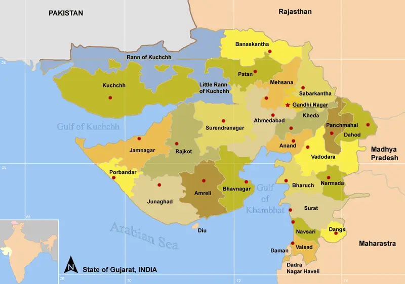
Click or tap the map to enlarge it.
Map Of Gujarat Districts – A Detailed Guide
Key Takeaways
- Gujarat, located on the western coast of India, is divided into 33 districts.
- The state is known for its rich cultural heritage, architectural wonders, and diverse landscapes.
- A map of Gujarat districts is essential for understanding the administrative division and geographical spread of the state.
- The districts offer a blend of historical sites, natural beauty, and vibrant cities.
History
Gujarat has a rich historical background that dates back to ancient times. The region has witnessed the rise and fall of various kingdoms and empires, contributing to its cultural diversity.
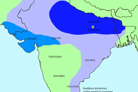
During the ancient period, Gujarat was part of the Indus Valley Civilization, an advanced urban culture that thrived around 2500 BCE. The Mauryan Empire and the Gupta Empire also held influence over the region.
In the medieval era, Gujarat became an important center of trade and commerce due to its strategic location on the Arabian Sea. The region was ruled by various dynasties, including the Solankis, Vaghelas, and Mughals.
Later, the Portuguese, Dutch, and British East India Company established their presence along the Gujarat coast. The British Raj led to numerous changes in governance and infrastructure development.
After India gained independence in 1947, Gujarat emerged as a separate state in 1960.
Unique Insights
The map of Gujarat districts provides several unique insights into the state:
- Gujarat has a diverse topography, ranging from the arid Rann of Kutch to the lush green hills of Saputara.
- The state is well-known for its industrial development, with major industrial cities like Ahmedabad, Surat, and Vadodara.
- Gujarat is home to various world-renowned sites such as the UNESCO World Heritage Site of Champaner-Pavagadh Archaeological Park, the Sun Temple of Modhera, and the Rani-ki-Vav stepwell in Patan.
- The districts of Gujarat offer a balance between modernity and tradition, with ancient temples, palaces, and vibrant cultural festivals.
Table of Relevant Facts
| District | Establishment Year | Population (2021) |
|---|---|---|
| Ahmedabad | 1960 | 7,690,000 |
| Surat | 1960 | 6,123,000 |
| Vadodara | 1960 | 2,768,000 |
| Rajkot | 1949 | 1,643,000 |
| Bhavnagar | 1960 | 603,095 |
Frequently Asked Questions (FAQ)
1. How many districts are there in Gujarat?
Gujarat is divided into 33 districts.
2. What are some popular tourist attractions in Gujarat?
Gujarat offers numerous tourist attractions including the Rann of Kutch, Gir National Park, Somnath Temple, and Statue of Unity.
3. Which is the largest district in Gujarat?
Kutch is the largest district in Gujarat, known for its vast salt flats and unique natural beauty.
4. What is the best time to visit Gujarat?
The best time to visit Gujarat is during the winter season, from November to February, when the weather is pleasant.
5. What is the significance of the Champaner-Pavagadh Archaeological Park?
The Champaner-Pavagadh Archaeological Park is a UNESCO World Heritage Site and contains the remains of an ancient fortified city and various Hindu and Jain temples.
6. Are there any wildlife sanctuaries in Gujarat?
Yes, Gujarat has several wildlife sanctuaries, such as Gir National Park (home to the Asiatic lion) and Wild Ass Sanctuary (known for its endangered wild ass species).
7. What are some major industries in Gujarat?
Gujarat is known for its thriving textile, chemical, pharmaceutical, and diamond industries, contributing significantly to the state’s economy.