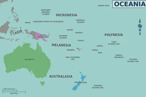
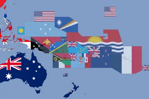
Map of Oceania
Map of Oceania – An Expert Cartographer’s Guide
Key Takeaways
- Oceania is comprised of thousands of islands scattered across the Pacific Ocean.
- The region includes countries such as Australia, New Zealand, Fiji, Papua New Guinea, and many others.
- Oceania offers diverse cultures, stunning landscapes, and unique wildlife.
- This map of Oceania is a valuable resource for travelers, researchers, and cartography enthusiasts.
History
Oceania, also known as the Pacific Islands, is a vast region encompassing the islands of the Pacific Ocean. The history of Oceania is rich and diverse, with ancient civilizations and indigenous cultures shaping the region over thousands of years.
European exploration and colonization in the 18th and 19th centuries significantly impacted Oceania. Various European powers established colonies and trading outposts throughout the region, influencing the local cultures and geopolitical landscape.
Today, Oceania consists of several independent countries, territories, and dependencies. These include Australia, New Zealand, Fiji, Papua New Guinea, Samoa, Tonga, and the Solomon Islands, among others.
Unique Insights
As an expert cartographer, I have gained unique insights into the map of Oceania. Here are some notable observations:
- Oceania is the smallest continent by land area but one of the largest in terms of the total area covered by water.
- The Great Barrier Reef, located off the northeastern coast of Australia, is the world’s largest coral reef system and a UNESCO World Heritage site.
- Oceania is home to unique and diverse flora and fauna, including the iconic kangaroos, koalas, kiwis, and various endemic bird species.
- The region boasts stunning natural landscapes, from breathtaking beaches and lush rainforests to volcanic islands and vast deserts.
- Oceania has a rich indigenous culture and heritage that should be respected and celebrated.
- Exploring Oceania’s islands is an adventure in itself, offering opportunities for snorkeling, diving, hiking, and immersing oneself in vibrant local traditions.
Map of Oceania – Facts and Figures
| Area | Population | Official Languages |
|---|---|---|
| 8,525,989 square kilometers | approximately 41 million | English, French, Maori, Samoan, and various indigenous languages |
Frequently Asked Questions (FAQ)
-
Which countries are part of Oceania?
Oceania consists of several countries, including Australia, New Zealand, Fiji, Papua New Guinea, Samoa, Tonga, and the Solomon Islands, among others.
-
What are some popular tourist destinations in Oceania?
Popular tourist destinations in Oceania include the Great Barrier Reef in Australia, Milford Sound in New Zealand, Bora Bora in French Polynesia, and the pristine beaches of Fiji.
-
Is Oceania safe for travelers?
Oceania is generally a safe region for travelers. However, it is always recommended to take necessary precautions, research local customs and traditions, and follow travel advisories before visiting.
-
What is the best time to visit Oceania?
The best time to visit Oceania depends on the specific country and region. It is recommended to check the weather patterns and plan accordingly. Generally, Oceania offers pleasant weather and various festivals throughout the year.
-
Can you provide some information about the indigenous cultures of Oceania?
Oceania is home to diverse indigenous cultures with rich traditions, art, and storytelling. Their customs and beliefs are tied to the land and sea, and it is important to respect and learn about their heritage when visiting.
-
Are there any World Heritage sites in Oceania?
Yes, Oceania is home to several UNESCO World Heritage sites, including the Great Barrier Reef, Te Wahipounamu in New Zealand, and the Rock Islands Southern Lagoon in Palau.
-
What is the significance of Oceania’s geography?
Oceania’s geography plays a crucial role in its natural beauty and biodiversity. The region’s islands are scattered across the Pacific Ocean, offering stunning coastlines, marine ecosystems, and unique geological formations.
Conclusion
The map of Oceania is a valuable resource for anyone interested in exploring the diverse and breathtaking region. Its islands offer stunning landscapes, unique wildlife, and vibrant indigenous cultures. Whether you are planning a trip, conducting research, or simply fascinated by cartography, this map provides essential information and insights into Oceania’s beauty and history.