Map of the Cities and Towns in the Deccan Plateau India
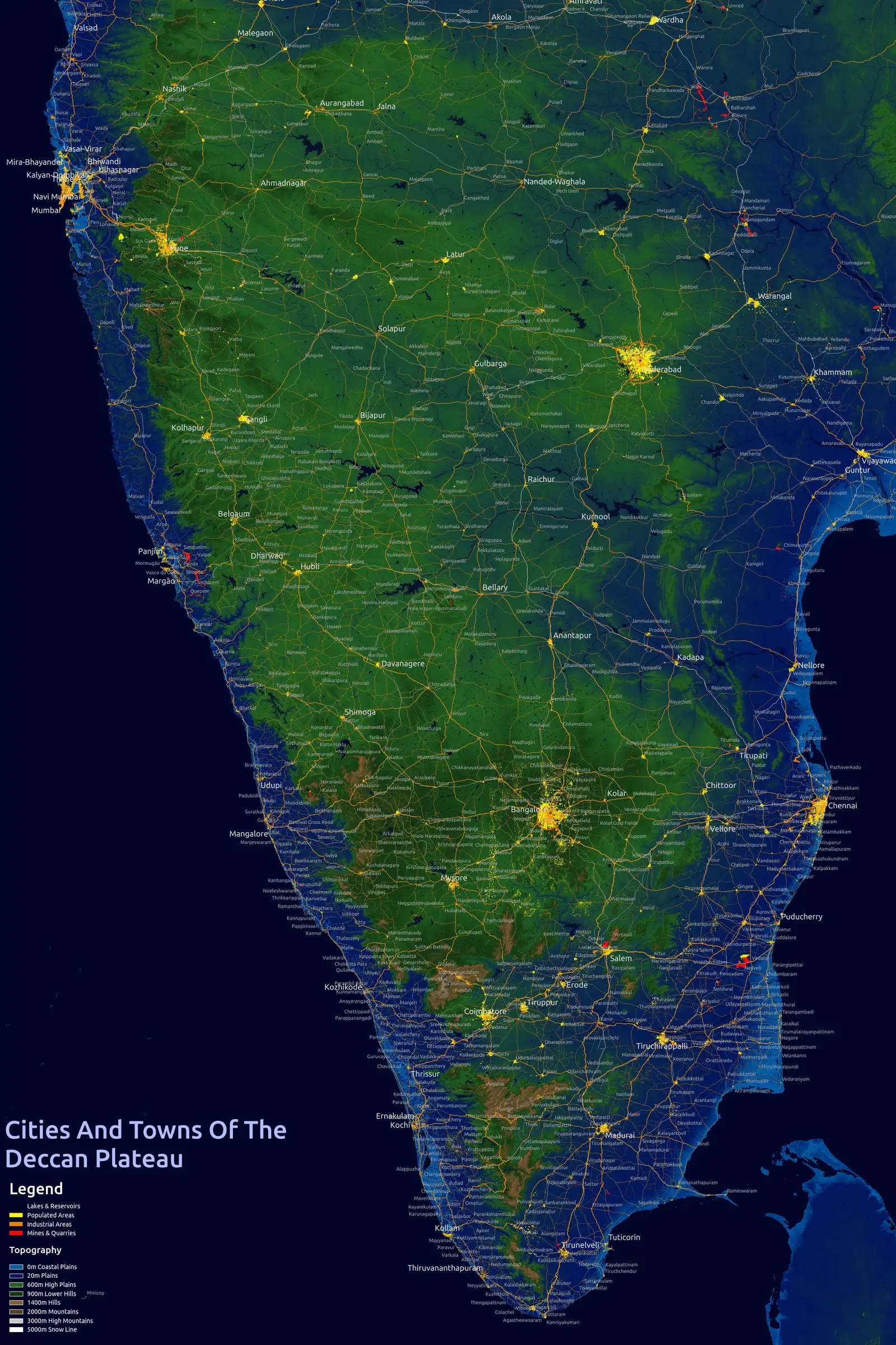
Click or tap the map to enlarge it.
Key Takeaways
- The Deccan Plateau in India is known for its rich history and diverse cities and towns.
- Exploring the cities and towns in the Deccan Plateau provides a unique cultural and geographical experience.
- Historical landmarks, natural beauty, and culinary delights await visitors in this region.
History
The Deccan Plateau, located in central and southern India, is an expansive region known for its historical significance. It has been home to various dynasties and empires throughout history, resulting in a rich tapestry of cultures and civilizations. The plateau is bordered by the Western Ghats on the west and the Eastern Ghats on the east, with the Indian Ocean to the south.
Several important cities and towns are situated within the Deccan Plateau, each with its own unique history and cultural heritage. These cities have witnessed the rise and fall of kingdoms, the exchange of ideas, and the formation of distinctive architectural styles.
Unique Insights
- The Deccan Plateau is renowned for its ancient rock-cut caves, such as the famous Ajanta and Ellora Caves.
- Pune, known as the “Oxford of the East,” is a major educational and cultural center in the Deccan Plateau.
- Hyderabad, often referred to as the “Pearl City,” is famous for its iconic Charminar monument and delicious cuisine.
Table: Relevant Facts
| City/Town | Significance | Year Founded |
|---|---|---|
| Aurangabad | Gateway to the UNESCO World Heritage Sites of Ajanta and Ellora Caves | 1610 |
| Pune | Educational hub and cultural center | 8th century AD |
| Hyderabad | Historical city with iconic landmarks and rich culinary traditions | 1591 |
| Bengaluru | India’s IT capital and thriving cosmopolitan city | 1537 |
| Mysuru | Known for grand palaces and rich cultural heritage | 1399 |
Frequently Asked Questions (FAQs)
1. What is the Deccan Plateau?
The Deccan Plateau is a large region in central and southern India characterized by its elevated landform and diverse landscapes.
2. Which cities are prominent in the Deccan Plateau?
Some of the prominent cities in the Deccan Plateau include Aurangabad, Pune, Hyderabad, Bengaluru, and Mysuru.
3. What are the major historical landmarks in Aurangabad?
Aurangabad is home to the world-famous Ajanta and Ellora Caves, UNESCO World Heritage Sites known for their rock-cut Buddhist and Hindu temples.
4. Why is Pune known as the “Oxford of the East”?
Pune is renowned for its numerous educational institutions and is often referred to as the “Oxford of the East” due to its academic and research-oriented environment.
5. What is the significance of Hyderabad’s Charminar?
The Charminar, a magnificent monument built in 1591, is an iconic symbol of Hyderabad and an important historical site. It is known for its impressive Indo-Islamic architecture.
6. Why is Bengaluru considered India’s IT capital?
Bengaluru has emerged as India’s IT capital due to its flourishing information technology industry and numerous tech parks housing multinational corporations.
7. What makes Mysuru a popular tourist destination?
Mysuru’s rich heritage, highlighted by its opulent palaces like the Mysuru Palace, vibrant festivals like Dasara, and traditional arts and crafts, attracts numerous tourists every year.