Map of Warren County Pennsylvania
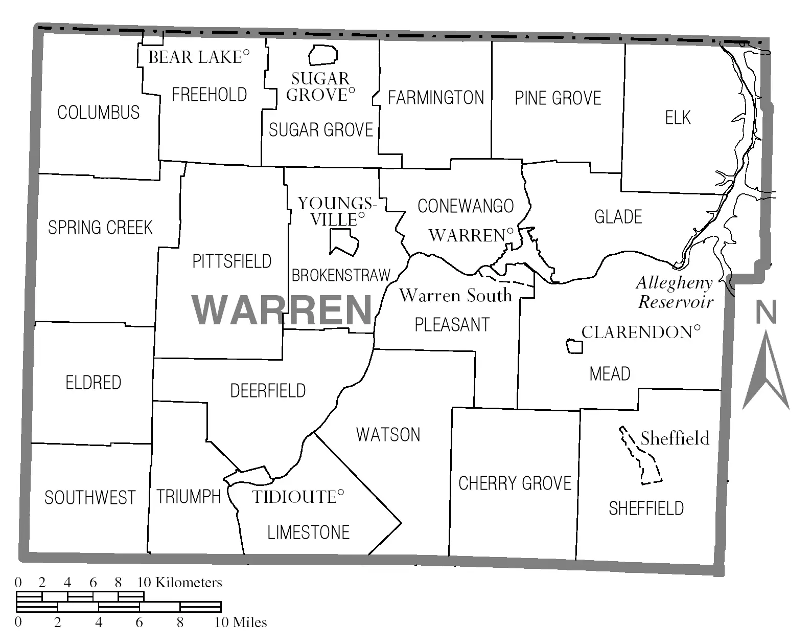
Click or tap the map to enlarge it.
Key Takeaways
- Warren County Pennsylvania, a picturesque region in northwest Pennsylvania, is known for its stunning natural beauty and outdoor recreational opportunities.
- The Map of Warren County Pennsylvania provides detailed information about the county’s geography, landmarks, and roads.
- Cartographers play a crucial role in creating accurate and informative maps that enhance navigation and understanding of a particular area.
- Understanding the history, unique insights, and frequently asked questions about the Map of Warren County Pennsylvania adds value to its usage and appreciation.
History
Warren County, Pennsylvania was established on March 12, 1800. It was named after General Joseph Warren, a hero of the American Revolutionary War. The county’s early economy relied on logging, timber, and farming.
Over the years, Warren County experienced industrial growth with the emergence of oil production in the late 19th century. This led to an economic boom and attracted new residents to the area.
The map of Warren County Pennsylvania has evolved over time, reflecting the changes in infrastructure, population, and natural resources. It provides an essential tool for navigation and planning within the county.
Unique Insights
1. Allegheny National Forest: Warren County is home to a significant portion of the Allegheny National Forest, which spans over 513,000 acres. This forest provides ample opportunities for outdoor activities such as hiking, camping, fishing, and wildlife observation.
2. Kinzua Dam and Reservoir: The map highlights the Kinzua Dam and Reservoir, a large-scale hydraulic engineering project located in Allegheny National Forest. It serves as a water resource, flood control, and recreational area, attracting visitors from all over.
3. Chapman State Park: Situated in Clarendon, Chapman State Park stands out on the map. It offers various recreational opportunities, including boating, swimming, picnicking, and camping.
Facts of Warren County Pennsylvania
| Year Established | County Seat | Area | Population |
|---|---|---|---|
| 1800 | Warren | 898 square miles | 40,652 (2020) |
Frequently Asked Questions (FAQ)
1. What are the major towns in Warren County Pennsylvania?
The major towns in Warren County include Warren, North Warren, and Youngsville, among others.
2. Can I find hiking trails in Warren County Pennsylvania?
Absolutely! Warren County offers numerous hiking trails, especially within the Allegheny National Forest, providing opportunities to explore the region’s natural beauty.
3. Are there any museums or cultural attractions in Warren County?
Yes, there are several museums and cultural attractions, such as the Warren County Historical Society and the Wilder Museum, where visitors can learn about the rich history and heritage of the area.
4. What recreational activities can be enjoyed in the Kinzua Dam and Reservoir area?
Visitors can engage in activities such as boating, fishing, hiking, picnicking, and wildlife viewing at the Kinzua Dam and Reservoir area.
5. Can I find campgrounds in Warren County?
Yes, Warren County offers various campgrounds and camping sites, including those in Allegheny National Forest and Chapman State Park.
6. Is Warren County Pennsylvania a good place for outdoor enthusiasts?
Definitely! With its natural beauty, ample outdoor recreational opportunities, and the presence of Allegheny National Forest, Warren County is a paradise for outdoor enthusiasts.
7. How can I obtain a physical copy of the Map of Warren County Pennsylvania?
Physical copies of the map can be obtained from the Warren County Government or local tourism offices. Additionally, digital versions may be available on their official websites.