Norfolk Map
Click or tap the map to enlarge it.
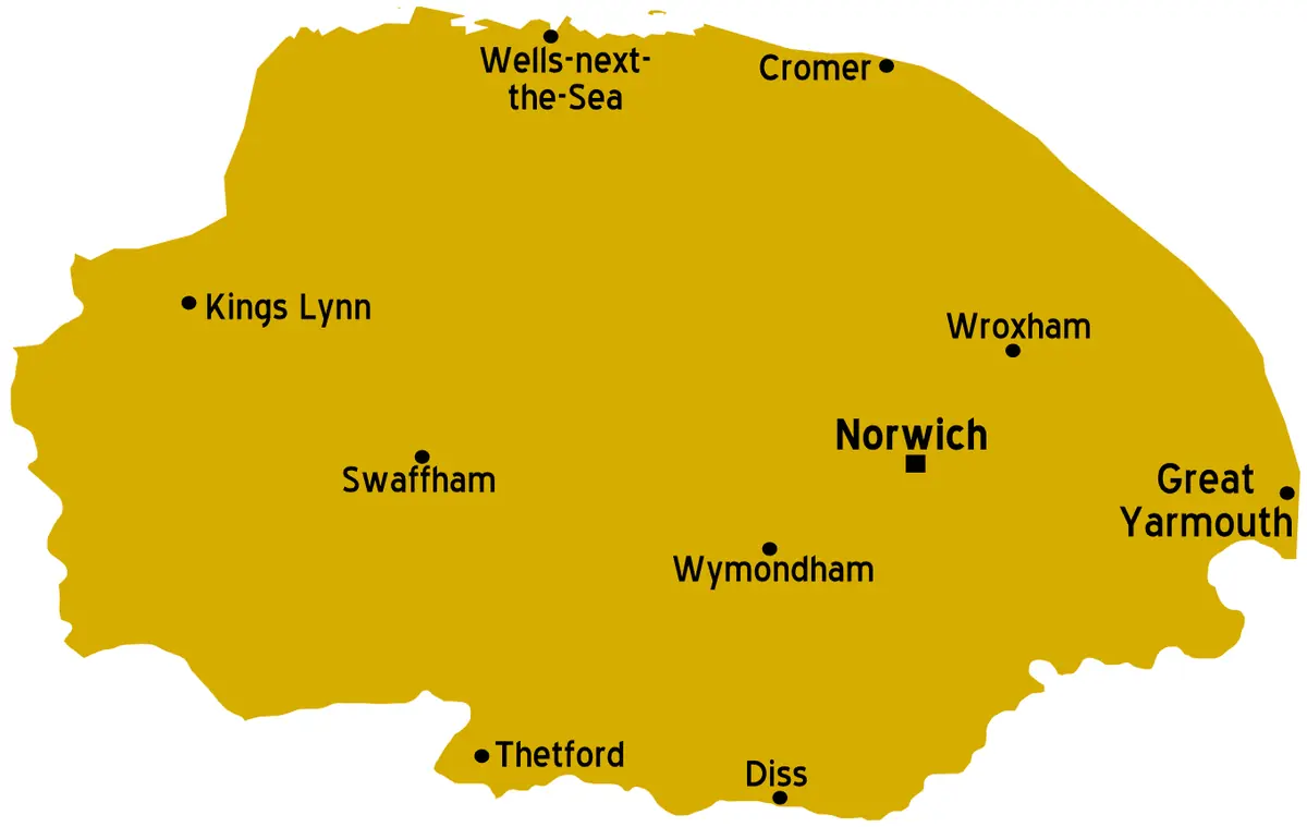
This simple map outlines the English county of Norfolk and labels its main towns, among them Norwich, King's Lynn, Great Yarmouth, Thetford, Swaffham, Wymondham, Diss, Cromer and Wells-next-the-Sea.
Norfolk bulges out into the North Sea in the east of England and is one of the flattest counties in the country. Its highest point, Beacon Hill near West Runton, is only 105 metres above sea level.
Reading Norfolk from the map
Norwich, the county town, sits near the middle of the county and has been its regional centre since the Middle Ages. Norwich Cathedral was founded in 1096 and Norwich Castle, begun in the same era, still dominates the skyline. The west of the county is oriented to King's Lynn on The Wash and to Thetford at the Suffolk border, while the east is defined by Great Yarmouth, a seaside and port town at the mouth of the River Yare.
The north coast runs from Hunstanton to Cromer and includes Wells-next-the-Sea, Blakeney and Holkham, an area of salt marsh, dunes and beaches protected as the Norfolk Coast Area of Outstanding Natural Beauty.
The Broads and the landscape
The Norfolk Broads, a network of shallow lakes and navigable rivers shared with north Suffolk, is a protected landscape with the status of a national park. The lakes are not natural: they are flooded medieval peat diggings. Around 125 miles of waterways are navigable by boat, and the area is one of the best-known wetland habitats in Britain.
Key facts
| Fact | Detail |
|---|---|
| Region | East of England |
| County town | Norwich |
| Area | About 5,370 square kilometres |
| Population (2021 census) | About 916,000 |
| Highest point | Beacon Hill, 105 m |
| Protected landscapes | The Broads and the Norfolk Coast AONB |
Questions about this map
Where is Norfolk?
It is a county on the east coast of England, bordered by Suffolk to the south, Cambridgeshire and Lincolnshire to the west, and the North Sea to the north and east.
Is Norfolk hilly?
Not really. It is mostly low-lying, with gently rolling land in the north and the lowest ground in the Broads and Fens.
What are the Broads?
A network of rivers and shallow lakes, created when medieval peat pits flooded, now protected for wildlife and boating.