Political World Map with Disputed Territories
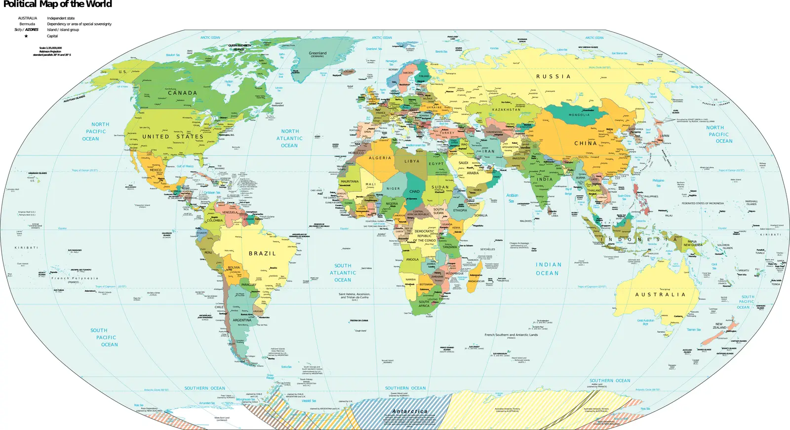
Click or tap the map to enlarge it.
Key Takeaways
- A political world map with disputed territories provides valuable information regarding disputed regions around the globe.
- Understanding the complexities and historical context of these disputed territories is crucial for accurate mapping.
- Cartographers play a vital role in representing disputed territories accurately, adhering to objectivity and neutrality.
- Political world maps with disputed territories offer insight into geopolitical conflicts and their impact on international relations.
History of Political World Maps with Disputed Territories
Political world maps with disputed territories have evolved over centuries, reflecting changes in international boundaries and political contexts. The concept of depicting disputed territories on maps began as early as the 16th century when cartography gained prominence. These maps aimed to represent areas where conflicting claims or disputes existed, providing a comprehensive overview of geopolitical complexities.
As European colonial powers expanded their reach, incorporating new territories into their empires, disputes over land ownership and boundaries intensified. The exploration and colonization of the Americas, Africa, and Asia led to numerous conflicts and territorial disagreements, giving rise to the inclusion of disputed territories on world maps.
Modern technological advancements, such as satellite imagery and geographic information systems, have enhanced the accuracy and precision of cartographic representations. With these tools, cartographers can more effectively illustrate the intricacies of disputed territories, considering various geopolitical factors, historical contexts, and legal claims.
Unique Insights into Political World Maps with Disputed Territories
While studying political world maps with disputed territories, several unique insights can be gained:
- Understanding Historical Controversies: These maps aid in comprehending the historical controversies surrounding specific regions or territories. They provide a visual representation of the geopolitical dynamics and the ongoing disputes associated with these areas.
- Geopolitical Impact: Political maps with disputed territories offer valuable insights into the geopolitical impact of conflicting claims. They showcase the challenges faced by nations in resolving territorial disputes and the potential implications on international relations.
- Limited International Recognition: Disputed territories often face limited international recognition, resulting in complex political dynamics. By studying these maps, one can analyze the regions that are subject to competing territorial claims and understand the complexities of international diplomacy.
- Legal and Diplomatic Implications: Political world maps with disputed territories help explore the legal and diplomatic implications of conflicting claims. These maps reveal the legal frameworks, international agreements, and historical precedents that shape territorial disputes and influence the decision-making process.
Table of Relevant Facts in Political World Maps with Disputed Territories
| Date | Disputed Territory | Countries Involved | Resolution Status |
|---|---|---|---|
| 1947 | Kashmir | India, Pakistan, and China | Ongoing |
| 1982 | Falkland Islands | United Kingdom, Argentina | Disputed |
| 1959 | Aksai Chin | India and China | Ongoing |
| 1945 | Kuril Islands | Russia and Japan | Disputed |
Frequently Asked Questions about Political World Maps with Disputed Territories
- Q: What is the significance of including disputed territories on political world maps?
A: Including disputed territories on political world maps is crucial as it provides a comprehensive understanding of geopolitical complexities and ongoing conflicts around the world. - Q: How do cartographers ensure neutrality while representing disputed territories?
A: Cartographers maintain objectivity and neutrality by relying on factual data, international agreements, and recognized legal claims when depicting disputed territories. - Q: Can disputed territories change over time?
A: Yes, disputed territories can change over time due to various factors such as diplomatic negotiations, conflict resolution, or changes in geopolitical dynamics. - Q: Are there universally accepted standards for depicting disputed territories on maps?
A: There are no universally accepted standards, as different countries and organizations may have varying perspectives and political interests regarding disputed territories. - Q: How can individuals utilize political world maps with disputed territories?
A: Individuals can utilize these maps to enhance their understanding of complex international relations, historical conflicts, and diplomatic negotiations. - Q: Are disputed territories always a source of tension between countries?
A: Disputed territories often lead to tensions between countries, but diplomatic efforts and negotiations can work towards finding peaceful resolutions. - Q: Can political world maps with disputed territories contribute to conflict resolution?
A: Yes, these maps can contribute to conflict resolution by facilitating dialogue, promoting understanding, and assisting in negotiations between involved parties.