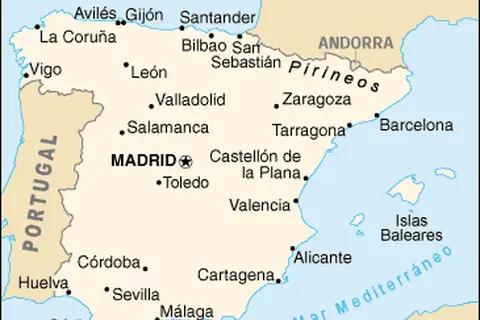
Portugal Spain Location Map
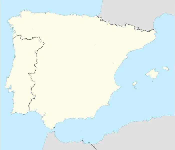
Click or tap the map to enlarge it.
Key Takeaways:
- The Portugal Spain Location Map showcases the geographical location of both countries on the Iberian Peninsula.
- It provides an understanding of the neighboring countries and surrounding bodies of water.
- The map is useful for travelers, geographers, historians, and anyone interested in exploring the region.
History:
The Portugal Spain Location Map represents the historical and cultural context of two countries that have shared a long and complex history.
Portugal and Spain both emerged as separate nations during the Middle Ages. Portugal, known for its maritime exploration, established its global influence through discoveries made during the Age of Discovery, starting in the 15th century. Spain, on the other hand, became a powerful empire through its conquests in the Americas, fueled by the ambition for wealth and territorial expansion.
Despite their distinct histories, Portugal and Spain have influenced each other in many ways over the centuries. The Iberian Peninsula provides a unique setting for understanding the connections and interactions between these two countries.
Unique Insights:
By exploring the Portugal Spain Location Map, several unique insights about the region can be gained:
- The natural boundary of the Pyrenees Mountains separates Spain from the rest of Europe, making it geographically distinct.
- The proximity to the Atlantic Ocean and the Mediterranean Sea has significantly shaped the history, culture, and economies of both countries.
- Portugal boasts a rich seafaring heritage, as demonstrated by its historical exploration and trade routes.
- The shared border between Portugal and Spain spans approximately 1,214 kilometers (754 miles), with various towns and cities serving as important crossing points.
- The map showcases the diverse landscapes of the region, including the mountainous regions of the Pyrenees and the Iberian System, as well as the fertile plains and coastal areas.
Table of Relevant Facts:
| Year | Event |
|---|---|
| 711 | Moors invade the Iberian Peninsula |
| 1139 | Portugal gains independence from the Kingdom of León |
| 1492 | Christopher Columbus reaches the Americas under the Spanish flag |
| 1580 | Portugal and Spain unite under Spanish rule |
| 1640 | Portuguese Restoration War leads to Portugal regaining independence |
| 1974 | Carnation Revolution in Portugal marks the end of the Estado Novo dictatorship |
FAQ:
-
1. What is the total area of Portugal and Spain combined?
The total area of Portugal is approximately 92,090 square kilometers (35,560 square miles), while Spain covers about 505,990 square kilometers (195,360 square miles). Combined, the two countries cover an area of approximately 598,080 square kilometers (230,920 square miles).
-
2. How long is the coastline of Portugal and Spain?
The coastline of Portugal stretches for approximately 1,793 kilometers (1,115 miles), while the coastline of Spain is around 4,964 kilometers (3,082 miles) in length.
-
3. Are there any significant mountain ranges in the region?
Yes, the Pyrenees Mountains form a natural border between Spain and France, while the Iberian System runs through both Portugal and Spain, primarily in the eastern part of the peninsula.
-
4. What are the major rivers in Portugal and Spain?
In Portugal, the major river is the Tagus (Tejo), while in Spain, the major rivers include the Ebro, Guadalquivir, and Douro (Duero).
-
5. Is the region prone to any natural disasters?
While the region is generally safe from major natural disasters, occasional earthquakes can occur, especially in southern Spain, due to its proximity to the African tectonic plate.
-
6. Can you access the Atlantic Ocean from Portugal?
Yes, Portugal has a long coastline along the Atlantic Ocean, providing access to the western part of Europe.
-
7. Are there any important landmarks in the region?
Yes, the region is home to several famous landmarks, including the Tower of Belém in Lisbon, Portugal, and the Sagrada Família in Barcelona, Spain.