A satellite map of Tajikistan borders overlaid
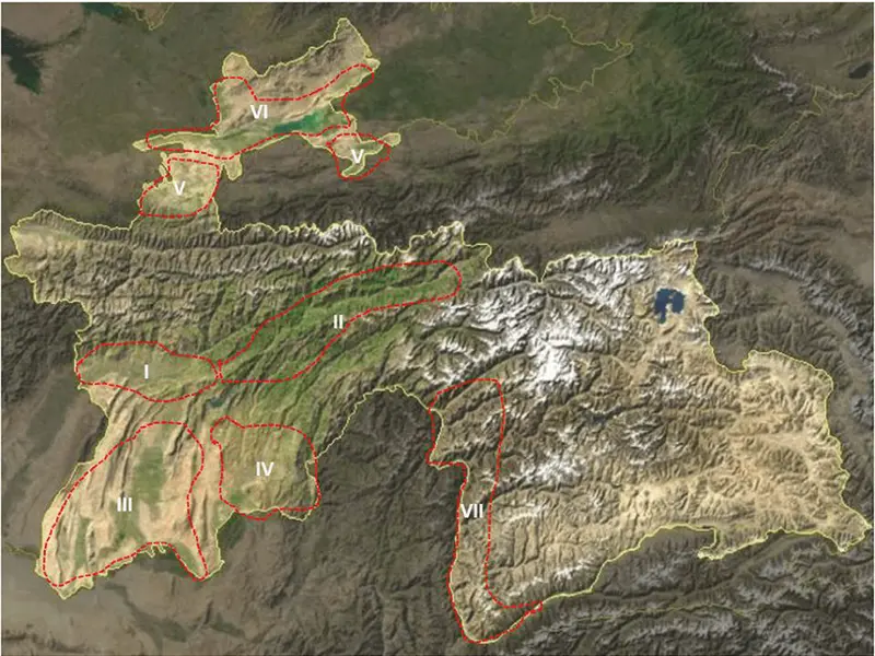
Click or tap the map to enlarge it.
A satellite map of Tajikistan borders overlaid
A satellite map of Tajikistan borders overlaid
An Aerial Perspective: Satellite Map of Tajikistan Borders Overlaid
A satellite map of Tajikistan with its borders overlaid provides a striking and informative perspective on this Central Asian nation. But what makes this kind of visualization so important? Let’s explore the geographical and political significance of Tajikistan’s borders.
The Geographical Setting
Tajikistan, located in Central Asia, is landlocked and shares borders with four countries: Afghanistan, China, Kyrgyzstan, and Uzbekistan. Viewing these borders on a satellite map offers a clear perspective of Tajikistan’s geographic context and the nature of its terrain.
Interpreting the Map
A satellite map overlaid with Tajikistan’s borders would visually present the nation’s topographical features, providing insights into its geographical realities.
Mountain Ranges
Tajikistan is known for its rugged terrain, with over 90% of its land area covered by mountains. The Pamir Mountains, often referred to as the “Roof of the World,” dominate the country’s eastern region. To the north, the Alay Range forms a natural border with Kyrgyzstan.
Fergana Valley
A significant feature on the western side is the Fergana Valley, one of Central Asia’s most fertile and densely populated regions. This area is an intricate tangle of enclaves and exclaves shared between Tajikistan, Uzbekistan, and Kyrgyzstan, an anomaly that becomes evident on an overlaid satellite map.
River Borders
The map also showcases important rivers like the Panj and Amu Darya, which form a considerable part of the border between Tajikistan and Afghanistan.
The Significance of Borders
Understanding Tajikistan’s borders is crucial, as they have significant political, economic, and security implications. For instance, the Tajikistan-Afghanistan border is strategically important given the ongoing security issues in Afghanistan.
Enhancing Understanding through Visualization
A satellite map overlaid with Tajikistan’s borders enhances comprehension of the country’s geographical realities. It provides a bird’s-eye view of the nation’s diverse landscape, from its towering mountain ranges to its fertile valleys, and its unique geopolitical setting.
Conclusion
A satellite map of Tajikistan with its borders overlaid offers a visually engaging and informative exploration of this Central Asian country’s geography. From highlighting its rugged terrain to elucidating the significance of its borders, such a map underscores the intricate interplay between geography and politics in shaping the realities of a nation.
A satellite map of Tajikistan borders overlaid