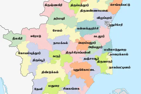
Tamil Nadu District Map
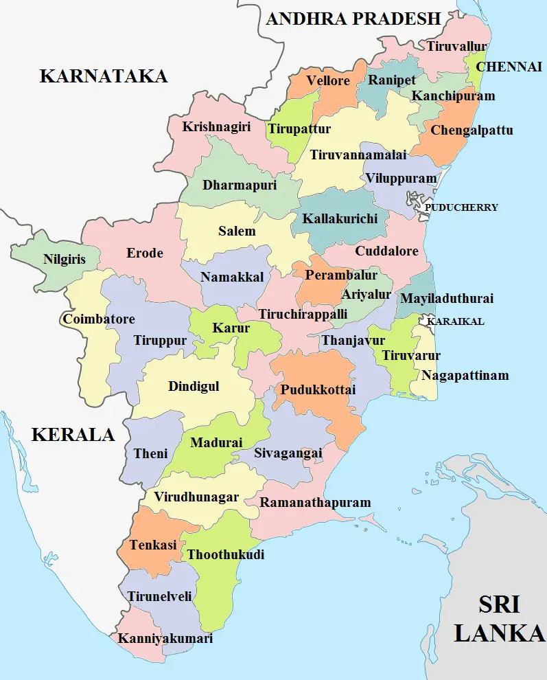
Click or tap the map to enlarge it.
Tamil Nadu District Map – An Expert Cartographer’s Guide
Key Takeaways
- The Tamil Nadu district map showcases the administrative divisions of the state.
- There are a total of 38 districts in Tamil Nadu.
- Each district has its unique geographical features, culture, and history.
- The district map serves as a valuable resource for travelers, researchers, and administrators.
- Tamil Nadu’s districts vary in terms of population, economy, and development.
History
Tamil Nadu, located in the southern part of India, has a rich historical background. The state’s origins can be traced
back to the ancient Indus Valley Civilization, lasting from 2500 BCE to 2000 BCE. Over the centuries, Tamil Nadu
witnessed the rise and fall of various dynasties, including the Cholas, Pandyas, and Pallavas, who left behind
architectural marvels and cultural heritage.
During the British colonial period, the region was part of the Madras Presidency. After India gained independence in
1947, Tamil Nadu became a separate state in 1950 and further underwent administrative reorganization.
Unique Insights
- Tamil Nadu’s districts have both coastal and inland areas, providing diverse landscapes.
- The state hosts several UNESCO World Heritage Sites, such as the Brihadeeswarar Temple and Group of Monuments at
Mahabalipuram. - Tamil Nadu is known for its classical dance forms like Bharatanatyam and traditional music.
- Agriculture plays a significant role in the economy of many districts.
- The Nilgiri Mountain Range, located in the western part of the state, offers breathtaking views and is famous for
its tea plantations.
Tamil Nadu District Map – Quick Facts
| Year | Fact |
|---|---|
| 1950 | Tamil Nadu became a separate state. |
| 1969 | The district of Chennai (formerly known as Madras) was formed. |
| 2019 | Kallakurichi district was carved out of Villupuram district, making it the most recently formed district. |
Frequently Asked Questions (FAQ)
1. How many districts are there in Tamil Nadu?
Tamil Nadu currently has 38 districts.
2. Which district is the capital of Tamil Nadu?
The district of Chennai serves as the capital of Tamil Nadu.
3. What are some famous tourist destinations in Tamil Nadu?
Tamil Nadu boasts several popular tourist spots, including Marina Beach, Meenakshi Amman Temple, Ooty, and Rameshwaram.
4. Which district is known for its silk industry?
Kancheepuram district is renowned for its silk industry and exquisite silk sarees.
5. What is the significance of the Nilgiri Mountain Range?
The Nilgiri Mountain Range is known for its scenic beauty, tea plantations, and as part of the Western Ghats, it is a
UNESCO World Heritage Site.
6. Which dance form is popular in Tamil Nadu?
Bharatanatyam, a classical dance form, is highly popular in Tamil Nadu and has its roots in the region.
7. How does agriculture contribute to Tamil Nadu’s economy?
Agriculture plays a significant role in the economy of Tamil Nadu, with districts like Thanjavur and Tiruchirappalli
known as the “Rice Bowl” of the state.