Tanzania in Africa Mini Map Rivers
Tanzania In Africa Mini Map Rivers
Key Takeaways
- Tanzania, located in East Africa, is known for its diverse landscapes and rich natural resources.
- The country is home to numerous rivers that play a significant role in the lives of its people and the region’s ecosystem.
- Understanding the geography of Tanzania’s rivers is crucial for various purposes, such as transportation, agriculture, and conservation efforts.
History
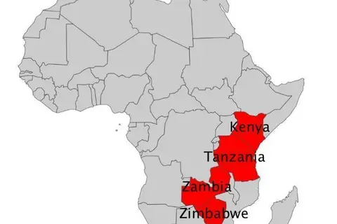
Tanzania, formerly known as Tanganyika, gained independence from British colonial rule in 1961 and united with Zanzibar in 1964 to form the United Republic of Tanzania. The country is situated in East Africa and shares borders with Kenya, Uganda, Rwanda, Burundi, the Democratic Republic of the Congo, Zambia, Malawi, and Mozambique.
Tanzania is renowned for its diverse landscapes, including the majestic Mount Kilimanjaro, the Serengeti National Park, and the picturesque Zanzibar archipelago. These natural wonders attract tourists from all over the world.
Unique Insights
One of the fascinating aspects of Tanzania’s geography is its intricate network of rivers. These rivers not only serve as vital water sources but also contribute to the biodiversity and the overall ecosystem of the country. Here are some unique insights about Tanzania’s rivers:
- The longest river in Tanzania is the Rufiji River, stretching approximately 600 miles (950 kilometers) from its origin in the Southern Highlands to the Indian Ocean.
- Lake Victoria, the largest lake in Africa, borders Tanzania to the northwest and provides an important water resource for the country.
- The Great Ruaha River, flowing through the Ruaha National Park, supports a diverse range of wildlife, including elephants, lions, and hippos.
- Tanzania’s rivers are crucial for irrigation purposes, supporting agriculture and enabling the growth of crops such as rice, maize, and sugarcane.
- The Pangani River, originating from Mount Kilimanjaro, is one of the few perennial rivers in Tanzania and plays a vital role in supplying water to various regions.
Table of Relevant Facts
| River | Length | Significance |
|---|---|---|
| Rufiji | Approximately 600 miles (950 km) | Main river system in Tanzania, supports agriculture and wildlife |
| Great Ruaha | Approximately 200 miles (320 km) | Flows through Ruaha National Park, supports diverse wildlife |
| Pangani | Approximately 250 miles (400 km) | Originates from Mount Kilimanjaro, supplies water to various regions |
FAQ
1. Which is the longest river in Tanzania?
The Rufiji River is the longest river in Tanzania, stretching approximately 600 miles (950 kilometers) from its origin in the Southern Highlands to the Indian Ocean.
2. How does Tanzania’s geography impact its rivers?
Tanzania’s diverse geography, including mountains, highlands, and lakes, influences the flow and formation of rivers. It contributes to the country’s rich river systems and supports various ecosystems.
3. Are Tanzania’s rivers important for agriculture?
Yes, Tanzania’s rivers play a crucial role in irrigation for agriculture. They provide water for crucial crops, supporting the country’s agricultural sector and ensuring food security.
4. Can you engage in water-related activities in Tanzania’s rivers?
Yes, Tanzania’s rivers offer various recreational activities such as fishing, boating, and wildlife watching. They provide opportunities to explore the country’s natural beauty and wildlife.
5. How do Tanzania’s rivers contribute to wildlife conservation?
Tanzania’s rivers are important habitats for a diverse range of wildlife species. They provide water sources for animals and support various ecosystems, aiding conservation efforts and the protection of endangered species.
6. Are there any threats to Tanzania’s rivers?
Like many rivers worldwide, Tanzania’s rivers face threats such as pollution, deforestation, and unsustainable agricultural practices. These challenges require active conservation measures to preserve the rivers and their ecosystems.
7. How can I visit Tanzania’s rivers?
Tanzania offers numerous tour operators and lodges that provide guided visits to various rivers and national parks. These tours allow visitors to witness the stunning landscapes, wildlife, and the significance of the rivers firsthand.