Topographic Map of Japan
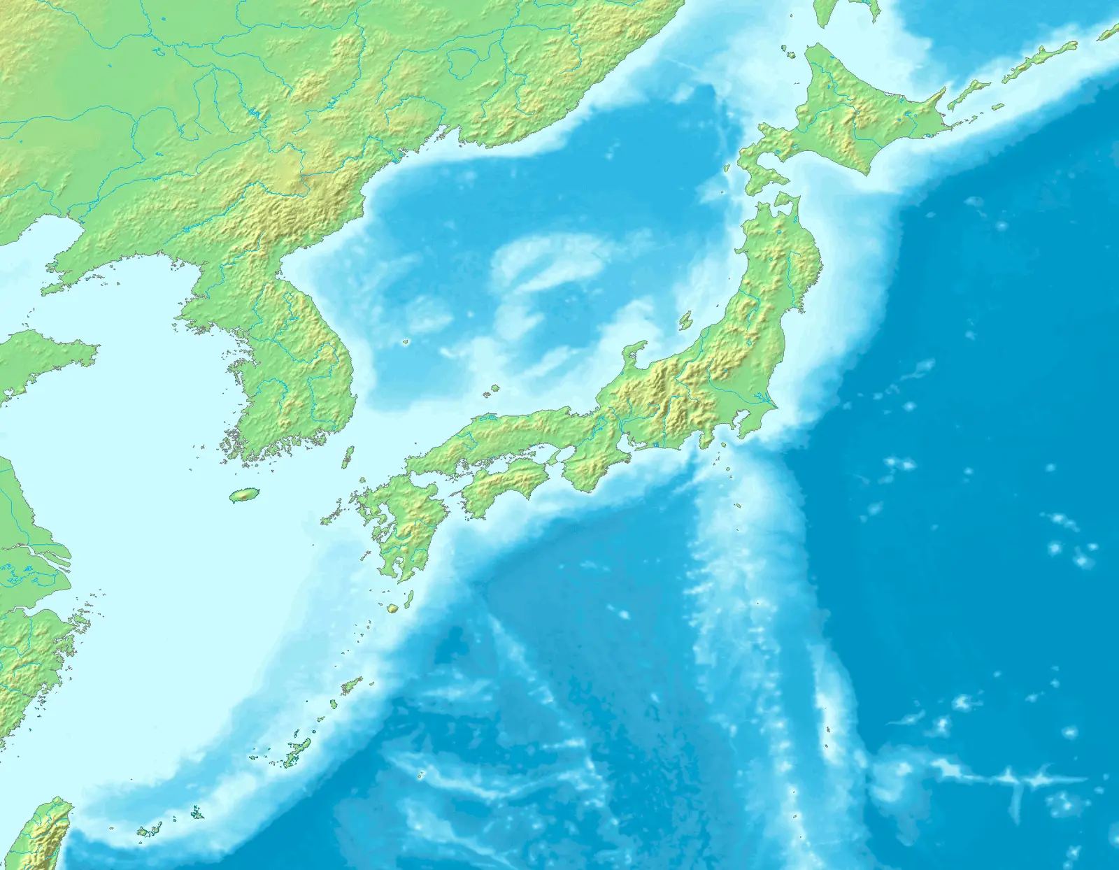
Click or tap the map to enlarge it.
Key Takeaways
- The topographic map of Japan provides detailed information about the physical features and landforms of the country.
- This map is essential for various purposes such as hiking, planning outdoor activities, and understanding Japan’s unique geography.
- By studying the topographic map, you can identify mountains, valleys, rivers, and other natural features in Japan.
History
The creation of topographic maps in Japan dates back to the late 19th century. During the Meiji period, Japan adopted Western cartographic techniques to survey and map its land. The initial purpose was to support national infrastructure development and ensure accurate land records.
Over the years, topographic mapping in Japan has evolved with advancements in technology. Today, the Geospatial Information Authority of Japan (GSI) is responsible for creating and maintaining accurate topographic maps of the country.
Unique Insights
The topographic map of Japan offers unique insights into the country’s diverse terrain and geographical features:
- Mount Fuji: The iconic volcano, Mount Fuji, is prominently displayed on the topographic map. Its elevation and surrounding topography can be studied for various purposes.
- The Japanese Alps: The map showcases the majestic Japanese Alps, a mountain range extending across the islands of Honshu, Shikoku, and Kyushu. The detailed contours reveal the peaks and valleys, attracting hikers and nature enthusiasts.
- Coastlines and Islands: Japan’s intricate coastline and numerous islands are represented on the map. It provides an understanding of the coastal geography, popular beaches, and potential areas prone to tsunamis.
- River Systems: The topographic map depicts the extensive river systems that have shaped Japan’s landscape throughout history. Major rivers such as the Shinano, Tone, and Kiso can be analyzed for their paths and tributaries.
Table of Relevant Facts
| Year | Event |
|---|---|
| 1880 | The Meiji government establishes the Geographical Survey Institute, marking the beginning of modern cartography in Japan. |
| 1949 | The Geographical Survey Institute is reorganized as the Geographical Survey Institute of Japan, and topographic mapping activities intensify. |
| 2001 | The Geographical Survey Institute of Japan is renamed the Geospatial Information Authority of Japan (GSI), emphasizing its expanded role in geospatial information. |
| Present | The GSI continues to update and improve the topographic maps of Japan using advanced technologies like LIDAR and satellite imagery. |
FAQ
-
What scale are the topographic maps of Japan available in?
The official topographic maps of Japan are available in various scales, including 1:25,000, 1:50,000, and 1:250,000. The choice of scale depends on the level of detail required for specific purposes.
-
Can I use the topographic maps for hiking and outdoor activities?
Absolutely! The topographic maps are highly useful for hikers and outdoor enthusiasts. They provide information about elevation, trails, water bodies, and natural features, aiding in navigation and route planning.
-
Are there digital versions of the topographic maps available?
Yes, digital versions of the topographic maps of Japan are available. The Geospatial Information Authority of Japan provides online access to their maps, allowing users to explore and download the data.
-
Are there any historical landmarks marked on the topographic maps?
While the primary focus of topographic maps is on the physical features of the land, important historical landmarks such as castles, temples, and shrines may also be included as points of interest.
-
Do topographic maps show roads and transportation networks?
Yes, topographic maps display major roads, highways, and transportation networks. They provide a comprehensive view of the land, including man-made infrastructure, where relevant.
-
Can the topographic maps assist in understanding Japan’s geological hazards?
Definitely. Topographic maps are valuable resources for assessing Japan’s geological hazards. They illustrate fault lines, volcanic regions, and areas prone to landslides, helping in risk assessment and disaster preparedness.
-
What is the accuracy of the topographic maps?
The topographic maps of Japan are highly accurate. They are continuously updated and refined, incorporating the latest surveying techniques and data sources to ensure precision.
External Links
- Geospatial Information Authority of Japan (GSI)
- GSI Maps – Japan
- Exploring Japan’s Geography – MATCHA
LSI Keywords
- Topographic map of Japan
- Geospatial Information Authority of Japan
- Mount Fuji
- Japanese Alps
- Coastlines and islands of Japan
- River systems in Japan
- Meiji period and cartography
- Geospatial technology in mapping