Topographic Map of South America
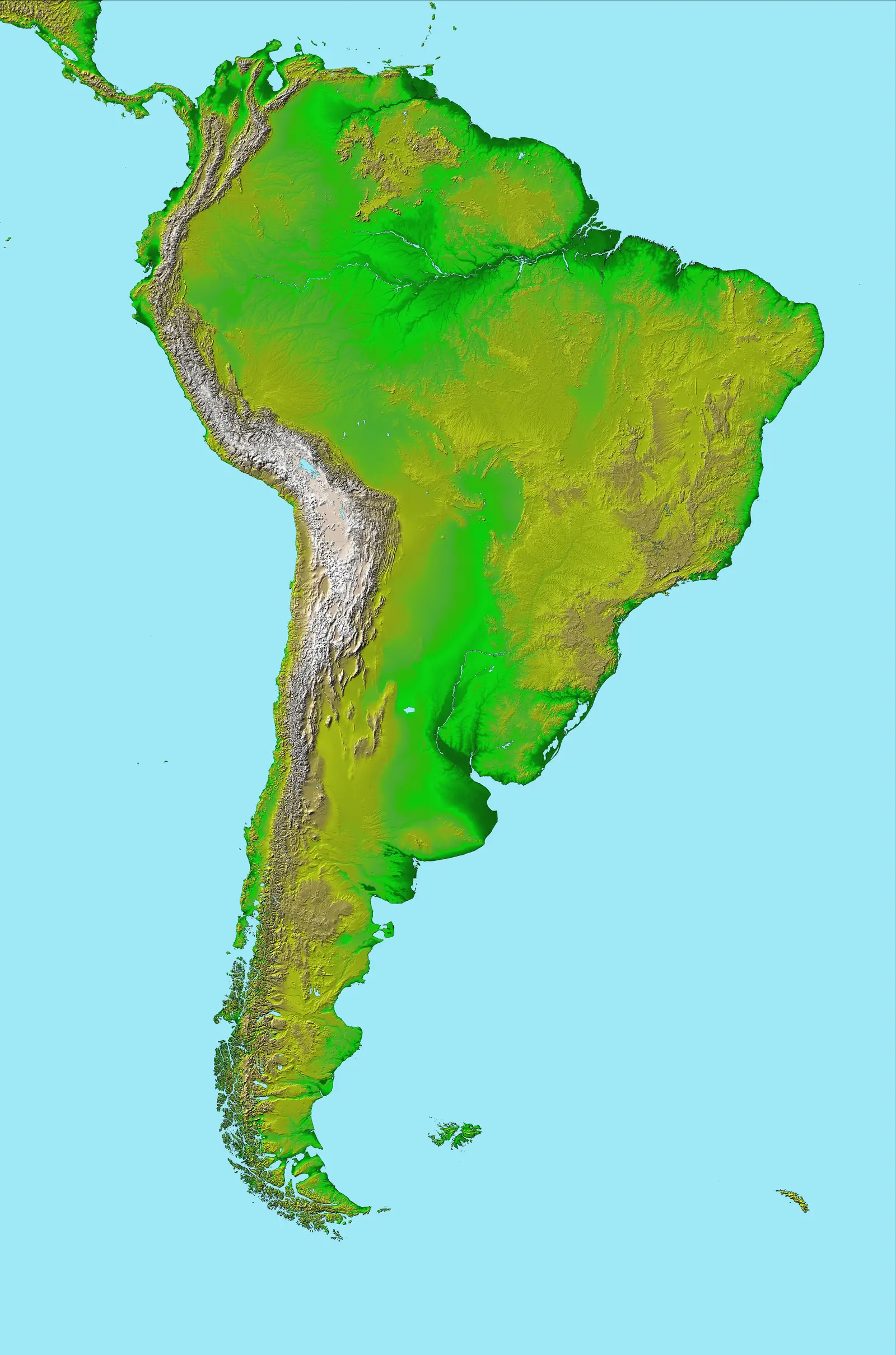
Click or tap the map to enlarge it.
Key Takeaways
- South America is a diverse and fascinating continent with unique topographical features.
- A topographic map of South America provides detailed information about the physical characteristics of the land, including mountains, rivers, and plateaus.
- Understanding the topography of South America is essential for various purposes such as environmental planning, adventure travel, and scientific research.
History
The creation of topographic maps began in the mid-1800s when advancements in surveying techniques and mapping technology enabled cartographers to accurately represent the terrain of different regions. South America, with its vast and varied landscape, became an important area of focus for cartographers.
Over the years, numerous expeditions and surveys were conducted to gather data about the topography of South America. These efforts involved measuring heights, using advanced surveying instruments, and collecting aerial imagery through satellites. The data obtained was then processed and converted into topographic maps.
Unique Insights
The topographic map of South America offers several unique insights into the continent’s geography. Some notable features include:
- The Andes Mountains: Stretching over 7,000 kilometers, the Andes is the longest mountain range in the world. It runs through seven South American countries and includes several peaks over 6,000 meters.
- The Amazon Rainforest: Covering a significant portion of South America, the Amazon Rainforest is known for its rich biodiversity and dense vegetation. The topographic map shows the vastness of this complex ecosystem.
- The Pampas: Located in Argentina, the Pampas are expansive grasslands that extend into Uruguay and Brazil. These flat, fertile plains are favored for agriculture and cattle farming.
- The Atacama Desert: Positioned on the western coast of South America, the Atacama Desert is considered one of the driest places on Earth. The map reveals its arid and barren landscapes.
Table of Relevant Facts
| Year | Event |
|---|---|
| 1819 | Simón Bolívar’s forces defeat the Spanish in the Battle of Boyaca, leading to the independence of Colombia, Ecuador, and Venezuela. |
| 1879 | The War of the Pacific begins between Chile and an alliance of Bolivia and Peru, resulting in territorial changes in the region. |
| 1934 | The Chaco War commences between Bolivia and Paraguay, leading to border disputes and territorial changes in the Gran Chaco region. |
FAQ
-
What is the purpose of a topographic map?
A topographic map provides detailed information about the elevation and physical characteristics of an area. It helps users understand the terrain, locate landmarks, and plan routes for various activities such as hiking, urban planning, and scientific research.
-
How is data collected for topographic maps?
Data for topographic maps is collected through various methods such as ground surveys, aerial photography, and satellite imagery. Advanced instruments and technologies are used to measure heights, distances, and angles, which are then processed to create accurate maps.
-
What are some key features of South America’s topography?
South America is known for its diverse topography, including the towering Andes Mountains, vast rainforests like the Amazon, expansive grasslands such as the Pampas, and unique geological formations like the Atacama Desert.
-
How can topographic maps be useful for adventure travel in South America?
Topographic maps provide crucial information for adventure travelers, helping them plan routes, identify landmarks, and be aware of the elevation changes and natural hazards in the region. They are essential tools for activities such as mountaineering, trekking, and exploration.
-
Are topographic maps helpful for studying the environment?
Absolutely! Topographic maps play a vital role in environmental planning and research. They help scientists and researchers analyze the impact of human activities on the landscape, study watersheds, identify potential habitats, and conduct geological surveys.
-
Can topographic maps be used for urban planning?
Yes, topographic maps are valuable tools for urban planning. They assist in understanding the natural landscape, drainage patterns, and potential risks in an area. Planners use this information to design infrastructure, locate suitable development areas, and make informed decisions regarding zoning and construction.
-
Are topographic maps available online?
Yes, many topographic maps are now available online. Organizations such as national mapping agencies, geographic information systems (GIS) providers, and online map platforms offer digital versions of topographic maps that can be accessed by users.