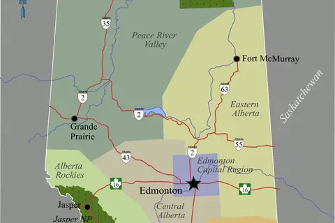
Alberta Map
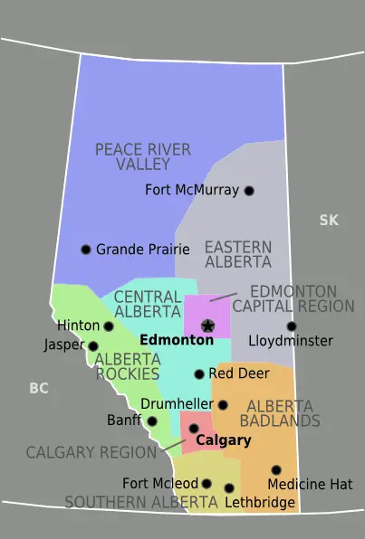
Click or tap the map to enlarge it.
Key Takeaways
- Alberta is a province located in western Canada.
- Alberta is known for its stunning landscapes, including the Rocky Mountains.
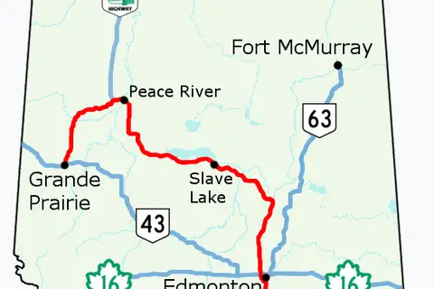
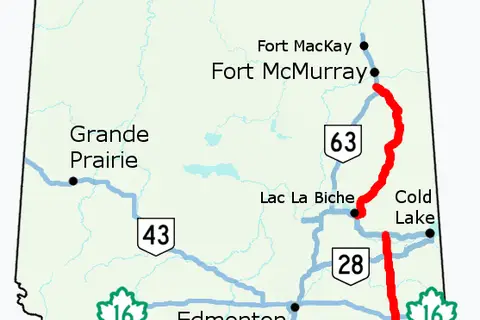
- The map of Alberta showcases its various cities, natural attractions, and major roadways.
- Exploring Alberta using a detailed map can enhance travel experiences and help in planning trips effectively.
History
The province of Alberta, Canada, has a rich history that is closely tied to the exploration and development of the western region of the country. The name “Alberta” was derived from Princess Louise Caroline Alberta, the fourth daughter of Queen Victoria and Prince Albert, and it officially became a province on September 1, 1905.
The expansive territory of Alberta has been inhabited by Indigenous peoples for thousands of years. Indigenous cultures thrived in the region, living off the land and maintaining a deep spiritual connection to the natural surroundings.
European exploration of present-day Alberta began in the late 1700s when fur traders from the Hudson’s Bay Company and the North West Company arrived in search of valuable furs. This led to the establishment of trading posts, which eventually evolved into settlements and cities.
Over the years, Alberta experienced significant growth and development, especially with the discovery of oil in the early 20th century. The province quickly transformed into a major hub for the oil and gas industry, attracting both workers and investors. Today, Alberta’s economy is diversified and includes industries such as agriculture, manufacturing, and technology.
Unique Insights
The Alberta map offers several unique insights into this breathtaking province. Here are a few notable features:
-
Rocky Mountains
The Rocky Mountains dominate the southwestern region of Alberta, providing stunning vistas and opportunities for outdoor activities such as hiking, skiing, and wildlife viewing. The map showcases various mountain ranges and national parks, including Banff National Park and Jasper National Park.
-
Calgary and Edmonton
The Alberta map highlights the cities of Calgary and Edmonton, which serve as major urban centers in the province. Calgary is known for its vibrant downtown core, annual Calgary Stampede, and proximity to the Rocky Mountains. Edmonton, on the other hand, offers a thriving arts scene, beautiful river valley, and numerous festivals throughout the year.
-
Dinosaur Provincial Park
Situated in southeastern Alberta, Dinosaur Provincial Park is a UNESCO World Heritage Site and a must-visit destination for paleontology enthusiasts. The map highlights this unique park, which boasts one of the richest dinosaur fossil beds in the world.
-
Badlands and Hoodoos
The Alberta map also showcases the stunning badlands and hoodoos that can be found in certain regions of the province. These geological formations provide a glimpse into the fascinating natural history of the area and make for excellent photography opportunities.
Table of Relevant Facts
| Year | Event |
|---|---|
| 1535 | First European sighting of present-day Alberta by Sir Thomas More |
| 1670 | Hudson’s Bay Company begins fur trading in the region |
| 1867 | Canada becomes a confederation, including parts of present-day Alberta |
| 1885 | Completion of the Canadian Pacific Railway connects Alberta to the rest of the country |
| 1905 | Alberta becomes a province |
| 1947 | Leduc No. 1 oil well discovers oil, leading to Alberta’s oil boom |
Frequently Asked Questions
1. What are the most popular tourist attractions in Alberta?
Alberta is home to numerous popular tourist attractions. Some of them include Banff National Park, Jasper National Park, Lake Louise, Calgary Stampede, Royal Tyrrell Museum of Paleontology, and the West Edmonton Mall.
2. Can I hike in the Rocky Mountains in Alberta?
Yes, Alberta offers various hiking opportunities in the Rocky Mountains. Banff National Park and Jasper National Park have several trails suitable for hikers of all levels, allowing you to immerse yourself in the stunning alpine scenery.
3. Are there any cultural festivals in Alberta?
Yes, Alberta hosts numerous cultural festivals throughout the year. The Calgary Stampede, Edmonton Folk Music Festival, and Calgary Folk Music Festival are just a few examples of the vibrant cultural scene that can be experienced in the province.
4. How can I explore the badlands and hoodoos in Alberta?
The badlands and hoodoos can be explored by visiting locations such as Drumheller and Writing-on-Stone Provincial Park. Guided tours and hiking options are available, allowing visitors to witness the unique geological formations up close.
5. Are there any UNESCO World Heritage Sites in Alberta?
Yes, Alberta is home to multiple UNESCO World Heritage Sites. These include Canadian Rocky Mountain Parks, Dinosaur Provincial Park, Head-Smashed-In Buffalo Jump, and Wood Buffalo National Park.
6. What is the best time to visit Alberta?
The best time to visit Alberta largely depends on your interests. Summer months (June to August) offer pleasant weather for outdoor activities, while winter months (December to February) provide opportunities for skiing and winter sports. Spring and fall offer milder temperatures and are perfect for exploring cities and cultural events.
7. Does Alberta have any iconic landmarks?
Yes, Alberta is home to several iconic landmarks, including the Calgary Tower, Alberta Legislature Building, Columbia Icefield, Athabasca Falls, and Lake Louise. These landmarks offer unique experiences and stunning photo opportunities.