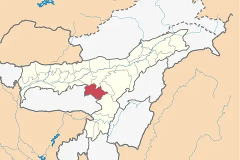
Assam Karbi Anglong Locator Map
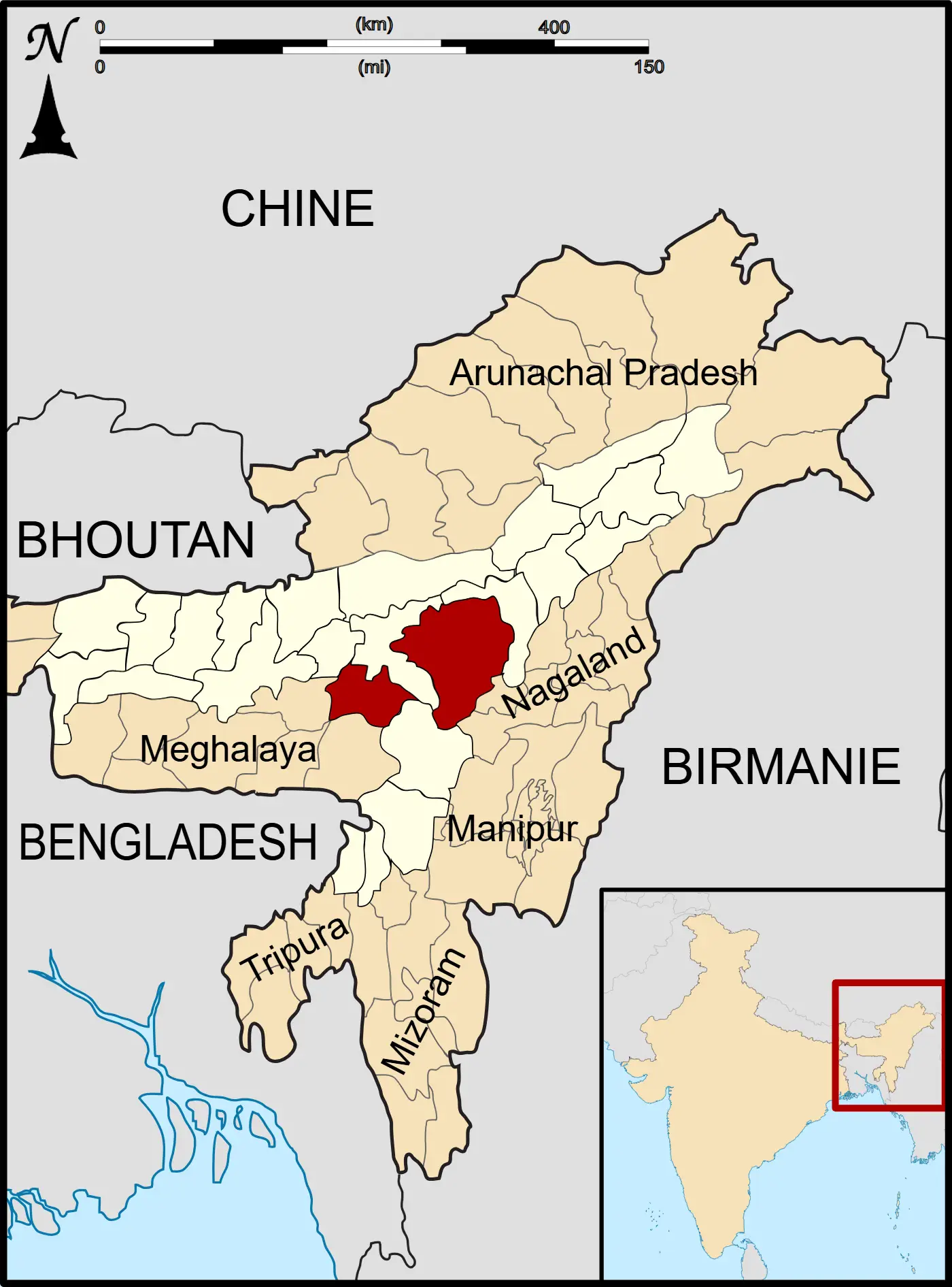
Click or tap the map to enlarge it.
Assam Karbi Anglong Locator Map – A Detailed Overview
Key Takeaways
- The Assam Karbi Anglong Locator Map provides the exact geographical location of the Karbi Anglong District in Assam, India.
- It highlights important landmarks, roads, and boundaries, assisting travelers, researchers, and residents in understanding the district’s layout.
- The map serves as a valuable tool for navigation, planning, and gaining geographical insights.
- It can be a helpful resource for tourists looking to explore the unique natural and cultural heritage of Karbi Anglong.
History
The Assam Karbi Anglong Locator Map showcases the Karbi Anglong District, located in the northeastern state of Assam, India. The district was created on 17 November 1976 and is known for its rich biodiversity and diverse ethnic communities.
Karbi Anglong is home to the Karbi people, one of the major indigenous tribes in Assam. The district exhibits a blend of natural wonders, including lush forests, majestic hills, and picturesque water bodies. The map displays these natural features, allowing users to explore and appreciate the district’s unique topography.
Unique Insights
- The Karbi Anglong District is a significant part of the larger Assam state and plays a crucial role in maintaining its cultural and ecological diversity.
- With over 80% forest cover, Karbi Anglong is considered one of the greenest districts in Assam.
- The district is known for its rich wildlife, including endangered species like the Hoolock Gibbon, Asian Elephant, and Royal Bengal Tiger.
- Karbi Anglong is home to several indigenous communities, each with its distinct traditions, festivals, and crafts. The map showcases their settlements and cultural sites.
- Within Karbi Anglong, one can find the famous Kaziranga National Park, a UNESCO World Heritage Site renowned for housing two-thirds of the world’s Great One-horned Rhinoceroses.
Table of Relevant Facts
| Year | Event |
|---|---|
| 1976 | Establishment of Karbi Anglong District |
| 1986 | Formation of the Karbi People’s Liberation Tigers (KPLT) |
| 2002 | Creation of the autonomous hill district council, Karbi Anglong Autonomous Council (KAAC) |
| 2018 | Inauguration of the East Karbi Anglong district |
Frequently Asked Questions (FAQ)
-
What is the significance of the Assam Karbi Anglong Locator Map?
The Assam Karbi Anglong Locator Map is a valuable tool for understanding the geography and planning routes within the Karbi Anglong District. It highlights the district’s boundaries, important landmarks, and roads, aiding researchers, travelers, and residents in gaining a comprehensive understanding of the region.
-
What natural features can be observed in Karbi Anglong?
Karbi Anglong is known for its lush forests, majestic hills, and picturesque water bodies. The district boasts over 80% forest cover, making it one of the greenest regions in Assam. Visitors can appreciate the diverse flora and fauna, including endangered species like the Hoolock Gibbon, Asian Elephant, and Royal Bengal Tiger.
-
Are there any famous tourist attractions in Karbi Anglong?
Within Karbi Anglong, tourists can explore the renowned Kaziranga National Park, a UNESCO World Heritage Site. The park is home to a significant population of the Great One-horned Rhinoceroses, along with numerous other wildlife species. It offers thrilling wildlife safaris and is a must-visit destination for nature enthusiasts.
-
How diverse are the ethnic communities in Karbi Anglong?
Karbi Anglong is home to several indigenous communities, such as the Karbi people, who have their distinct customs, traditions, festivals, and handicrafts. These communities contribute to the cultural richness of the district, and the Assam Karbi Anglong Locator Map showcases their settlements and cultural heritage sites.
-
When was Karbi Anglong District established?
The Karbi Anglong District was created on 17 November 1976. Since then, it has played a significant role in preserving the cultural and ecological diversity of Assam.
-
What was the formation of the Karbi People’s Liberation Tigers (KPLT)?
The Karbi People’s Liberation Tigers (KPLT) formed in 1986. It is an armed insurgent group in Assam that seeks to address the political aspirations and rights of the Karbi people.
-
What is the Karbi Anglong Autonomous Council (KAAC)?
The Karbi Anglong Autonomous Council (KAAC) was created in 2002. It is an autonomous district council that works towards the overall development of the Karbi Anglong District.