California County Map Sacramento County Highlighted
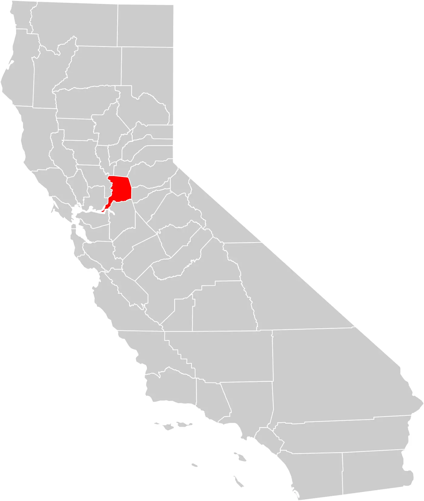
Click or tap the map to enlarge it.
Key Takeaways
- Explore the boundaries and features of Sacramento County on the California County Map
- Discover the diverse geography encompassing urban areas, mountains, rivers, and more within Sacramento County
- Learn about the history, attractions, and notable locations in the county
- Utilize this map for navigation, educational purposes, or trip planning in Sacramento County
History
Sacramento County, located in the central part of California, has a rich history dating back to the early 19th century. The county was established on February 18, 1850, just weeks after California became a state.
Initially, Sacramento County included a significantly larger area than it does today. Over time, as other counties were formed, the boundaries of Sacramento County were refined to their current configuration. Today, it spans approximately 994 square miles and is home to numerous cities, towns, and unincorporated communities.
Unique Insights
1. Diverse Geography: Sacramento County exhibits a diverse range of geography, from the fertile Sacramento Valley in the west to the scenic Sierra Nevada Mountains in the east. The American River and Sacramento River run through the county, offering picturesque landscapes and recreational opportunities.
2. State Capital: Sacramento, the state capital of California, is located within Sacramento County. The city is home to important government institutions, including the State Capitol building, and offers a vibrant cultural scene, museums, and historic attractions.
3. Agriculture and Farming: Sacramento County has a significant agricultural presence, with fertile land ideal for farming. The county is known for its production of crops such as rice, tomatoes, almonds, and wine grapes.
4. Outdoor Recreation: Outdoor enthusiasts can enjoy a variety of recreational activities in Sacramento County. The county features numerous parks, nature reserves, and wildlife sanctuaries, providing opportunities for hiking, boating, fishing, and wildlife spotting.
5. Historic Gold Rush Connections: Sacramento County played a pivotal role in the California Gold Rush of the mid-19th century. The area served as a major transportation hub during this period, with the Sacramento River being an essential route for miners seeking their fortunes.
Table: Relevant Facts about Sacramento County
| Year | Event |
|---|---|
| 1848 | Discovery of gold in California triggers the Gold Rush, which eventually leads to increased settlement in the region. |
| 1850 | Sacramento County is established on February 18, shortly after California becomes a state. |
| 1854 | Sacramento becomes the official capital of California. |
| 1879 | The current State Capitol building in Sacramento is completed. |
| 1918 | A devastating flu pandemic reaches Sacramento County, impacting the local population. |
| 1967 | The California State Fair relocates permanently to Cal Expo in Sacramento County. |
| 2000 | Sacramento International Airport undergoes a major expansion to accommodate increasing air travel. |
Frequently Asked Questions (FAQs)
1. What are the major cities in Sacramento County?
The major cities in Sacramento County include Sacramento (the capital city of California), Elk Grove, Folsom, Citrus Heights, and Rancho Cordova.
2. Can I visit the State Capitol building in Sacramento?
Yes, the State Capitol building in Sacramento is open to the public for guided tours. Visitors can learn about the state’s history, government processes, and explore the beautiful architecture of the Capitol.
3. Are there any notable attractions in Sacramento County?
Absolutely! Some notable attractions include the Crocker Art Museum, the California State Railroad Museum, the Old Sacramento Waterfront, Sutter’s Fort State Historic Park, and the Sacramento Zoo.
4. Are there opportunities for outdoor activities in the county?
Indeed, Sacramento County offers abundant outdoor opportunities. You can enjoy activities like hiking, biking, fishing, boating, and birdwatching in the county’s parks, nature reserves, and waterways.
5. What is the best time to visit Sacramento County?
Sacramento County experiences a Mediterranean climate, with hot summers and mild winters. The spring (March to May) and fall (September to November) seasons are generally considered pleasant for outdoor activities and sightseeing.
6. Can I explore the nearby Sierra Nevada Mountains from Sacramento County?
Yes, Sacramento County serves as a gateway to the Sierra Nevada Mountains. The mountains offer various recreational opportunities, including hiking, skiing, camping, and breathtaking scenic drives.
7. Are there any annual events or festivals held in Sacramento County?
Absolutely! Sacramento County hosts numerous events and festivals throughout the year, including the California State Fair, the Farm-to-Fork Festival, the Gold Rush Days, the Jazz Jubilee, and various holiday celebrations.