Czechoslovak Republic Map 1919
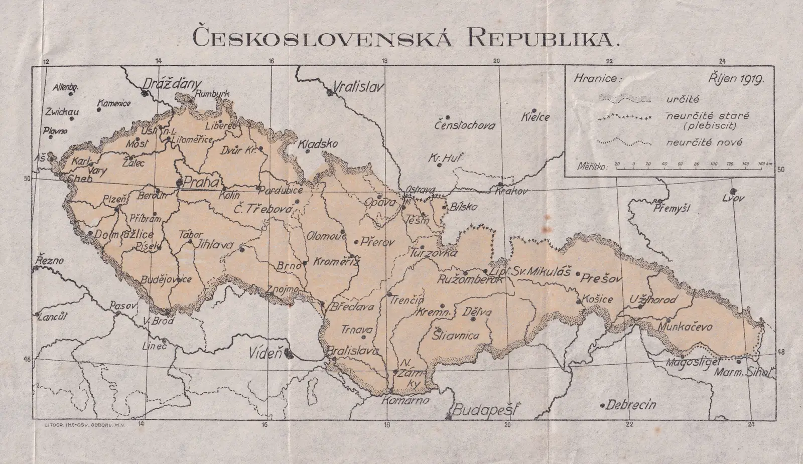
Click or tap the map to enlarge it.
Czechoslovak Republic Map 1919 – A Detailed Exploration
Key Takeaways
- The Czechoslovak Republic Map of 1919 showcased the newly-established independent nation in Central Europe.
- It depicted the borders, major cities, and geographical features of the Czechoslovak Republic after the First World War.
- This map holds historical significance as it represents the formation of a nation that would eventually shape the region’s history.
History
The Czechoslovak Republic Map of 1919 illustrates the borders and geography of the newly founded independent country, known as Czechoslovakia, after the First World War. On October 28, 1918, Czechoslovakia declared its independence from the Austro-Hungarian Empire, which collapsed following the war.
The map reflects the transformative period when the Czechoslovak Republic emerged, uniting the Czech and Slovak territories. The proclamation of the republic marked a significant milestone for the people of Czechoslovakia, who now had their own sovereign nation.
The borders of the Czechoslovak Republic were defined by the Treaty of Saint-Germain-en-Laye, signed on September 10, 1919. This treaty acknowledged the nation’s independence and assigned it specific territories, including parts of former Austria-Hungary and Germany.
Unique Insights
Exploring the Czechoslovak Republic Map of 1919 provides us with several unique insights into the nation’s geography and historical context:
- 1. Border Changes: The map demonstrates the significant territorial changes that occurred after the dissolution of the Austro-Hungarian Empire, including the incorporation of areas with a diverse ethnic population.
- 2. Capital City: Prague, the capital of the Czechoslovak Republic, is prominently displayed on the map. The city’s central location within the country symbolizes its importance both geographically and culturally.
- 3. Carpathian Mountains: The Carpathian Mountains are depicted on the map, highlighting their role in shaping the nation’s eastern border and serving as a natural barrier.
- 4. Major Rivers: The Danube and Morava rivers are illustrated, underscoring their significance for transportation and trade within the Czechoslovak Republic.
Table of Relevant Facts
| Year | Event |
|---|---|
| 1918 | Declaration of Czechoslovak independence |
| 1919 | Treaty of Saint-Germain-en-Laye signed |
| 1919 | Establishment of the Czechoslovak Republic |
| 1920 | Recognition of Czechoslovakia by major world powers |
FAQ
-
When was the Czechoslovak Republic Map created?
The Czechoslovak Republic Map was created in 1919, shortly after the establishment of the independent nation.
-
What does the Czechoslovak Republic Map depict?
The map depicts the borders, major cities, and geographical features of the Czechoslovak Republic after its formation in 1918.
-
What was the significance of the Czechoslovak Republic?
The Czechoslovak Republic was significant as it represented the first independent state of the Czech and Slovak people, following the collapse of the Austro-Hungarian Empire.
-
Who initiated the formation of Czechoslovakia?
The Czechoslovak independence movement, led by political leaders such as Tomáš Garrigue Masaryk, initiated the formation of Czechoslovakia.
-
Which countries’ territories were incorporated into Czechoslovakia?
Czechoslovakia incorporated parts of former Austria-Hungary and Germany, including areas with diverse ethnic populations.
-
What treaty officially acknowledged Czechoslovakia’s independence?
The Treaty of Saint-Germain-en-Laye, signed in 1919, officially acknowledged Czechoslovakia’s independence.
-
What major rivers are depicted on the map?
The map illustrates the Danube and Morava rivers, which played important roles in transportation and trade within the Czechoslovak Republic.