East Asia Topographic Map
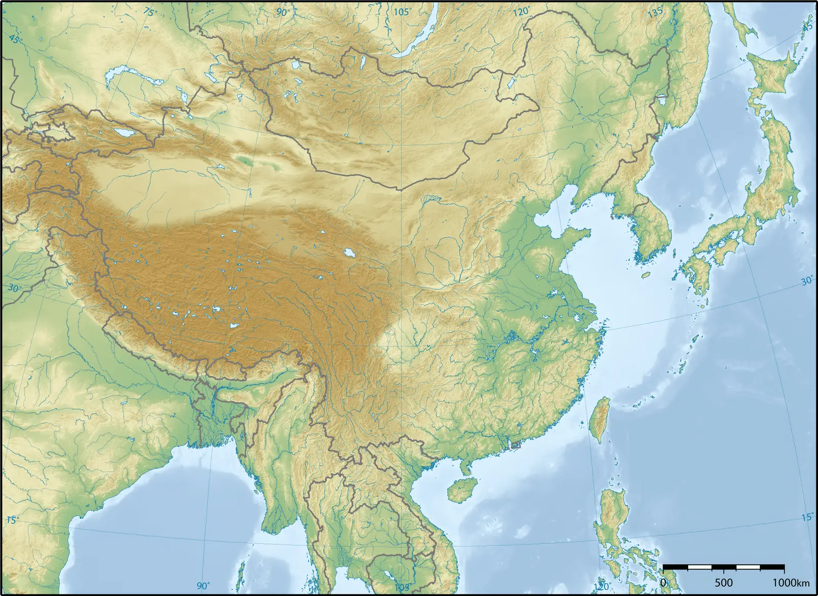
Click or tap the map to enlarge it.
Key Takeaways
- East Asia boasts diverse and breathtaking landscapes, making it a fascinating destination for exploration.
- The East Asia Topographic Map provides a detailed representation of the region’s physical features, including mountains, rivers, and plains.
- Understanding the topography of East Asia is crucial for various purposes such as planning travel, studying geography, and conducting environmental research.
History
The East Asia Topographic Map has a rich history that dates back centuries. Throughout the ages, cartographers have been endlessly fascinated by the unique geography of this region. The map goes beyond mere cartography; it serves as a window into East Asia’s remarkable past.
Early renditions of East Asia’s maps could be found in ancient Chinese manuscripts, dating as far back as the 2nd century BCE. These early maps primarily focused on Chinese territories, emphasizing the political boundaries and providing a basic overview of the terrain.
Over time, as exploration and trade flourished, more accurate and detailed maps of East Asia emerged. European travelers and mapmakers, such as Marco Polo and Matteo Ricci, played a significant role in producing updated and Western-influenced cartographic representations.
Today, the East Asia Topographic Map combines traditional cartographic techniques with advanced satellite imagery and digital mapping systems, creating a comprehensive and precise depiction of the region’s topography.
Unique Insights
Exploring the East Asia Topographic Map offers several unique insights into the region’s geography:
- The towering Himalayas, extending along the border of Tibet and Nepal, are the highest mountain range globally, with Mount Everest reaching an astonishing height of 8,848 meters (29,029 feet)
- The vast Gobi Desert, situated in Mongolia and China, is one of the largest deserts in the world and features captivating sand dunes and unique wildlife.
- The Yangtze River, the longest river in Asia and the third-longest globally, cuts through China, offering breathtaking views of its gorges and serving as a vital transportation route.
- Japan, an archipelago located off the eastern coast of mainland Asia, showcases a stunning coastline, mountainous landscapes, and volcanoes, including Mount Fuji, an iconic symbol of the country.
- The Korean Peninsula, divided between North and South Korea, is characterized by picturesque mountain ranges, coastal plains, and numerous rivers.
- Southeast Asia, including countries such as Thailand, Vietnam, and Cambodia, features lush rainforests, pristine beaches, and a diverse array of flora and fauna.
- The South China Sea, bordered by China, Vietnam, Malaysia, and the Philippines, is home to numerous islands and coral reefs, making it a popular destination for diving and marine exploration.
Table of Relevant Facts
| Year | Significant Event |
|---|---|
| 221 BCE | Unified China under the Qin Dynasty |
| 1271 | Start of the Mongol Empire under Genghis Khan |
| 1603 | The beginning of the Edo period in Japan |
| 1949 | Establishment of the People’s Republic of China |
| 1953 | Signing of the Korean Armistice Agreement |
Frequently Asked Questions
-
What is a topographic map?
A topographic map is a detailed representation of the physical features of an area, including its elevation, mountains, valleys, rivers, and other natural and man-made structures. It provides valuable information about the terrain for various purposes.
-
What is the scale used in the East Asia Topographic Map?
The scale of the East Asia Topographic Map may vary depending on the source. However, a common scale is 1:1,000,000, which means that one unit on the map represents one million units on the ground.
-
How can I use the East Asia Topographic Map for travel planning?
The East Asia Topographic Map is an invaluable tool for travel planning. It allows you to identify scenic routes, locate national parks and natural attractions, and determine the elevation and difficulty of hiking trails.
-
Is the East Asia Topographic Map beneficial for educational purposes?
Absolutely! The map serves as an excellent educational resource for study purposes. Students can learn about the geography, geology, and environmental aspects of East Asia while visually exploring the region’s diverse physical features.
-
Can I obtain a physical copy of the East Asia Topographic Map?
Yes, physical copies of the East Asia Topographic Map are available for purchase in select map stores or can be obtained through online retailers. Additionally, many websites provide downloadable versions of the map as well.
-
Can I use the East Asia Topographic Map for scientific research?
Absolutely! The map serves as a valuable tool for conducting scientific research. Its detailed representation of East Asia’s topography can assist in various fields such as geology, climatology, and environmental studies.
-
Are there any digital versions of the East Asia Topographic Map available?
Yes, numerous online platforms provide interactive digital versions of the East Asia Topographic Map. These digital maps often allow users to zoom in, toggle different layers, and access additional information.