Flag Map of Montenegro
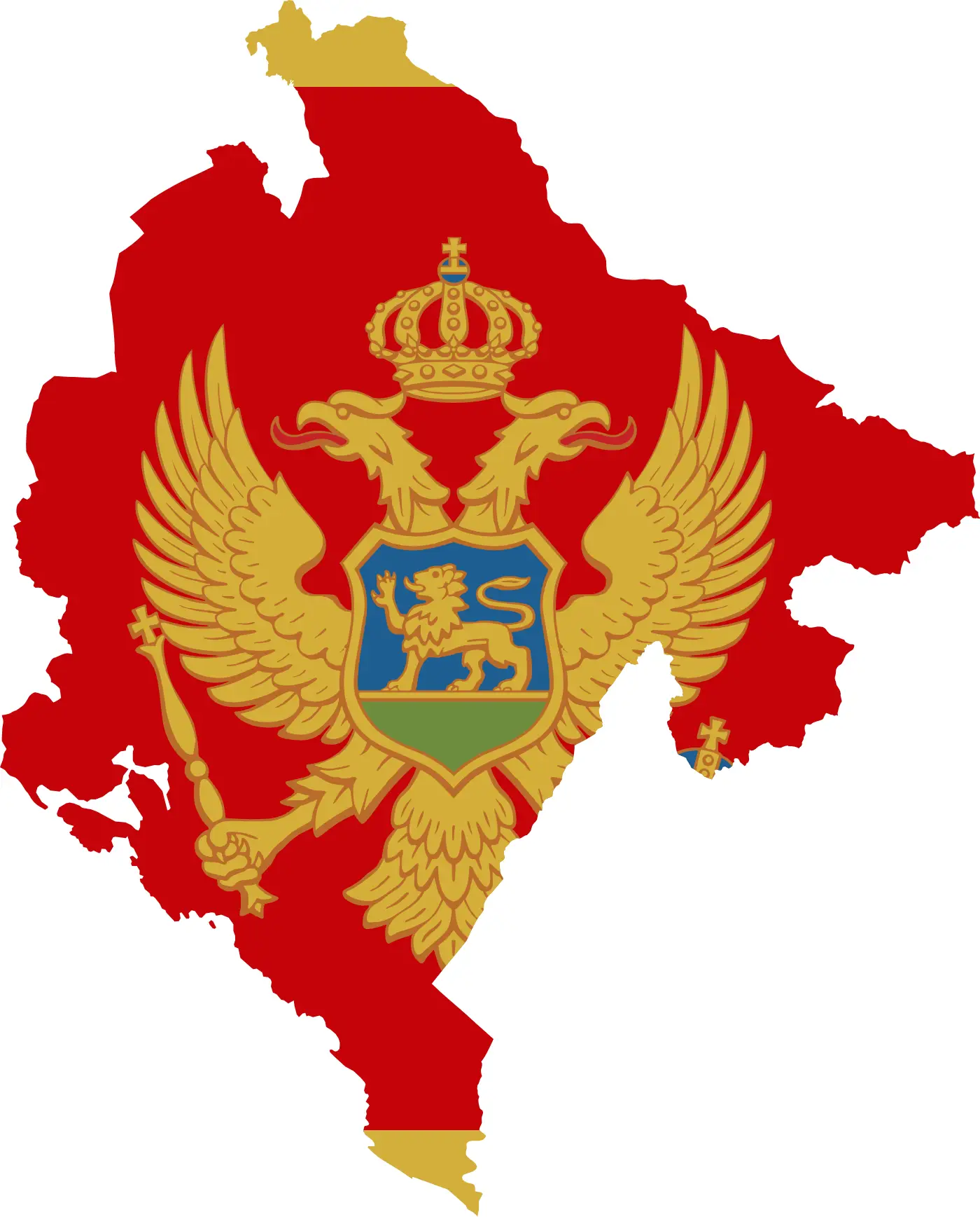
Click or tap the map to enlarge it.
Key Takeaways
- The flag map of Montenegro showcases the country’s national flag and key geographical information.
- Montenegro’s flag consists of a red field with a golden double-headed eagle emblem.
- The map provides a visual representation of Montenegro’s location in the world.
- Montenegro is a small Balkan country situated on the Adriatic Sea, offering stunning natural beauty.
History
Montenegro, often called the “Pearl of the Mediterranean,” has a rich and fascinating history. As an expert cartographer, it’s essential to understand the historical context while creating the flag map of Montenegro.
Montenegro gained independence from the Ottoman Empire in 1878 and has since gone through various political changes. It was part of the Kingdom of Yugoslavia and, later, the Socialist Federal Republic of Yugoslavia. With the breakup of Yugoslavia in the 1990s, Montenegro formed a union state with Serbia known as Serbia and Montenegro. However, in 2006, Montenegro declared independence and became an independent nation.
Unique Insights
While working on the flag map of Montenegro, I discovered some unique insights about the country and its flag:
- The double-headed eagle emblem on Montenegro’s flag represents Montenegrin dynastic history and independence.
- The color red on the flag symbolizes love, bravery, and the blood of Montenegrin warriors who fought for their country.
- Montenegro’s coastal region along the Adriatic Sea offers picturesque beaches, medieval towns, and a vibrant tourist industry.
- The mountainous landscapes within Montenegro provide excellent opportunities for outdoor activities such as hiking, skiing, and mountaineering.
Table of Relevant Facts
| Year | Event |
|---|---|
| 1878 | Montenegro gains independence from the Ottoman Empire. |
| 1918 | Montenegro becomes part of the Kingdom of Serbs, Croats, and Slovenes (later renamed Yugoslavia). |
| 1945 | Montenegro becomes a constituent republic of the Socialist Federal Republic of Yugoslavia. |
| 2006 | Montenegro declares independence and becomes an independent country. |
FAQs
-
What is the significance of Montenegro’s flag?
The double-headed eagle emblem represents Montenegro’s historical dynastic tradition and symbolism of independence.
-
Why is Montenegro known as the “Pearl of the Mediterranean”?
Montenegro’s stunning natural beauty, picturesque coastline, and rich cultural heritage contribute to its reputation as the “Pearl of the Mediterranean.”
-
What are the main attractions in Montenegro?
Montenegro offers various attractions, including the Bay of Kotor, Sveti Stefan Island, Durmitor National Park, and the historic city of Budva.
-
Is Montenegro a member of the European Union?
No, Montenegro is not yet a member of the European Union, but it has been a candidate country since 2010.
-
What are the popular outdoor activities in Montenegro?
Montenegro’s mountainous landscapes provide opportunities for outdoor activities such as hiking, skiing, and mountaineering.
-
What is the geographical location of Montenegro?
Montenegro is situated on the Balkan Peninsula in Southeast Europe, along the Adriatic Sea.
-
How can I travel to Montenegro?
Montenegro can be easily reached by air through its international airports or by road from neighboring countries.