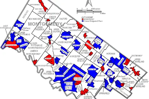
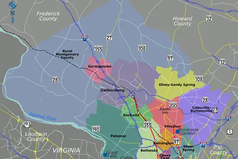
Map of Montgomery County Pennsylvania
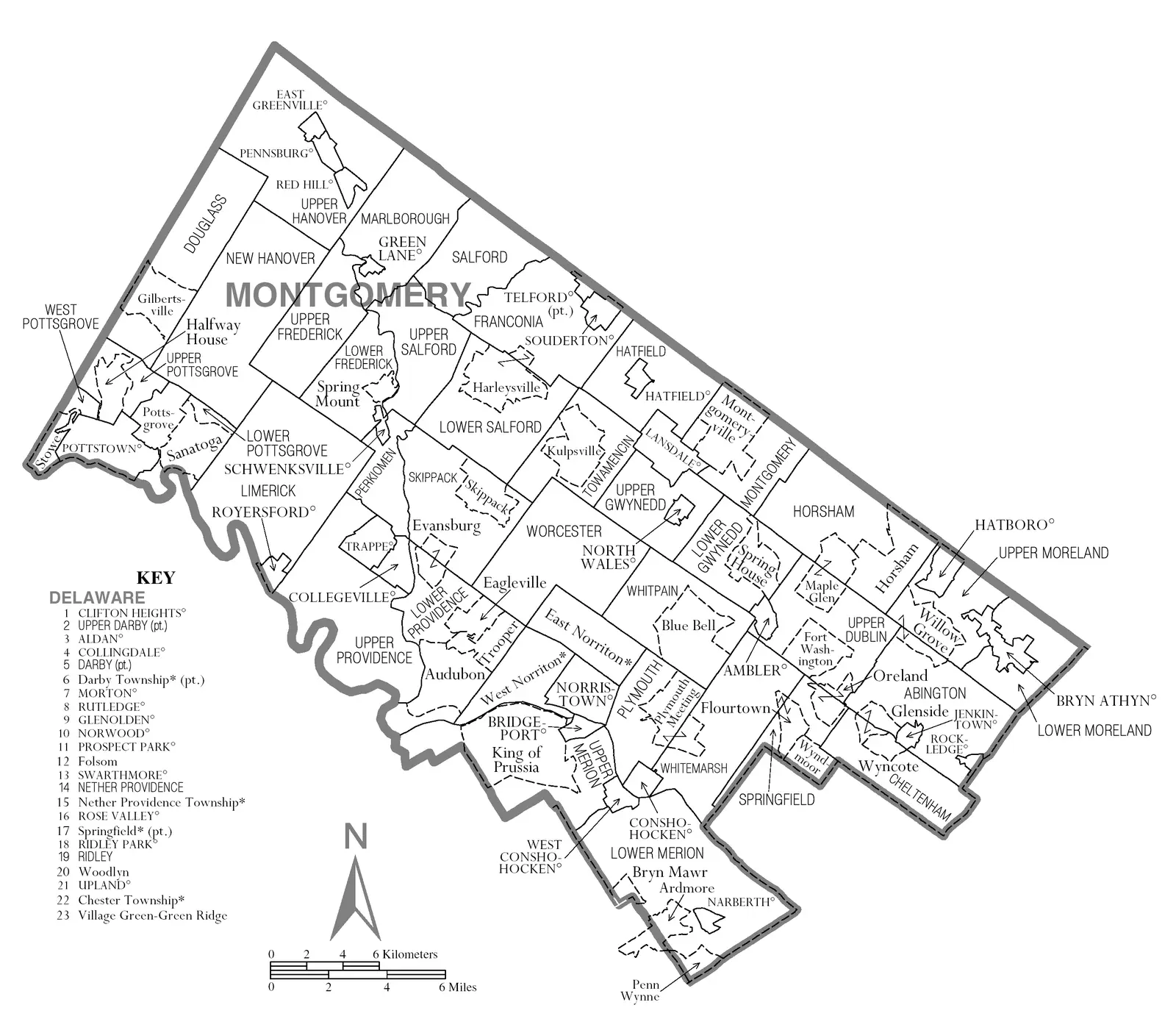
Click or tap the map to enlarge it.
Key Takeaways
- Montgomery County, Pennsylvania is located in the southeastern part of the state.
- The map showcases the various cities, towns, and landmarks within the county.
- It provides valuable information for residents, tourists, and businesses.
- The map is a useful tool for navigation and understanding the geographical layout of Montgomery County.
History of Montgomery County, Pennsylvania
Montgomery County, Pennsylvania was established on September 10, 1784, and was named after General Richard Montgomery, a Revolutionary War hero. The county has a rich history, starting from its Native American roots to becoming a key location during the American Revolutionary War.
During the 1800s, Montgomery County experienced rapid industrialization, with the rise of manufacturing and textile industries. It played a significant role in the development of the region and attracted many immigrants seeking job opportunities.
Over the years, Montgomery County has evolved into a suburban area with a diverse population and a thriving economy. Today, it is known for its vibrant communities, excellent educational institutions, and numerous historical landmarks.
Unique Insights
1. Geographic Diversity: Montgomery County, Pennsylvania is geographically diverse, offering a mix of urban, suburban, and rural environments. From the bustling city of Norristown to the idyllic rural landscapes of Skippack, the county has something to offer for everyone.
2. Historical Landmarks: The map highlights several significant historical landmarks within Montgomery County. From Valley Forge National Historical Park, where George Washington and his troops camped during the winter of 1777-1778, to Graeme Park, the residence of a colonial governor, the county is steeped in history.
3. Natural Beauty: The county is blessed with picturesque landscapes and natural beauty. Montgomery County is home to several parks, including Evansburg State Park and Green Lane Park, offering opportunities for outdoor activities such as hiking, fishing, and picnicking.
4. Economic Hub: With its proximity to Philadelphia and easy access to major transportation routes, Montgomery County serves as an economic hub in the region. It attracts businesses from various industries, contributing to a robust economy and providing employment opportunities for residents.
Table of Relevant Facts
| Year | Event |
|---|---|
| 1683 | William Penn founded the town of Norriton, later known as Norristown, which now serves as the county seat. |
| 1777-1778 | Valley Forge in Montgomery County served as the winter encampment for George Washington’s Continental Army. |
| 1900 | The county experienced significant industrial growth, with the rise of textile mills and manufacturing industries. |
| 1950s-1970s | The county witnessed a suburban boom, with the population increasing due to the migration from Philadelphia. |
| 2009 | Montgomery County established a nonprofit land preservation program to protect open spaces and farmland. |
Frequently Asked Questions (FAQ)
1. How do I get to Montgomery County, Pennsylvania?
To reach Montgomery County, you can fly into Philadelphia International Airport, which is approximately 30 minutes away. You can also access the county by train or car, as it is well-connected through major roadways and public transportation.
2. What are some popular attractions in Montgomery County?
Montgomery County offers a range of attractions to explore. Some popular ones include Valley Forge National Historical Park, Longwood Gardens, King of Prussia Mall, and the Barnes Foundation.
3. Are there any outdoor activities available in the county?
Absolutely! Montgomery County is known for its beautiful parks and outdoor recreational areas. You can enjoy hiking, biking, fishing, boating, and even camping in various locations throughout the county.
4. What are the must-visit historical landmarks in Montgomery County?
Valley Forge National Historical Park, Graeme Park, and Peter Wentz Farmstead are highly recommended historical sites to visit in the county. These places offer a glimpse into the region’s significant role during the American Revolutionary War.
5. How is the weather in Montgomery County?
Montgomery County experiences all four seasons, with hot summers and cold winters. Spring and fall offer mild and pleasant weather, making it an ideal time to visit the region.
6. Can you recommend any local dining options in Montgomery County?
Montgomery County has a vibrant culinary scene with a range of dining options. Some popular eateries include farm-to-table restaurants, ethnic cuisines, and cozy cafes offering delicious food and warm hospitality.
7. Are there any annual events or festivals held in Montgomery County?
Yes, Montgomery County hosts several annual events and festivals throughout the year. Some notable ones include the KOP Beerfest Royale, Lansdale Beer Tasting Festival, and the Elmwood Park Zoo’s Harvest Fest.