Flag Map of the Indian Subcontinent
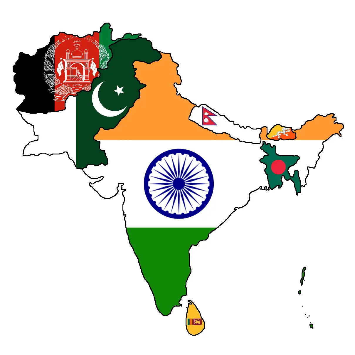
Click or tap the map to enlarge it.
Key Takeaways
- The Flag Map of the Indian Subcontinent is a unique representation that combines geography and national flags.
- This map serves as a visual representation of the countries that form the Indian Subcontinent, displaying their flags in a striking way.
- It is an excellent tool for educational purposes, aiding in teaching cultural diversity and geography.
- Using this map helps in understanding the national emblems and symbols of the Indian Subcontinent countries.
Introduction
The Flag Map of the Indian Subcontinent is a visually captivating and informative map that combines the geography of the region with the national flags of each country. This unique representation provides an excellent resource for understanding the countries that form the Indian Subcontinent and their respective national emblems. It serves as a perfect blend of education, cultural diversity, and geographical awareness.
History
The history of the Indian Subcontinent is rich and complex, with a diverse range of cultures, traditions, and historical events. The region comprises several countries, including India, Pakistan, Bangladesh, Nepal, Sri Lanka, Bhutan, and the Maldives. Each nation within the Indian Subcontinent has its own unique history, and this map allows for a visual representation of their flags and the symbolic representation of their national identity.
Unique Insights
The Flag Map of the Indian Subcontinent offers several unique insights into the region:
- Representation of National Flags: The map showcases the flags of each country in a creative and visually appealing manner, allowing for easy recognition and understanding.
- Cultural Diversity: By displaying the flags together on a single map, it highlights the diverse cultures and traditions present within the Indian Subcontinent.
- Geographical Features: The map also features the geographical locations of each country, giving a sense of the region’s physical layout.
- Education and Awareness: This map serves as an excellent educational tool, helping students and enthusiasts learn about the flags and geography of the Indian Subcontinent.
Table of Relevant Facts
| Country | Flag | Capital | Population | Official Languages |
|---|---|---|---|---|
| India | New Delhi | 1.35 billion | Hindi, English | |
| Pakistan | Islamabad | 225 million | Urdu | |
| Bangladesh | Dhaka | 168 million | Bengali | |
| Nepal | Kathmandu | 30 million | Nepali | |
| Sri Lanka | Colombo | 22 million | Sinhala, Tamil | |
| Bhutan | Thimphu | 0.8 million | Dzongkha | |
| Maldives | Male | 0.4 million | Dhivehi |
Frequently Asked Questions (FAQ)
1. How can I use the Flag Map of the Indian Subcontinent for educational purposes?
The Flag Map of the Indian Subcontinent serves as a great educational tool for teaching geography, cultural diversity, and national symbols. You can use it in classrooms, presentations, or educational websites to enhance understanding and knowledge.
2. Can I purchase a physical copy of the Flag Map of the Indian Subcontinent?
Yes, many online stores offer physical copies of the Flag Map of the Indian Subcontinent. You can find posters, wall decals, or even framed versions for display purposes.
3. Are the flags on the map accurately represented?
Yes, the flags are designed to accurately represent the national flags of the countries within the Indian Subcontinent. They have been carefully crafted to retain the correct proportions and colors.
4. Are there any other maps available that combine flags and geography?
Yes, there are various maps available that combine flags and geography, showcasing different regions or countries. Some examples include the European Flag Map, African Flag Map, and South American Flag Map.
5. How can I study the geography of the Indian Subcontinent in more detail?
There are numerous resources available, including atlases, books, and online websites, that provide detailed information on the geography of the Indian Subcontinent. You can also consider enrolling in geography courses or consulting geographical experts.
6. Is there any historical significance behind the flags displayed on the map?
Each flag displayed on the map has its own historical significance, representing the national identity, struggles, and achievements of the respective countries within the Indian Subcontinent. Exploring the history of each flag is a fascinating journey.
7. Can I use the Flag Map of the Indian Subcontinent for commercial purposes?
Commercial use of the Flag Map of the Indian Subcontinent may require permission depending on the specific context. It is advisable to consult the creator or copyright holder of the map for further clarification.
External links
- Official Website of the Government of India
- Official Website of the Government of Pakistan
- Official Website of the Government of Bangladesh
- Official Website of the Government of Nepal
- Official Website of the Government of Sri Lanka
- Official Website of the Government of Bhutan
- Official Website of the Government of Maldives