Flag Map of Vietnam
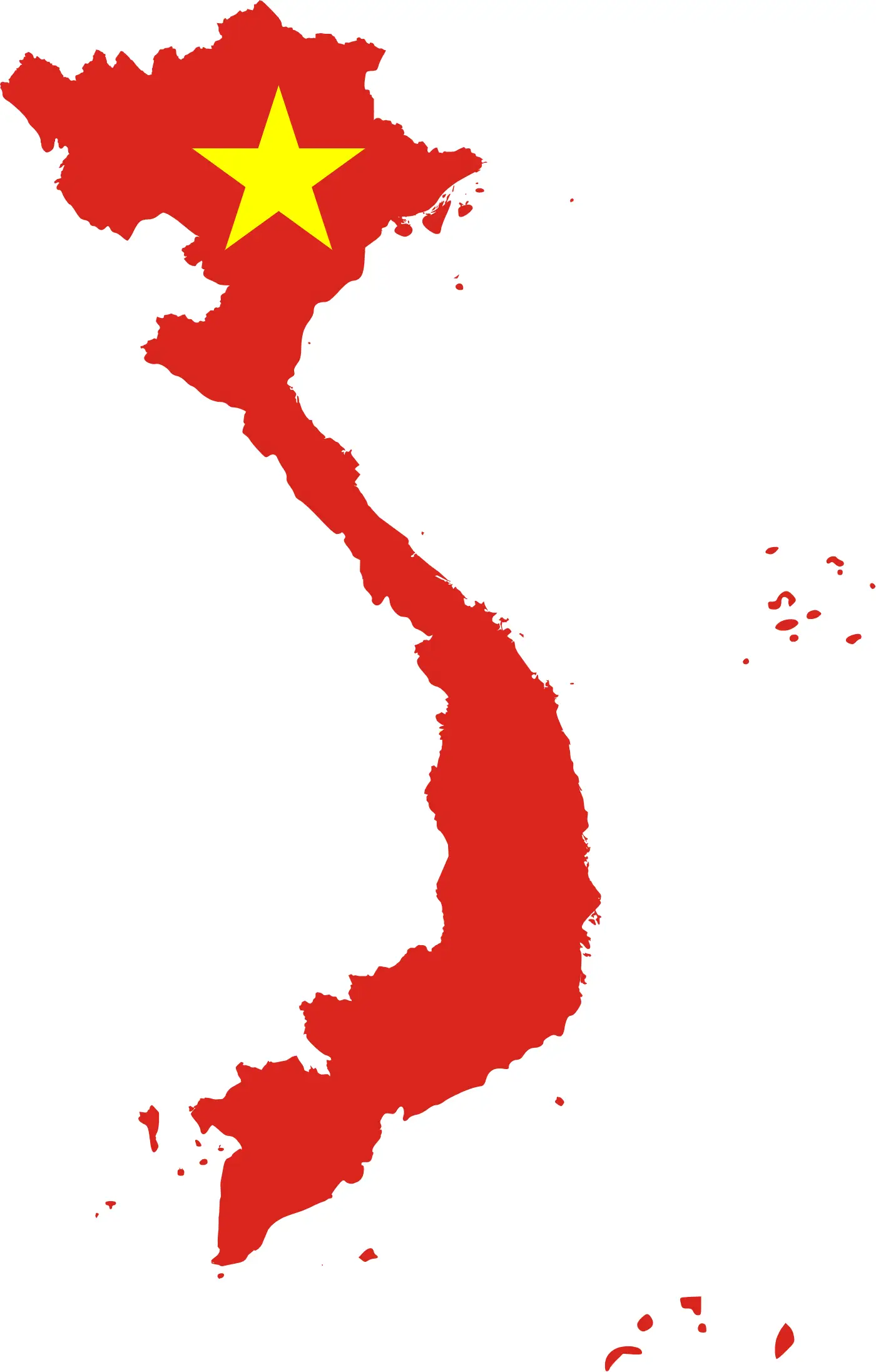
Click or tap the map to enlarge it.
Key Takeaways
- The Flag Map of Vietnam offers a unique representation of the country’s flag through cartographic design.
- Combining elements of geography and national symbolism, this map serves as an excellent educational resource.
- Understanding the historical context and significance of flag maps can enhance our knowledge of a country’s identity.
History
The Flag Map of Vietnam is a graphical representation of Vietnam’s national flag created by integrating the flag design into the geographic boundaries of the country. It uniquely showcases both the physical geography and the symbol of the Vietnamese nation. This innovative concept combines cartography with patriotic symbolism, resulting in a visually appealing and informative map.
Unique Insights
- The Flag Map of Vietnam visually portrays the flag’s design within the borders of the country, creating a powerful visual connection between land and national identity.
- This map helps viewers understand the geographic context that shaped Vietnam’s history and cultural heritage.
- The integration of the flag into the map provides a vivid illustration of the unity and pride of the Vietnamese people.
- By incorporating the national flag into a cartographic representation, this map celebrates the patriotic spirit of Vietnam.
Relevant Facts
| Year | Event |
|---|---|
| 1945 | The modern-day Vietnamese national flag, with a red background and a yellow star in the center, was first adopted. |
| 1955 | The flag’s design was slightly modified, changing the ratio of the flag’s proportions. |
| 1976 | With the reunification of North and South Vietnam, the flag became the national flag for the entire country. |
| 1992 | A law was passed, officially codifying the design and proportions of the national flag. |
FAQ
1. What does the flag represent?
The flag of Vietnam represents the country’s determination for independence, freedom, and the unity of the Vietnamese people.
2. Why was the flag design changed in 1955?
The flag’s design was modified to adjust the proportions and ensure a more balanced representation of the flag on various displays.
3. Can I use the Flag Map of Vietnam for educational purposes?
Yes, the Flag Map of Vietnam can be used as an educational resource to teach geography, history, and national symbolism.
4. Does the flag hold any religious meaning?
No, the Vietnamese national flag does not hold any religious connotations. It solely represents the nation’s pride and identity.
5. Is the Flag Map of Vietnam widely recognized in the country?
While the Flag Map of Vietnam may not be widely recognized, it offers a unique artistic representation of the flag.
6. Are there any specific rules for the display of the Vietnamese national flag?
Yes, there are guidelines regarding the proper display and usage of the Vietnamese national flag, which should be followed respectfully.
7. Are there any other countries that have flag maps?
Yes, flag maps have been created for other countries as well, combining national symbolism with geography.
External Links
LSI Keywords
- Flag Map of Vietnam
- Vietnamese national flag
- Geography of Vietnam
- Patriotic symbolism
- Vietnam’s cultural heritage
- Unity of the Vietnamese people
- Vietnam’s independence