India Map 2017
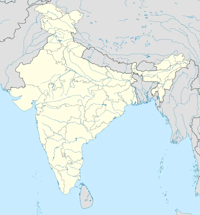
Click or tap the map to enlarge it.
Key Takeaways
- The India Map of 2017 provides an accurate representation of the country, highlighting its geography, states, and major cities.
- It is an essential tool for understanding the political and territorial organization of India at that time.
- By examining the map, one can observe the diverse landscapes, rivers, and other geographical features of India.
- The India Map 2017 also serves as a valuable resource for travelers, researchers, historians, and students.
History of the India Map 2017
The India Map 2017 is a detailed cartographic representation of the country, providing a snapshot of its geographic boundaries, states, and major cities during that specific year. Maps have played a crucial role in human history, aiding in exploration, navigation, and territorial understanding. The India Map 2017 holds significant importance for historians, geographers, and those interested in studying India’s political and geographic landscape at the time.
The art of cartography in India dates back centuries, with early maps being created using various techniques like hand-drawing, engraving, and lithography. The advancements in technology have revolutionized cartography over time, allowing for precise and accurate representations of the world.
The India Map 2017 provides a visual representation of India’s political boundaries, highlighting its 29 states and 7 union territories. It also displays major cities, transportation networks, rivers, and other important geographic features. The map is designed to be highly informative, enabling users to get a comprehensive understanding of India’s territorial organization.
Unique Insights
Examining the India Map 2017 allows for several unique insights into the country’s geography and political structure. Here are some key observations:
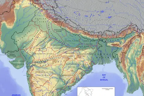
- The map displays India’s diverse topographical features, such as the towering Himalayan mountain range in the north, the vast Gangetic plains, the Thar Desert in the west, and the coastal regions along the Arabian Sea and the Bay of Bengal.
- It showcases the country’s major rivers, including the Ganges, Yamuna, Brahmaputra, and Godavari, providing a glimpse into India’s extensive water networks.
- The map highlights the location and boundaries of India’s states and union territories, giving an understanding of the political divisions within the country.
- One can identify the major cities of India, such as New Delhi, Mumbai, Kolkata, Chennai, and Bengaluru, which serve as significant economic, cultural, and political centers.
- The transportation networks depicted on the map include highways, railways, and airports, showcasing the connectivity within and beyond India’s borders.
Table of Relevant Facts – India 2017
| Fact | Description |
|---|---|
| Total Area | India covers an area of approximately 3.29 million square kilometers, making it the seventh-largest country in the world. |
| Population | As of 2017, India had a population of over 1.3 billion people, making it the second most populous country globally. |
| States | India is divided into 29 states, each with its own distinct identity and local government. |
| Union Territories | In addition to the states, India has 7 union territories that are directly governed by the central government. |
| National Capital | New Delhi serves as the national capital of India and is a major political and cultural hub. |
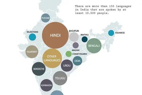
| Languages | India is known for its linguistic diversity, with over 1,600 languages spoken across the country. Hindi and English are the official languages. |
| Geographical Features | India encompasses various geographical features, including the Himalayan mountain range, Thar Desert, and the coastline along the Arabian Sea and the Bay of Bengal. |
FAQ – Frequently Asked Questions
-
What is the importance of the India Map 2017?
The India Map 2017 provides valuable insights into the country’s political boundaries, states, major cities, and geographical features at that specific time. It aids researchers, historians, and geographers in studying India’s territorial organization.
-
How can the India Map 2017 be beneficial for travelers?
For travelers, the India Map 2017 serves as a helpful guide, showcasing major cities, transportation networks, and geographical landmarks. It assists in planning routes and understanding the country’s diverse landscapes.
-
What are some unique insights gained from the India Map 2017?
By examining the India Map 2017, one can observe India’s varied topography, major rivers, state divisions, and significant cities. It highlights the country’s natural and cultural diversity.
-
How has technology impacted the field of cartography?
Advancements in technology have revolutionized cartography, allowing for more accurate and detailed maps. Digital mapping tools, satellite imagery, and GPS technology have significantly enhanced the precision and effectiveness of cartographic representations.
-
Are political boundaries subject to change in India?
Yes, political boundaries can change over time due to various reasons such as the creation of new states, redrawing of borders, or geopolitical shifts. Therefore, it is essential to refer to the most up-to-date maps for accurate information.
-
How can students benefit from the India Map 2017?
Students can use the India Map 2017 as a visual aid in their geography, history, or social studies classes. It helps in understanding India’s territory, states, and major cities, enabling comprehensive learning.
-
Where can I find the India Map 2017 in digital or physical format?
The India Map 2017 is available from various sources, including online map repositories, bookstores, libraries, and educational institutions. Online platforms such as government websites, map portals, and e-commerce platforms offer digital versions for download or purchase.