India Railways Map
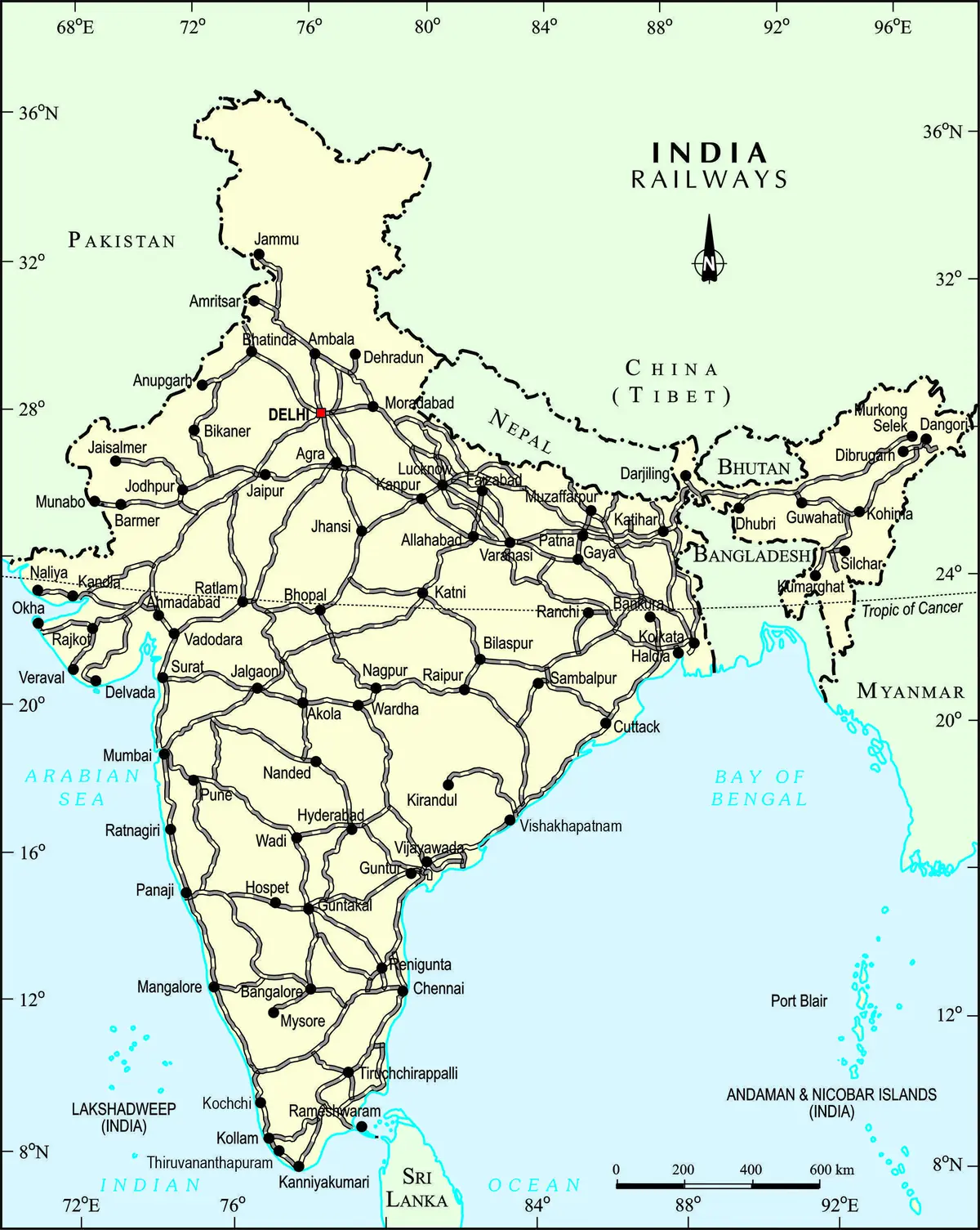
Click or tap the map to enlarge it.
This map shows the rail network of India, the dense web of lines that connects its major cities from Delhi and Mumbai to Chennai, Kolkata and the north-east. Along with the lines it picks out the names of stations and junctions.
The network is among the largest in the world. It has about 68,000 kilometres of route and carries well over 20 million passengers on an average day.
How the network grew
The first passenger train in India ran on 16 April 1853 between Bombay (Mumbai) and Thane, a distance of about 34 kilometres. Private companies built most early lines, and the railways were organised into regional zones after independence, beginning with Southern Railway in 1951. Today there are 18 zones, each with its own headquarters.
Most lines use broad gauge, 1,676 millimetres wide. The great junction cities, such as Delhi, Mughal Sarai, Nagpur and Vijayawada, appear on the map as points where many lines meet.
Heritage lines and firsts
Three mountain railways are on the UNESCO World Heritage List: the Darjeeling Himalayan Railway, the Nilgiri Mountain Railway and the Kalka–Shimla Railway. Mumbai's Chhatrapati Shivaji Maharaj Terminus is also listed. Kolkata opened India's first metro line in 1984.
Key facts
| Fact | Detail |
|---|---|
| First passenger train | 16 April 1853, Bombay to Thane |
| Route length | About 68,000 km |
| Zones | 18 |
| Standard gauge for most lines | Broad gauge, 1,676 mm |
| First Indian metro | Kolkata, 1984 |
Questions about this map
When did Indian Railways start?
The first passenger service ran on 16 April 1853 between Bombay and Thane.
What is broad gauge?
A track width of 1,676 millimetres, wider than the standard gauge used in much of the world.
Which Indian railways are UNESCO sites?
The Darjeeling Himalayan Railway, the Nilgiri Mountain Railway, the Kalka–Shimla Railway and Chhatrapati Shivaji Maharaj Terminus in Mumbai.