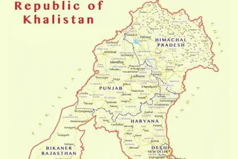
Khalistan Map
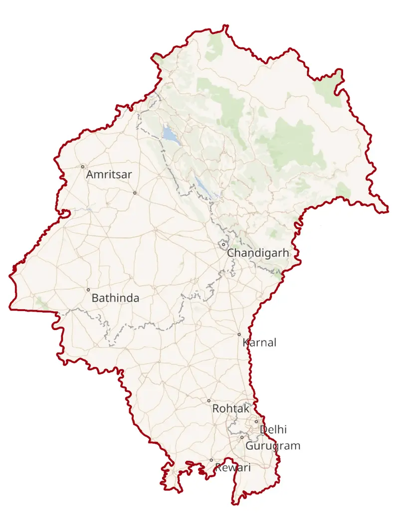
Click or tap the map to enlarge it.
Key Takeaways
- The Khalistan Map represents the proposed homeland for Sikhs, known as Khalistan.
- It is a region in northwestern India that encompasses parts of Punjab, Haryana, and Himachal Pradesh.
- The demand for Khalistan emerged during the 20th century as Sikhs sought to establish a separate Sikh state.
- The Khalistan Map symbolizes the socio-political aspirations of the Sikh community.
- Understanding the historical context behind the Khalistan movement is essential to comprehend its significance today.
History of the Khalistan Map
The Khalistan Map is a conceptual representation of the proposed Sikh homeland, Khalistan. The origins of the demand for Khalistan can be traced back to the early 20th century when Sikhs began advocating for a separate state.
The movement gained momentum in the 1970s amidst rising tensions between the Indian government and the Sikh community. Various Sikh organizations, such as the Sikh National Council and the Shiromani Akali Dal, played significant roles in mobilizing support for the establishment of Khalistan.
This demand was ultimately rooted in the desire to assert the distinct identity and preserve the Sikh religion and culture. The Khalistan movement reached its peak during the 1980s, marked by violent clashes and protests.
Despite a decline in the intensity of the movement in subsequent years, the legacy of the Khalistan movement continues to shape Sikh aspirations and political discourse.
Unique Insights
Exploring the Khalistan Map provides several unique insights into the socio-political landscape of Punjab and the Sikh community:
- The Khalistan Map highlights the collective identity and aspirations of Sikhs who believe in the idea of a separate homeland.
- It serves as a symbolic representation of the Sikh struggle for self-determination and religious freedom.
- Understanding the Khalistan Map helps to comprehend the ongoing debates around Sikh rights, autonomy, and representation.
- The map’s significance extends beyond its geographical boundaries, influencing political, social, and cultural discourses globally.
- It provides a lens through which one can explore themes of regional identity, nationalism, and the complexities of multicultural societies.
Table of Relevant Facts
| Year | Event |
|---|---|
| 1947 | India gains independence from British rule, leading to the partition of India. |
| 1966 | The state of Punjab is divided into Punjab and Haryana. |
| 1971 | Gurmit Singh, a Sikh activist, first raises the demand for Khalistan. |
| 1984 | The Golden Temple, the holiest Sikh shrine, is attacked by the Indian military, leading to widespread protests. |
| 1993 | The Khalistan movement loses momentum, partially due to increased political negotiations. |
Frequently Asked Questions
1. What is the Khalistan Map?
The Khalistan Map represents the proposed Sikh homeland, encompassing parts of Punjab, Haryana, and Himachal Pradesh.
2. When did the demand for Khalistan emerge?
The demand for Khalistan emerged during the early 20th century and gained momentum in the 1970s.
3. What is the significance of the Khalistan movement?
The Khalistan movement symbolizes the socio-political aspirations of the Sikh community and their struggle for self-determination.
4. How did the Khalistan movement shape Punjab?
The Khalistan movement led to protests, violence, and political tensions in Punjab during the 1980s and subsequent years.
5. Is the demand for Khalistan still prevalent today?
While the intensity of the demand has diminished, the idea of Khalistan continues to influence Sikh political discourse.
6. What are the key organizations associated with the Khalistan movement?
Organizations such as the Sikh National Council and the Shiromani Akali Dal have played significant roles in advocating for Khalistan.
7. How does the Khalistan Map influence global conversations?
The Khalistan Map reflects broader themes of regional identity, multiculturalism, and self-determination that resonate globally.