Location Map of Greater Colombo
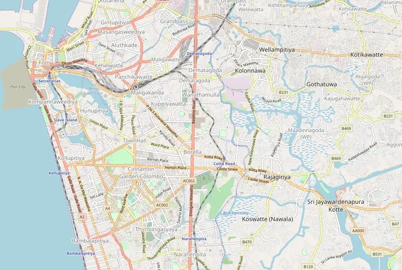
Click or tap the map to enlarge it.
Location Map Of Greater Colombo
Key Takeaways
- Greater Colombo is the capital city of Sri Lanka and the largest city in the country.
- It is a major commercial, economic, and cultural hub, as well as the administrative center of Sri Lanka.
- The location map of Greater Colombo provides an overview of the city and its surrounding areas.
- It is a useful tool for navigation and understanding the layout of the city.
- The map showcases the various landmarks, neighborhoods, and important points of interest in Greater Colombo.
History
Greater Colombo has a rich history that dates back to ancient times. The city’s strategic location along the trade routes of the Indian Ocean attracted various civilizations and colonial powers.
It was originally known as Kolomthota, which means “port on the river Kelani.” Over the centuries, it evolved into a bustling cosmopolitan city.
In the 16th century, the Portuguese arrived and established a fort in Colombo, making it their administrative center. The Portuguese were later defeated by the Dutch, who took control of the city and built the famous Colombo Fort. The British eventually took over and made Colombo the capital of Ceylon (now Sri Lanka) in 1802.
The city witnessed significant development during the British colonial period, with the construction of modern infrastructure, including roads, railways, and public buildings. After gaining independence in 1948, Colombo continued to grow as the political and economic center of the country.
Unique Insights
- Greater Colombo is home to a diverse population, including people from various ethnic, religious, and cultural backgrounds.
- The city offers a blend of modern skyscrapers, colonial architecture, and historical landmarks.
- One of the highlights of Greater Colombo is Galle Face Green, a vast ocean-side urban park where locals and visitors enjoy leisure activities.
- Bandaranaike International Airport, located in the neighboring city of Katunayake, serves as the primary gateway to Sri Lanka.
- Colombo Port is one of the busiest ports in South Asia, facilitating international trade and commerce.
Map of Greater Colombo
| Year | Event |
|---|---|
| 1505 | The Portuguese arrive in Colombo |
| 1656 | The Dutch gain control of Colombo |
| 1796 | The British capture Colombo |
| 1802 | Colombo becomes the capital of Ceylon under British rule |
| 1948 | Sri Lanka gains independence |
Frequently Asked Questions
-
What is the population of Greater Colombo?
The population of Greater Colombo is approximately 5 million.
-
What are some popular attractions in Greater Colombo?
Popular attractions in Greater Colombo include the National Museum, Gangaramaya Buddhist Temple, and Viharamahadevi Park.
-
How can I travel to Greater Colombo?
You can travel to Greater Colombo by air through Bandaranaike International Airport or by train or road from other parts of Sri Lanka.
-
Is Greater Colombo a safe city for tourists?
Greater Colombo is generally safe for tourists, but it’s always recommended to take standard safety precautions and stay informed about the local conditions.
-
What is the best time to visit Greater Colombo?
The best time to visit Greater Colombo is during the dry season, which is typically from December to March.
-
Are there any nearby beaches near Greater Colombo?
Yes, there are several beautiful beaches located near Greater Colombo, including Mount Lavinia Beach and Negombo Beach.
-
Can I take a day trip to explore other parts of Sri Lanka from Greater Colombo?
Yes, you can easily take day trips to popular destinations like Kandy, Galle, and Nuwara Eliya from Greater Colombo.
External Links
LSI Keywords
- Greater Colombo map
- Colombo landmarks
- Colombo history
- Sri Lanka capital
- Colombo tourism
- Colombo attractions
- Colombo population