Metro Manila Elevation Map
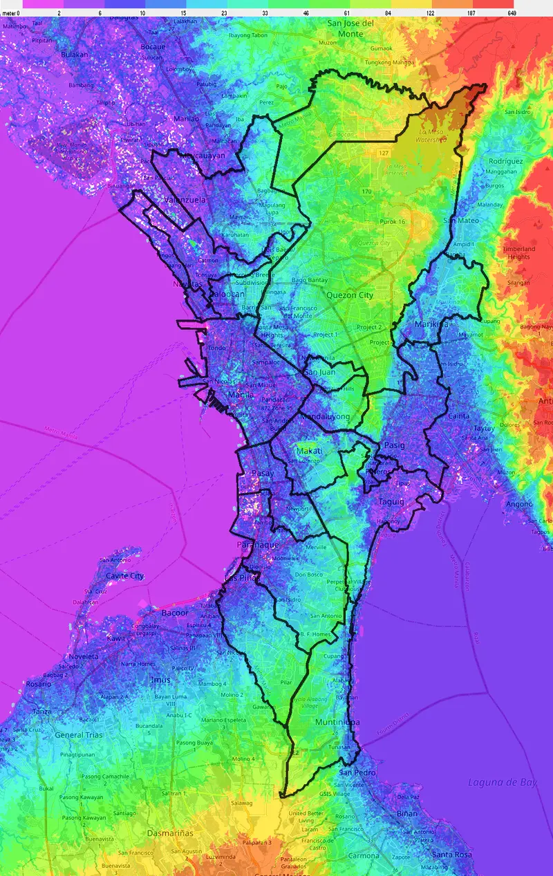
Click or tap the map to enlarge it.
Metro Manila Elevation Map – A Comprehensive Overview
Key Takeaways
- Metro Manila is the capital region of the Philippines and consists of 16 cities and one municipality.
- The Metro Manila Elevation Map showcases the various elevations across the region, from low-lying areas to mountains.
- Understanding the elevation levels can help with urban planning, flood management, and transportation infrastructure development.
- The elevation map provides valuable insights into the topography and landscape of Metro Manila.
History
Metro Manila, also known as the National Capital Region (NCR), has a rich history that dates back to pre-colonial times. The area was originally inhabited by the Tagalog people, who established settlements along the banks of the Pasig River. During the Spanish colonization in the 16th century, Manila became the center of political, economic, and religious power.
Over the centuries, Metro Manila evolved into a vibrant and bustling metropolis. However, its rapid urbanization and population growth have presented numerous challenges, including congestion, disaster vulnerability, and environmental degradation.
Unique Insights
The Metro Manila Elevation Map provides unique insights into the geographical features of the region:
- The map showcases the coastal areas of Manila Bay and the Manila Baywalk, which attract tourists and offer picturesque views of the sunset.
- The elevation gradually increases when moving inland, with a range of hills and slopes that make up much of the landscape.
Facts about Metro Manila Elevation
| Location | Elevation (in meters) |
|---|---|
| Pasig | 10 |
| Quezon City | 25 |
| Marikina | 15 |
| Manila | 5 |
| Makati | 20 |
| Taguig | 5 |
FAQ
-
What is the purpose of the Metro Manila Elevation Map?
The Metro Manila Elevation Map serves as a tool to understand the variations in land height across the region. It aids in planning for urban development, flood control, and transportation infrastructure.
-
Which areas in Metro Manila are prone to flooding?
Low-lying areas such as Manila, Taguig, and parts of Pasig are more susceptible to flooding due to their lower elevations. The elevation map helps identify these vulnerable areas.
-
Does the Metro Manila Elevation Map include mountainous regions?
Yes, the elevation map highlights the mountainous regions surrounding Metro Manila, such as the Sierra Madre mountain range to the east and the Tagaytay Highlands to the south.
-
Are there any environmental implications related to the changes in elevation?
Yes, understanding the elevation changes can provide insights into the natural drainage patterns, potential landslides, and the impact on ecosystems in the region.
-
What is the highest point in Metro Manila?
The highest point in Metro Manila is Mount Oriod in Rodriguez, Rizal, with an elevation of approximately 740 meters above sea level.
-
Is the Metro Manila Elevation Map publicly accessible?
Yes, the elevation map is available to the public and can be accessed through various government and research institutions.
-
How often is the Metro Manila Elevation Map updated?
The elevation data is regularly updated to account for changes in the landscape due to human activities and natural processes.