Political Map of Metro Manila
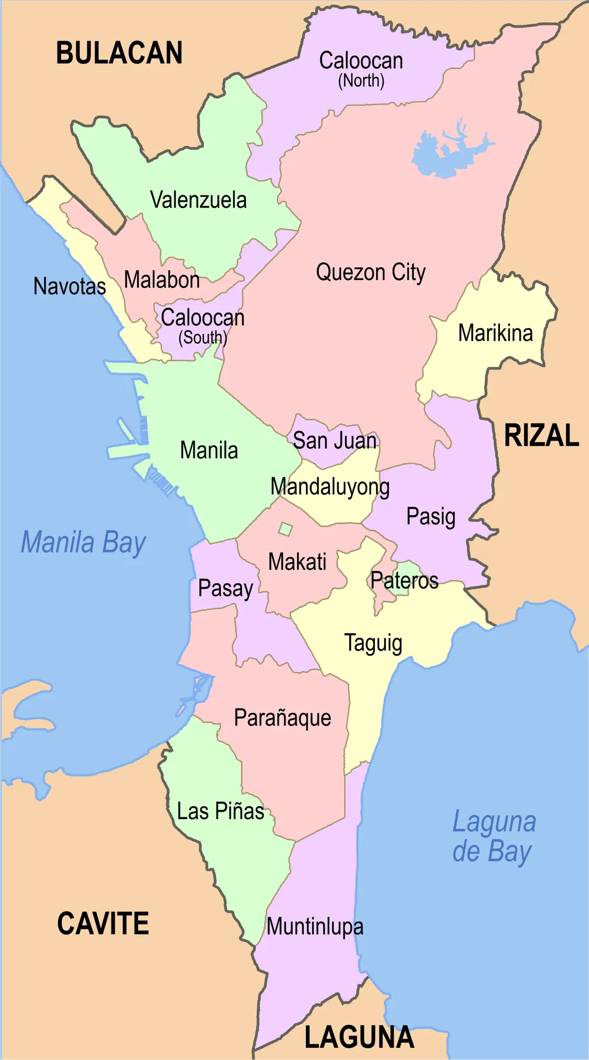
Click or tap the map to enlarge it.
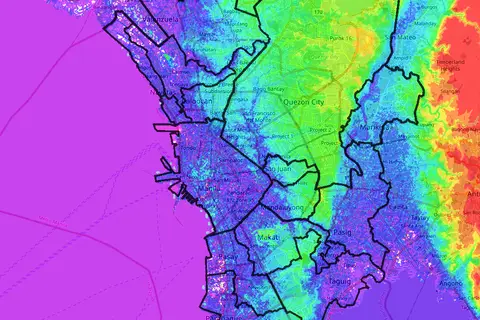
This political map divides Metro Manila, the National Capital Region of the Philippines, into its cities and its single municipality. Labelled areas include Manila, Quezon City, Caloocan, Makati, Pasig, Taguig, Mandaluyong, San Juan, Marikina, Pasay and Pateros, with Rizal province beside them.
Metro Manila is not a single city. It is a region made up of 16 cities and one municipality, Pateros, and its official population at the 2020 census was about 13.5 million.
How the region is organised
The City of Manila is the historic core and the official national capital, founded by the Spanish in 1571. Quezon City is the largest local government in both population and area, with just under three million residents. Makati is the main financial district, and Taguig includes Bonifacio Global City. Pateros, the only municipality, is the small area wedged between Pasig and Taguig.
Metro Manila was created as an integrated unit in 1975. Its planning and services are coordinated by the Metropolitan Manila Development Authority, which was set up in its present form in 1995.
What a political map is good for
A political map is about boundaries rather than terrain. For a region like Metro Manila, where the built-up area runs seamlessly across city limits, the map is the quickest way to see which local government covers a district, and why services such as traffic management and flood control need regional coordination.
Key facts
| Fact | Detail |
|---|---|
| Official name | National Capital Region (NCR) |
| Local governments | 16 cities and 1 municipality (Pateros) |
| Population (2020 census) | About 13.5 million |
| City of Manila founded | 1571 |
| Integrated as Metro Manila | 1975 |
Questions about this map
Is Manila the same as Metro Manila?
No. The City of Manila is one of the 16 cities in the region.
Which is the biggest city in Metro Manila?
Quezon City is the largest by both population and area.
What is Pateros?
Pateros is the only municipality in Metro Manila, as all the other local governments are cities.