Nepal National Highways Map
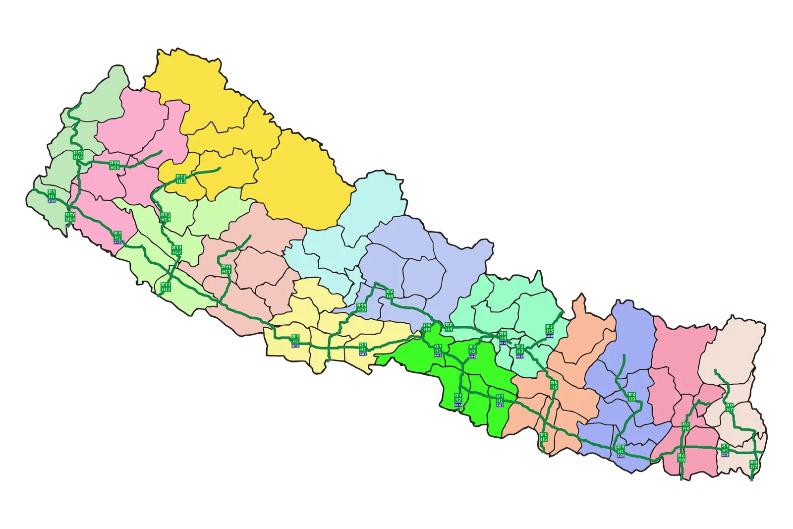
Click or tap the map to enlarge it.
Nepal National Highways Map: Key Takeaways
- The Nepal National Highways Map provides a comprehensive view of the road network in Nepal.
- This map offers essential information for travelers, tourists, and locals to navigate through the country.
- The road system in Nepal plays a crucial role in connecting various regions and promoting economic development.
- Nepal National Highways Map helps in understanding the transportation infrastructure of the country.
- It showcases major highways, district roads, and transportation hubs across the nation.
- The map highlights the diverse landscapes, cultural sites, and tourist destinations that can be explored via road travel.
History
The development of Nepal’s road network has been a significant undertaking, aiming to improve connectivity and accessibility throughout the country. The history of Nepal National Highways dates back to the mid-20th century. In 1959, Nepal saw the inauguration of its first national highway, the Tribhuvan Highway, connecting Kathmandu with the Indian border.
Over the years, Nepal’s road network has expanded, with the development and upgrade of numerous highways and district roads. These routes link major cities, towns, agricultural regions, and tourist destinations. The network has played a crucial role in promoting trade, tourism, and overall socio-economic development in Nepal.
Unique Insights
While exploring the Nepal National Highways Map, several unique insights emerge:
- Nepal’s geography poses various challenges in road construction, including rugged terrains, high altitudes, and seismic vulnerability. The road infrastructure has to withstand these conditions.
- Nepal’s highways extend from the flat southern Terai region to the hilly and mountainous regions in the north, showcasing the country’s diverse landscapes.
- The highways act as lifelines for remote communities, enabling access to essential services such as healthcare, education, and transportation.
- Some national highways in Nepal pass through breathtaking scenery, offering travelers awe-inspiring views of snow-capped mountains, deep valleys, and raging rivers.
Table of Relevant Facts
| Date | Events |
|---|---|
| 1959 | Inauguration of Tribhuvan Highway, the first national highway in Nepal. |
| 1967 | Construction of Prithvi Highway, a major road connecting Kathmandu with Pokhara. |
| 2008 | Completion of the East-West Highway, the longest highway in Nepal, running 1,763 kilometers from Mechinagar in the east to Mahakali in the west. |
| 2017 | Inauguration of Gautam Buddha Highway, linking Kathmandu with the birthplace of Lord Buddha in Lumbini. |
FAQ
-
What is the importance of the Nepal National Highways Map?
The Nepal National Highways Map is essential for understanding the road network, planning travel routes, and exploring the diverse landscapes and cultural sites across Nepal.
-
How many highways are there in Nepal?
Nepal has several major highways, including Tribhuvan Highway, Prithvi Highway, East-West Highway, and the newly built Gautam Buddha Highway.
-
Can I explore tourist destinations by road in Nepal?
Absolutely! Nepal’s road network allows travelers to access various tourist destinations, including popular trekking routes, national parks, and cultural heritage sites.
-
Are the highways in Nepal well-maintained?
While efforts have been made to improve the road conditions, some sections, especially in remote areas, may still require maintenance. It is advisable to gather the latest information before planning your journey.
-
Are there any tolls on Nepal’s national highways?
Yes, toll booths are present on certain highways in Nepal. These tolls contribute to the maintenance and development of the road infrastructure.
-
What safety precautions should I take while traveling on Nepal’s highways?
It is crucial to obey traffic rules and drive cautiously. Additionally, check road conditions, especially during monsoon season, as heavy rainfall can cause landslides and affect road accessibility.
-
Can I hire vehicles for road trips in Nepal?
Yes, there are various options available for hiring vehicles, including cars, motorcycles, and bicycles. Make sure to have a valid driving license or necessary permits.