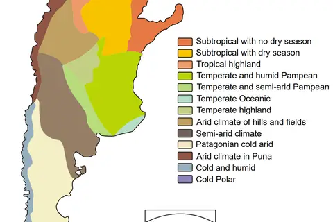
North America Map of Kppen Climate Classification
Key Takeaways
- The Köppen Climate Classification system categorizes climate zones based on temperature and precipitation patterns.
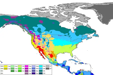
- The North America Map of Köppen Climate Classification provides a visual representation of the different climate zones across the continent.
- Understanding the climate zones can help with planning and preparing for various weather conditions in different regions.
History
The Köppen Climate Classification system was developed by German botanist and climatologist Wladimir Köppen in the late 19th century. Köppen aimed to classify climates based on observable patterns, considering temperature, precipitation, and vegetation. His classification has since been widely adopted around the world.
The North America Map of Köppen Climate Classification showcases the climate patterns specifically found in North America. The continent exhibits diverse climates due to its vast size and varied geography. From the frigid Arctic climates in northern Canada to the hot and arid deserts of the southwestern United States, the map provides valuable insights into the climatic conditions of this region.
Climate classification is essential for understanding and predicting weather patterns, as it helps identify the dominant climate types in different regions. Having insights into climate types allows scientists, planners, and individuals to make informed decisions about agriculture, construction, and resource management.
Unique Insights
The North America Map of Köppen Climate Classification reveals fascinating insights about this diverse continent:
- North America experiences a wide range of climate zones, including tropical, dry, temperate, continental, and polar climates.
- The western coast of North America features a Mediterranean climate, characterized by mild, wet winters and warm, dry summers.
- The central region of the continent has a continental climate, with hot summers, cold winters, and moderate precipitation.
- The northern parts of Canada and Alaska are predominantly covered by the tundra climate zone, characterized by extremely cold temperatures and low precipitation.
- The southeastern United States exhibits a humid subtropical climate, with hot, humid summers, mild winters, and abundant rainfall.
Table of Relevant Facts
| Climate Zone | Characteristics |
|---|---|
| Tropical | High temperatures and abundant rainfall year-round |
| Dry | Low precipitation and arid conditions |
| Temperate | Moderate temperatures with distinct seasons |
| Continental | Hot summers, cold winters, and moderate precipitation |
| Polar | Extremely cold temperatures and low precipitation |
| Humid Subtropical | Hot, humid summers, mild winters, and abundant rainfall |
FAQ
1. What is the Köppen Climate Classification system?
The Köppen Climate Classification system is a widely used method of categorizing climate zones based on temperature and precipitation patterns. It provides a standardized way to understand and compare different climates around the world.
2. How does the North America Map of Köppen Climate Classification help in understanding the continent’s climate?
The map visually represents the climate zones found in North America, allowing individuals to understand the predominant climate patterns in different regions. It helps with planning for weather conditions, resource management, and various other aspects that are influenced by climate.
3. What are some examples of climate zones found in North America?
North America features tropical, dry, temperate, continental, polar, and humid subtropical climate zones. Each zone has unique characteristics in terms of temperature, precipitation, and vegetation.
4. How does climate classification impact agriculture in North America?
Agriculture practices vary based on the climate zone. For example, areas with a Mediterranean climate are suitable for cultivating crops like olives and grapes, while regions with a continental climate may focus on wheat and corn production.
5. Are climate zones subject to change?
Climate zones can shift over time due to various factors, including climate change and natural variations. It’s essential to monitor and study these changes to plan for potential impacts on ecosystems and human activities.
6. Can climate classification help predict extreme weather events in North America?
While climate classification provides insights into broader climate patterns, it may not directly predict specific extreme weather events. However, understanding the general climate characteristics of an area can help assess its vulnerability to certain types of extreme weather.
7. How can individuals use the North America Map of Köppen Climate Classification for travel planning?
The map can assist travelers in understanding the likely weather conditions in different regions of North America. By knowing the climate zones, travelers can pack appropriate clothing and plan outdoor activities accordingly.