Portugal Regions Map
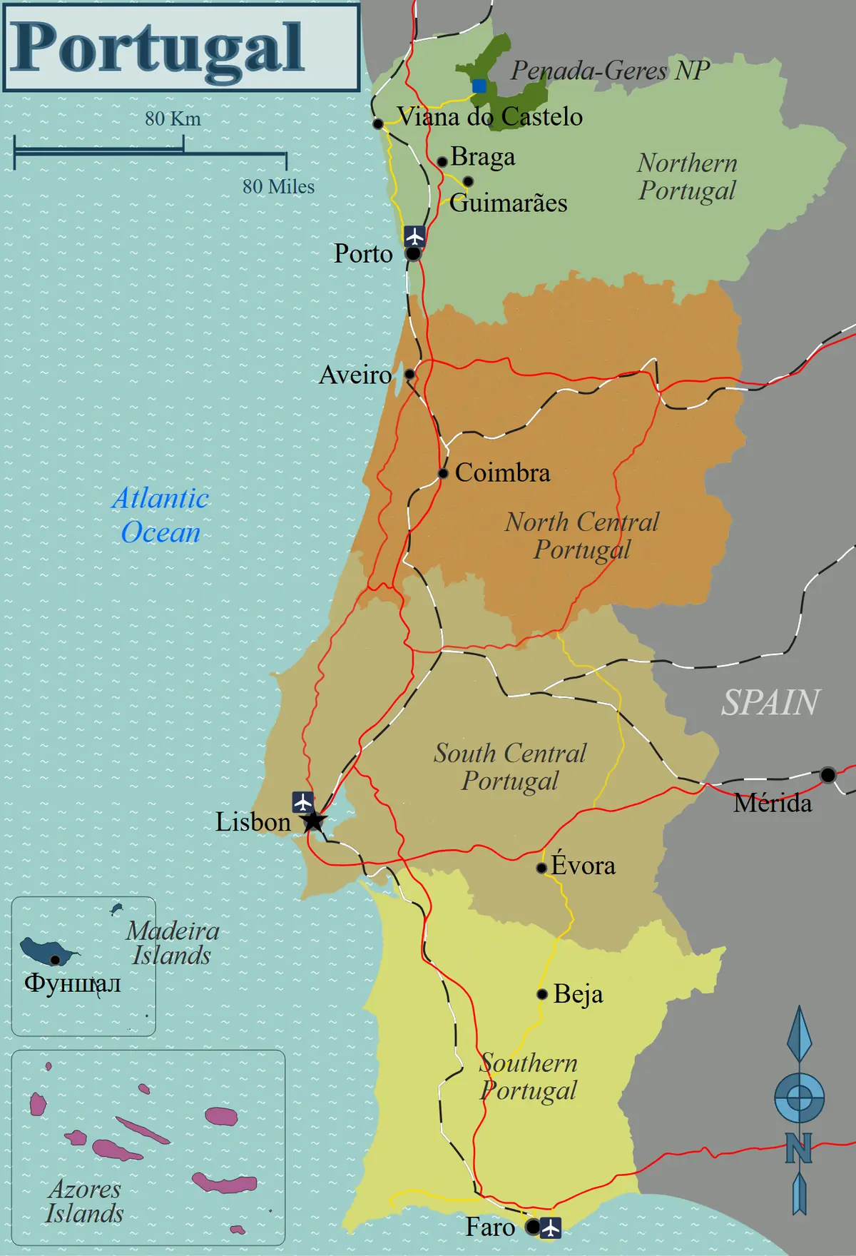
Click or tap the map to enlarge it.
This map divides mainland Portugal into regions and shows the main coastal and inland cities, including Aveiro, Coimbra and Lisbon, with Spain to the east and the Atlantic Ocean to the west.
Portugal has several overlapping ways of dividing its territory, so a regional map is most useful when you know which system it follows.
Regions, districts and municipalities
For statistics and planning, mainland Portugal is split into five regions at NUTS II level: Norte, Centro, the Lisbon metropolitan area, Alentejo and Algarve. The Azores and Madeira are autonomous regions in the Atlantic. Below that level the country has 308 municipalities, and historically it was grouped into 18 districts.
Travel maps often use looser regions, such as northern and central Portugal, so that the divisions follow culture and landscape. This is why two maps of Portugal's regions can look quite different.
A long-settled border
Portugal borders only Spain. Its land frontier was largely fixed by the Treaty of Alcañices in 1297, which makes it one of the oldest stable borders in Europe. The population was about 10.3 million at the 2021 census, and the country covers roughly 92,000 square kilometres, with most people living on the coast, in and around Lisbon and Porto.
Key facts
| Fact | Detail |
|---|---|
| Population (2021 census) | About 10.3 million |
| Area | About 92,000 square kilometres |
| Mainland statistical regions | Norte, Centro, Lisbon, Alentejo, Algarve |
| Autonomous regions | Azores and Madeira |
| Municipalities | 308 |
| Land border | Spain only, settled in 1297 |
Questions about this map
How many regions does Portugal have?
Mainland Portugal has five NUTS II statistical regions, plus the autonomous regions of the Azores and Madeira.
What is the capital?
Lisbon, which also lies at the heart of the largest metropolitan area.
Which country borders Portugal?
Only Spain.