Sinai Peninsula Map
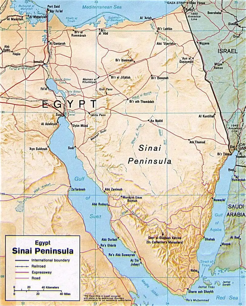
Click or tap the map to enlarge it.
This map shows the Sinai Peninsula, the triangular landmass of about 60,000 square kilometres that forms the only part of Egypt in Asia. It lies between the Mediterranean Sea to the north and the Red Sea to the south, with the Gulf of Suez to the west and the Gulf of Aqaba to the east.
The base map is credited to the United States Central Intelligence Agency and is in the public domain.
A land bridge between continents
Sinai links Africa and Asia and has been a crossing for armies, traders and pilgrims for thousands of years. The Suez Canal, opened in 1869, runs along its western edge and separates it from the rest of Egypt, although several road tunnels and bridges now cross the canal.
The south of the peninsula is mountainous. Mount Catherine (Jabal Katrina), at 2,629 metres, is the highest peak in Egypt, and nearby Mount Sinai (Jabal Musa), at around 2,285 metres, is revered in Jewish, Christian and Muslim tradition. At its foot stands Saint Catherine's Monastery, founded in the sixth century and listed by UNESCO in 2002.
Modern history
Israel occupied Sinai in 1967 and withdrew in stages following the 1979 peace treaty with Egypt, completing the handover in 1982 except for the small enclave of Taba, which was returned in 1989. Tourism, based on the coastal resorts and diving in the Red Sea, is a large part of the local economy, and Ras Mohammed National Park, created in 1983, protects coral reefs at the southern tip. Travellers should check current government advice before visiting, because security conditions in parts of North Sinai have varied.
Key facts
| Fact | Detail |
|---|---|
| Area | About 60,000 square kilometres |
| Highest peak | Mount Catherine, 2,629 m |
| Suez Canal opened | 1869 |
| Israeli withdrawal completed | 1982 (Taba in 1989) |
| Saint Catherine's Monastery | UNESCO World Heritage Site since 2002 |
Questions about this map
Is Sinai in Africa or Asia?
Sinai is in Asia. Egypt is a transcontinental country, with most of its land in Africa.
What are the two gulfs?
The Gulf of Suez lies to the west and the Gulf of Aqaba to the east, both arms of the Red Sea.
Where is Mount Sinai?
In the south of the peninsula, near Saint Catherine's Monastery.