Southampton Labelled Ward Map 2002
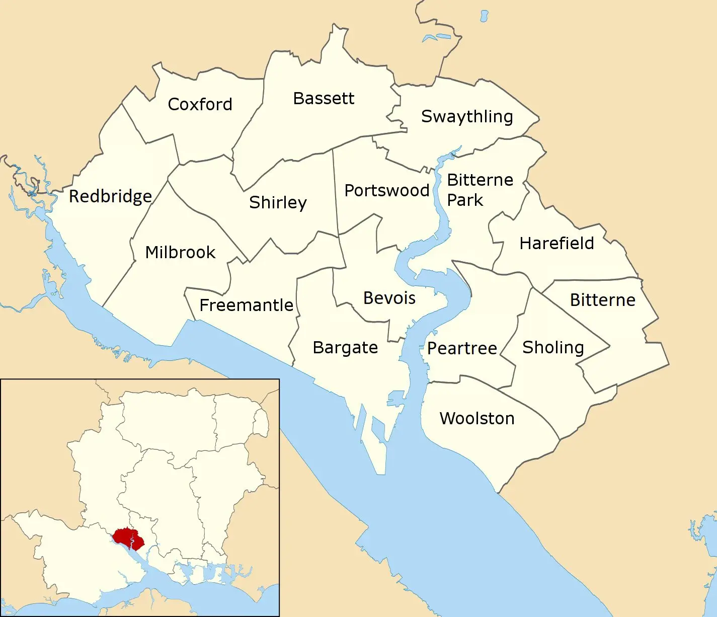
Click or tap the map to enlarge it.
Southampton Labelled Ward Map 2002
Key Takeaways
- The Southampton Labelled Ward Map 2002 provides a detailed depiction of the city’s administrative areas during that year.
- This map allows users to visualize the distribution of wards within Southampton, aiding in various decision-making processes.
- It serves as a valuable resource for historians, researchers, and individuals interested in understanding the spatial divisions of Southampton.
History
The Southampton Labelled Ward Map 2002 was created to provide a comprehensive overview of the city’s administrative divisions during that period. It was a collaborative effort between cartographers, local authorities, and spatial data experts.
Maps have long played an essential role in understanding and representing the world around us. They have been vital tools for navigation, planning, and analysis. The Southampton Labelled Ward Map 2002 contributes to this tradition by capturing a specific moment in the city’s history.
Unique Insights
- The Southampton Labelled Ward Map 2002 showcases the division of Southampton into distinct administrative units known as wards.
- Each ward is identified by a specific name and is color-coded for better differentiation.
- The map enables a visual understanding of the distribution of wards within the city and their proximity to key landmarks, transport routes, and neighborhood boundaries.
- It provides valuable insights into the distribution of resources, population density, and infrastructure planning during that period.
Table of Relevant Facts
| Year | City Name | Administrative Divisions | Key Features |
|---|---|---|---|
| 2002 | Southampton | Wards | Color-coded and labeled wards, landmarks, transport routes |
Frequently Asked Questions (FAQ)
-
What is the purpose of the Southampton Labelled Ward Map 2002?
The purpose of this map is to provide a visual representation of the administrative divisions (wards) within Southampton during the year 2002.
-
Who can benefit from using this map?
This map is beneficial for historians, researchers, urban planners, and individuals interested in the spatial distribution of Southampton’s wards.
-
How can the map be used for decision-making processes?
The map helps decision-makers understand the geographic distribution of resources, population density, and infrastructure planning within Southampton’s wards.
-
Can I access a digital version of the Southampton Labelled Ward Map 2002?
Yes, a digital version of the map can be accessed from the Southampton City Council’s official website or through relevant historical archives.
-
Are there any similar maps available for other years?
Yes, maps representing the administrative divisions of Southampton for various years are available. These maps offer insights into the city’s changing spatial organization over time.
-
Can I use the Southampton Labelled Ward Map 2002 for academic research or publications?
Absolutely! Researchers and individuals conducting academic studies can utilize this map as a valuable reference to analyze historical patterns and trends within Southampton.
-
Is there additional information available beyond the ward names?
While the map primarily focuses on the labeled wards, it may also include important landmarks, transport routes, and neighborhood boundaries to provide context within Southampton.