Vistula River Map
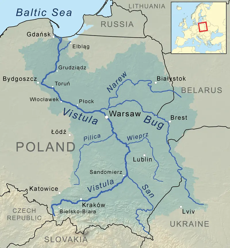
Click or tap the map to enlarge it.
Vistula River Map – Explore the Beauty of Poland
Key Takeaways
- The Vistula River is the longest river in Poland and spans approximately 1,047 kilometers.
- It flows through many major Polish cities, including Kraków, Warsaw, and Gdańsk.
- Vistula River played a crucial role in the historical and cultural development of Poland.
- The river is not only a significant transportation route, but also a tourist attraction with stunning natural beauty.
History
The Vistula River has been an integral part of Poland’s history for centuries. Its strategic location played a significant role in trade, defense, and cultural exchanges. Settlements and fortifications were established along its banks, making it a vital artery for transportation and commerce.
During the Middle Ages, the Vistula River served as an important trade route connecting Eastern Europe with the Baltic Sea. It allowed for the movement of goods such as wheat, timber, and salt, fostering economic growth and cultural exchange.
Throughout the years, the Vistula River witnessed various historical events and served as a witness to the changing political landscape of Poland. It played a crucial role during the Polish-Swedish wars, as well as in the conflicts of World War II.
Unique Insights
- The Vistula River is rich in biodiversity, hosting a wide array of plant and animal species.
- It has several islands along its course, providing unique ecosystems and habitats.
- The river supports a thriving bird population, making it a popular destination for birdwatching enthusiasts.
- The Vistula River Basin is an important agricultural region, contributing to Poland’s food production.
Table of Relevant Facts
| Year | Event |
|---|---|
| 966 | Christianization of Poland near the Vistula River |
| 1655-1660 | The Vistula River used as a defensive line during the Deluge |
| 1944 | The Warsaw Uprising took place near the Vistula River |
Frequently Asked Questions (FAQ)
1. Can you navigate on the Vistula River?
Yes, the Vistula River is navigable for both commercial vessels and recreational boaters.
2. Are there any boat tours available on the Vistula River?
Absolutely! Many companies offer boat tours, providing visitors with a unique perspective of Poland’s scenic landscape.
3. Which cities can I visit along the Vistula River?
Some of the major cities along the Vistula River include Kraków, Warsaw, Toruń, and Gdańsk.
4. Are there any dams on the Vistula River?
Yes, there are several dams along the river, including the Włocławek Dam and the Sandomierz Dam.
5. Is it safe to swim in the Vistula River?
Swimming in the Vistula River is generally safe, but it’s essential to follow local regulations and be aware of any currents.
6. Can I go fishing on the Vistula River?
Yes, fishing is a popular activity on the Vistula River. Some common species include pike, perch, and catfish.
7. How can I best explore the Vistula River?
You can explore the Vistula River on foot, by bike, or by boat. Consider taking a river cruise for a leisurely experience.